Background

NPS/J. Womble
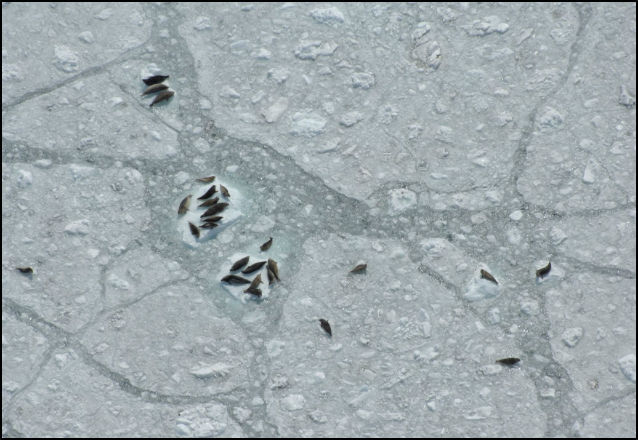
Tidewater glaciers calve icebergs into the marine environment, which then serve as pupping and molting habitat for some of the largest seasonal aggregations of harbor seals in Alaska. Although tidewater glaciers are naturally dynamic, advancing and retreating in response to local climatic and fjord conditions, most of the ice sheets that feed tidewater glaciers in Alaska are thinning and, as a result, many of the tidewater glaciers are retreating. Climate change models predict rapid loss of glacier ice with unknown impacts to seals that rely on tidewater glacial habitat.
Glacier Bay National Park & the National Park Service Coastal Cluster Program, in partnership with the University of Alaska Fairbanks–Geophysical Institute and the National Marine Mammal Laboratory–Polar Ecosystem Program, are currently conducting research that uses aerial digital imagery, remote sensing technology, and geospatial models to assess seasonal and annual changes in the availability and characteristics of glacier ice as habitat for seals in Johns Hopkins Inlet, a tidewater glacier fjord in Glacier Bay National Park.
Methods

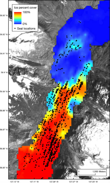
Systematic aerial photographic surveys are conducted of seals and ice during the pupping (June) and molting (August) seasons. Surveys are flown along a grid of 12 transects and high-resolution digital photos are taken directly under the plane using a vertically aimed camera. Seals are mapped in GIS and spatial statistical models are used to create an intensity surface from mapped seal densities. Object-based image analysis is used to quantify the amount and fine-scale characteristics of ice in the fjord. Characteristics included percent icebergs, percent brash ice (accumulations of floating, fragmented ice not more than 6 feet across), percent open water, iceberg size, and iceberg shape.
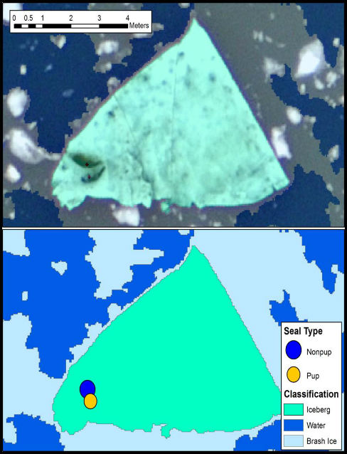
In the image above, the analysis classifies the iceberg in green, the water in dark blue, and the brash ice in light blue. The harbor seals resting on the ice are denoted as a nonpup (dark blue circle) and a pup (yellow circle).
Importance

Harbor seals exhibit high seasonal fidelity to tidewater glacial fjords during the pupping and molting seasons. Understanding relationships between glacier ice and harbor seal distribution and abundance will be critical for understanding how future changes in tidewater glaciers may impact harbor seals.
For More Information
Contact:
Jamie Womble, jamie_womble@nps.gov
https://www.nps.gov/glba/learn/nature/glacial-ice-and-seals-study.htm
Web article by: Erin Kunisch
Updated March 2016

Last updated: October 23, 2021


