In 1999, the National Park Service received settlement money from lawsuits against cruise ships for pollution and impact-related incidents in several locations, including Glacier Bay National Park. The Service worked though its nonprofit partner, the National Park Foundation, to invest and administer the funds.
The money was designated for the scientific study and protection of National Park Service marine ecosystems and for the benefit of Alaskans and park visitors.
NPS Photo
Beginning in 2004, the earnings were used to support the Coastal Marine Grant Program for small marine projects (about $10,000 each) that didn’t fit the requirements of other funding opportunities available to parks. Since only the earnings were being spent, these investment accounts weathered the Great Recession without losing value over the long-term; however, annual distributions declined for several years. Beginning in 2006, the Ocean Alaska Science and Learning Center (OASLC), an NPS entity devoted to the facilitation and communication of ocean science in Alaska’s national parks, supplemented funding to the annual grant. The combined result was $928,000 awarded to 103 projects across 10 Alaska park units and involving 24 different partners. In 2014, a decision was made to expend the balance of funds (around $3.3 million) on worthy projects that address some of the many marine issues facing Alaska’s national parks. This article highlights a small sample from ten years of small Coastal Marine Grants (2004-2013). A complete list is also included to highlight the broad spectrum of successful projects. Projects funded in 2014 are detailed in the following articles found throughout this issue of Alaska Park Science:
- Promoting spill preparedness in the western Arctic parks with the community integrated coastal response project
- Understanding the ecology of Arctic coastal lagoons through fisheries research and monitoring
- Feathered ambassadors of Arctic coastal parks
- The core of the matter: adventures in coastal geology at Kenai Fjords National Park
- Changing Tides project
- Whales, seals and vessels: Investigating the acoustic ecology of underwater Glacier Bay
- Removing marine debris from Alaskan coastal parks with numerous partners
Harbor Seals in Glacier Bay and Kenai Fjords National Parks
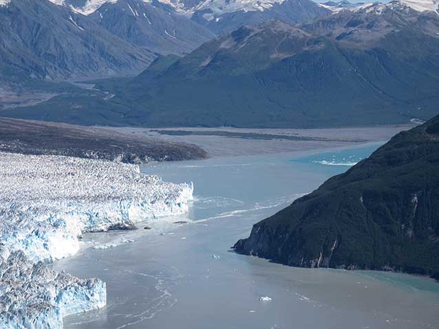
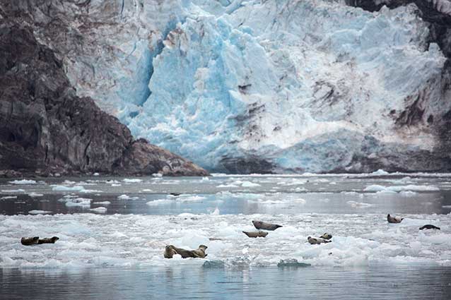
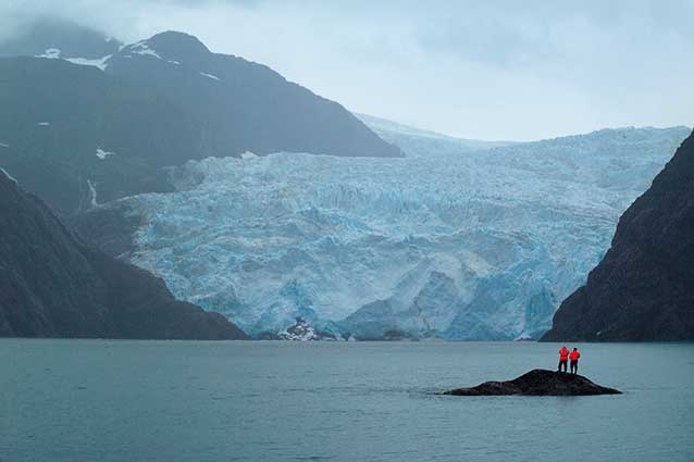
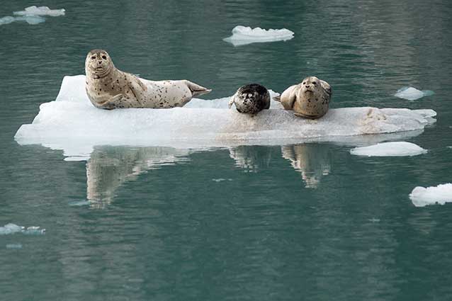
With large soulful eyes and furry bodies juxtaposed on cold blue icebergs, harbor seals (Phoca vitulina) are one of the most abundant and most photographed marine mammals in the Gulf of Alaska. Large, seasonal aggregations of harbor seals are found in tidewater glacial fjords in Glacier Bay, Kenai Fjords, and Wrangell-St. Elias national parks (Figure 2). Such fjords are popular destinations for tour boats and cruise ships, and visitors love seeing harbor seals. But climate change and other factors affect glacial activity, including the icebergs that some seals use to haul out. Declines in the number of harbor seals have been documented in Glacier Bay and Kenai Fjords national parks (Mathews and Pendleton 2006; Womble et al. 2010; Hoover-Miller et al. 2011); however, the reasons for the declines remain elusive.
NPS Photo
In Glacier Bay, funding was used to develop an understanding of harbor seal post-breeding season movements, diving and foraging behavior, and habitat use (Figure 3). Another award was used to analyze harbor seal blood and fecal samples for evidence of exposure to pathogens (Hueffer et al. 2011; 2013). Interestingly, harbor seals were found to travel widely outside of Glacier Bay during the post-breeding season (September-April), but most returned to Glacier Bay the following breeding season (Womble and Gende 2013). Two implications of this finding are that harbor seals may be susceptible to impacts both within and outside of the park, and that the park is a good place to rear pups. Even more interestingly, harbor seals using glacial ice as haul outs dove deeper, travelled farther, and spent less time on the bottom in search of food than did seals hauling out on land (Womble et al. 2014). In essence, seals hauling out on ice may be working hard to forage. So why bother hauling out on ice? One idea is that glacial ice may offer a refuge from predators, such as orcas (Orcinus orca), and also provide a stable resting place for nursing young (Womble et al. 2014; Pettit et al. 2015).
NPS Photo
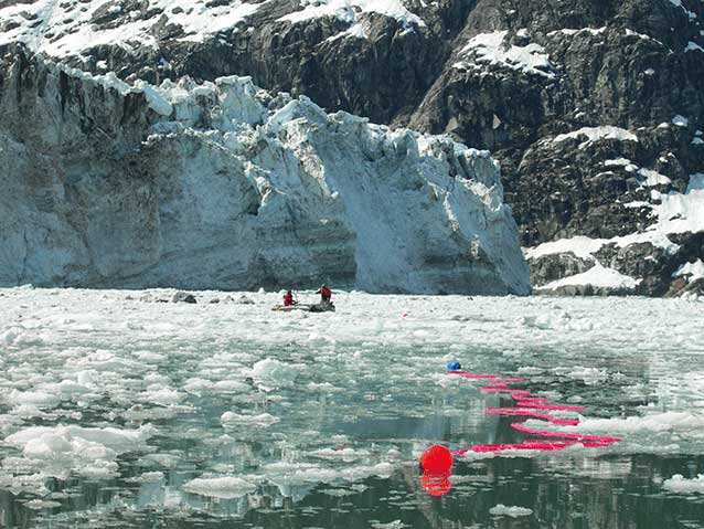
In Kenai Fjords National Park, funding was used by the Alaska SeaLife Center to set up remote cameras to observe harbor seals using ice habitat in Aialik Bay and Northwestern Fiord. Using these cameras, former Alaska SeaLife Center researcher Anne Hoover-Miller examined how often kayaks or tour boats disturbed seals, as both are popular means of exploring the park. Most park employees assumed the larger, noisier tour boats would cause more disturbances for seals, but the data showed the opposite was true: Kayakers disturbed the seals far more often than the tour boats (Hoover-Miller et al. 2013). One potential reason is that kayakers have an ability to approach seals much more quietly and surprise seals at close distance, whereas tour boats are not as stealthy. Also, harbor seals were hunted from kayaks not so long ago, but not from tour boats. Although highly speculative, it seems plausible that harbor seals could be instinctually wary of kayaks. These kinds of scientific studies are extremely useful when parks work with local tour operators and guides to use the area responsibly, especially when they challenge assumptions and lead to more effective decisions. Fortunately, Hoover-Miller et al.’s study also showed that voluntary changes to viewing guidelines on the part of both tour operators and kayak guides led to less harbor seal disturbances.
Although we may not yet fully understand the reasons for the decrease in Alaska’s most abundant marine mammal, these and ongoing studies definitely help fill in the pieces to the puzzle.
NPS Photo
The Sea Train
The true value of education-enrichment projects is often difficult to quantify. Lessons and experiences often bury themselves deep in the psyche of students, only to resurface years, and even decades, later in a sudden “Aha!” moment. Nevertheless, experiential lessons can have a strong influence on who children become, and how they may act as stewards of our parks and our society.
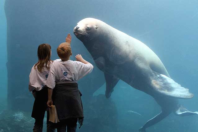
If the random anecdotes heard from parents are any indication, Sea Train was just such an experience. On more than one occasion I heard the comment from parents: “My son/daughter took the train to Seward and learned SO MUCH on that trip to the SeaLife Center!” Sea Train was a collaboration between the Alaska SeaLife Center, the Anchorage School District, and the Alaska Railroad Corporation with participation from the NPS and the U.S. Forest Service. The Sea Train program was designed to provide a science-based field learning experience for Anchorage students using Alaska Railroad cars as mobile classrooms. The trip from Anchorage to Seward and back culminated with several hands-on activities at the Alaska SeaLife Center (Figure 4). Students engaged invertebrates and vertebrates alike in the “touch tanks” and through underwater viewing areas of the aquarium, and learned multiple lessons about Alaska’s marine ecosystems.
NPS Photo
Almost 1,500 students participated in Sea Train during 2007, most from Title I schools (which include high percentages of students from low income families) or schools affiliated with military bases. These students comprised a diverse demographic, many of whom had never travelled to the Kenai Peninsula or experienced the ocean, despite living in a coastal city. Funding provided through the coastal marine grant was used to offset costs for the railroad charter. The Sea Train program ran from 2005 through 2008.
Grant and Higgins Repeat Photography
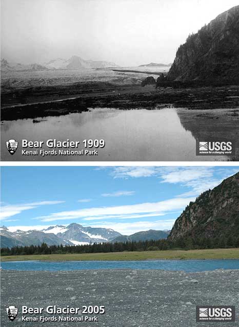
There is nothing quite like repeat photography to illustrate changes in our environment. U. S. Grant and D. F. Higgins were geologists with the U.S. Geological Survey (USGS). On a mineral surveying field trip in 1909, they surveyed and photographed dozens of glaciers in what would eventually become Kenai Fjords National Park. Although documenting glaciers was not the primary purpose of their trip, it is clear from their records that Grant and Higgins viewed their glacier photographs as important. Their prescience has paid off handsomely in our present-day bank of knowledge.
In 2004 and 2005, Dr. Bruce Molnia, also a USGS geologist, followed in their footsteps to repeat their effort (Figure 5). He used money from a coastal marine grant to help fund one of his trips to locate the exact spots they used to photograph the park’s glaciers and retake photos from those locations to understand the changes over the last 100 years (Figure 6). One of the goals of the project was to document the process scientists go through while studying glaciers. The resulting series of photographs are a powerful interpretive tool to illustrate the effects of climate change. The NPS continues to repeat these photographs annually to further document the changes occurring in Kenai Fjords National Park. These repeat photographs are used extensively in ranger talks, presentations, park movies, and interpretive signage to illustrate the dramatic changes in our local environment and to engage visitors in the complexities of climate change.
Silver Salmon Creek Fish Counts
Decades ago, the fishing lore on the Kenai Peninsula included tales of Silver Salmon Creek in Lake Clark National Park, where the fishing was so good you could catch a silver salmon on every cast when the fish were running. The Alaska Department of Fish and Game (ADFG) estimated the average annual harvest of silver salmon (Oncorhynchus kisutch) from Silver Salmon Creek to be about 1,000 fish per year, with a range of 356 in 2008 and 2,269 in 2003.
However, their estimates came from statewide mail-in harvest surveys, which generally have wide margins of error and tend to overestimate harvests when compared to other methods. Silver Salmon Creek is a mile-long stream flowing between a series of small lakes and the ocean. It’s narrow enough that most people could throw a rock across it without too much trouble. Silver salmon tend to have smaller runs, unlike the hundreds of thousands of pinks and red salmon common to the Alaska Peninsula and the Kenai Peninsula. On streams the size of Silver Salmon Creek, the silver run may only be a thousand fish per year, and no one knew for sure what it actually was. If fishers harvested 1,000 fish per year, they could potentially wipe out the run in a few years. And of course, bears and other wildlife also fish for salmon in this creek. Without more precise data, it is difficult to estimate the size of the run or how many salmon were really being harvested from this stream.
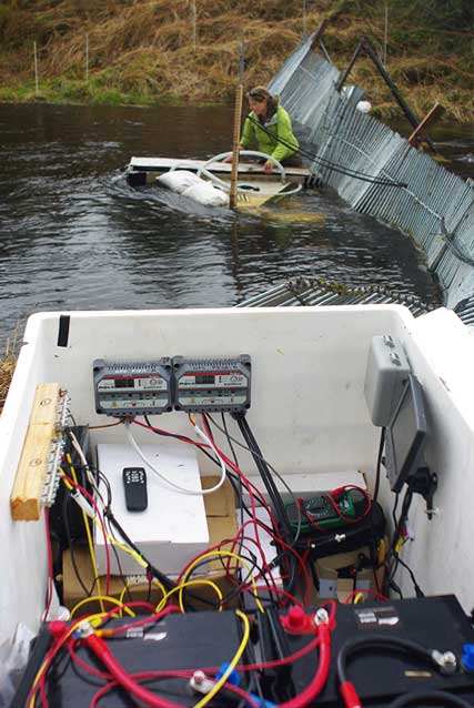
Dan Young, an NPS fisheries biologist, used a coastal marine grant to fund a project from 2011-2013 designed to determine the average run size, and count how many fish were being caught. To answer the first question, he built a video weir (Figure 7). Dan installed a fence across the river near the lake’s mouth that forced the salmon to swim through a narrow channel. Then he put an underwater camera in a windowed box filled with crystal-clear fresh water. The box was submerged right next to the channel in the fence. The camera was attached to a motion detector, so whenever a salmon swam through, the camera turned on for five seconds. Thus, the salmon could be counted on the video, without generating weeks of video footage. In the end, the run size turned out to be between 6,000 and 9,000 fish, depending on the year.
NPS Photo
To answer the second question, Dan and his assistants conducted a creel survey in 2013. A creel is a wooden basket anglers used to use to hold their catch. A creel survey simply asks fishermen what they have caught each day at the place they are fishing. Dan and his team interviewed nearly all of the fishermen in the area during the prime fishing season. It turned out the harvest in 2013 was around 200 fish, much less than the ADFG estimate from their statewide surveys. Estimates from other years ranged between 500 and 1,000 fish. The number of fish taken each year was an acceptable percentage of the total run size. Silver salmon were not the only things to swim through the weir. Aside from the occasional muskrat, the video camera recorded Dolly Varden (Salvelinus malma) along with a few chum (Oncorhynchus keta), pink (Oncorhynchus gorbuscha), and red salmon (Oncorhynchus nerka).
Seward Elementary School’s Plankton Comparison Study
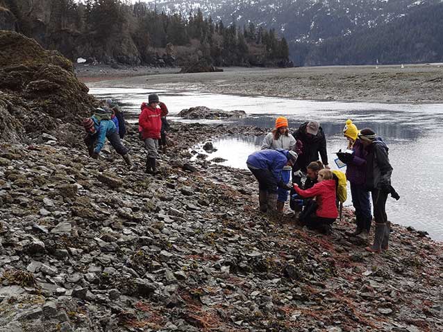
In 2006 and 2007, Bob Barnwell, a 6th grade teacher at Seward Elementary School, used a Coastal Marine Grant to fund a plankton comparison study for his students. During field trips inside Resurrection Bay and Kachemak Bay, the students gained basic knowledge of the plankton species that occurred in their local waters (Figure 8). They then studied the entire food web the plankton community supports to better understand the trophic links within the ecosystem. Along the way, they collaborated with local scientists to understand what was known and unknown about their local plankton.
One of the greatest challenges in teaching students about how ecosystems work is getting them to visualize and understand the monumental role that microscopic organisms play in our environment. This project opened the students’ eyes to the microscopic world of plankton and educated them about the agencies and scientists working on ocean issues in their community.
Conclusion
From studying resource allocation in the sugar kelp (Saccharina latissima) to installing collection stations for discarded monofilament, to “Tidepooling for Tots,” many successful projects ultimately fulfilled the full breadth of the original purposes envisioned for the money funded through these coastal marine grants. Although most of the available funds for these projects have now been expended, the long list of what has been accomplished will surely inspire many to continue to study the ocean and its resources.
References
Heuffer, K., D. Holcomb, L. Ballweber, S. Gende, G. Blundell, and T. O’Hara. 2011.
Serologic surveillance of pathogens in a declining harbor seal (Phoca vitulina) population in Glaceir Bay National Park, Alaska, USA and a reference site. Journal of Wildlife Diseases 47(4): 984-988.
Heuffer, K., S. Gende, and T. O’Hara. 2013
Assay dependence of Brucella antibody prevalence in a declining Alaskan harbor seal (Phoca vitulina) population. Acta Veterinaria Scandinavica 55(2)
Hoover-Miller, A., A. Bishop, J. Prewitt, S. Conlon, C. Jezierski, and P. Armato. 2013.
Efficacy of Voluntary Mitigation in Reducing Harbor Seal Disturbance. The Journal of Wildlife Management 77(4): 689-700.
Mathews, E., and G. Pendleton. 2006.
Declines in harbor seal (Phoca vitulina) numbers in Glaceir Bay National Park, Alaska, 1992-2002. Marine Mammal Science 22: 170-191.
Pettit, E., K. Lee, J. Brann, J. Nystuen, P. Wilson, and S. O’Neel. 2015.
Unusually loud ambient noise in tidewater glacier fjords: A signal of ice melt. Geophysical Research Letters 42(7): 2309-2316.
Womble, J., and S. Gende. 2013.
Post-breeding season migrations of a top predator, the harbor seal (Phoca vitulina richardii), from a marine protected area in Alaska. PLoS ONE. 8(2): e55386. http://journals.plos.org/plosone/article?id=10.1371/journal.pone.0055386.
Womble, J., G. Blundell, S. Gende, M. Horning, M. Sigler, and D. Csepp. 2014.
Linking marine predator diving behavior to local prey fields in contrasting habitats in a subarctic glacial fjord. Marine Biology 161(6): 1361-1374.
Womble, J., G. Pendleton, E. Mathews, G. Blundell, N. Bool, and S. Gende. 2010.
Harbor seal (Phoca vitulina richardii) decline continues in the rapidly changing landscape of Glaceir Bay National Park, Alaska 1992-2008. Marine Mammals Science 26(3): 686-697.
Part of a series of articles titled Alaska Park Science - Volume 15 Issue 1: Coastal Research Science in Alaska's National Parks.
Last updated: June 9, 2022
