Last updated: June 18, 2018
Article
Acidification Risk Assessment

high-elevation lakes, headwater streams, sugar maple and red spruce trees, are sensitive to the effects of acidification from atmospheric nitrogen and sulfur deposition.
NPS Photo
This report series evaluates the relative sensitivity of National Park Service (NPS) parks and inventory & monitoring networks to potential acidification effects caused by atmospheric nitrogen (nitrate and ammonium) and sulfur (sulfate) deposition. In terrestrial ecosystems, acidification depletes soil nutrients and mobilizes aluminum, affecting plant health and growth. In lakes and streams, acidification harms fish, amphibians, and aquatic insects.
The reports provide a relative risk assessment of acidification impacts from atmospheric nitrogen and sulfur deposition for 270 parks in 32 inventory & monitoring networks. This assessment considers three factors that influence acidification risk to park resources:
- Nitrogen and Sulfur Pollutant Exposure
- Ecosystem Sensitivity
- Park Protection Mandates
National parks and networks are ranked according to each of these factors (themes). An overall risk ranking is then calculated based on averages of the three theme rankings.
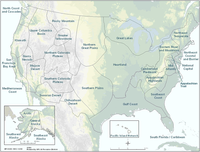
Select an acidification risk assessment report using the map or list below.
Acidification Risk Assessment Network Map

Main Report
The main report provides background for the project, describes the assessment methods, and summarizes ranking results. It should be used in conjunction with each network report.
Inventory & Monitoring Network Reports
- Appalachian Highlands
- Arctic
- Central Alaska
- Chihuahuan Desert
- Cumberland Piedmont
- Eastern Rivers and Mountains
- Great Lakes
- Greater Yellowstone
- Gulf Coast
- Heartland
- Klamath
- Mediterranean Coast
- Mid Atlantic
- Mojave Desert
- National Capital Region
- North Coast and Cascades
- Northeast Coastal and Barrier
- Northeast Temperate
- Northern Colorado Plateau
- Northern Great Plains
- Pacific Island
- Rocky Mountain
- San Francisco Bay Area
- Sierra Nevada
- Sonoran Desert
- South Florida/Caribbean
- Southeast Alaska
- Southeast Coast
- Southern Colorado Plateau
- Southern Plains
- Southwest Alaska
- Upper Columbia Basin
