Last updated: June 10, 2021
Article
Skull Valley and Hastings Pass: Backcountry Route
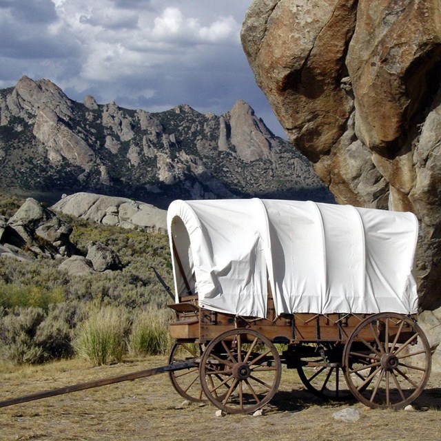
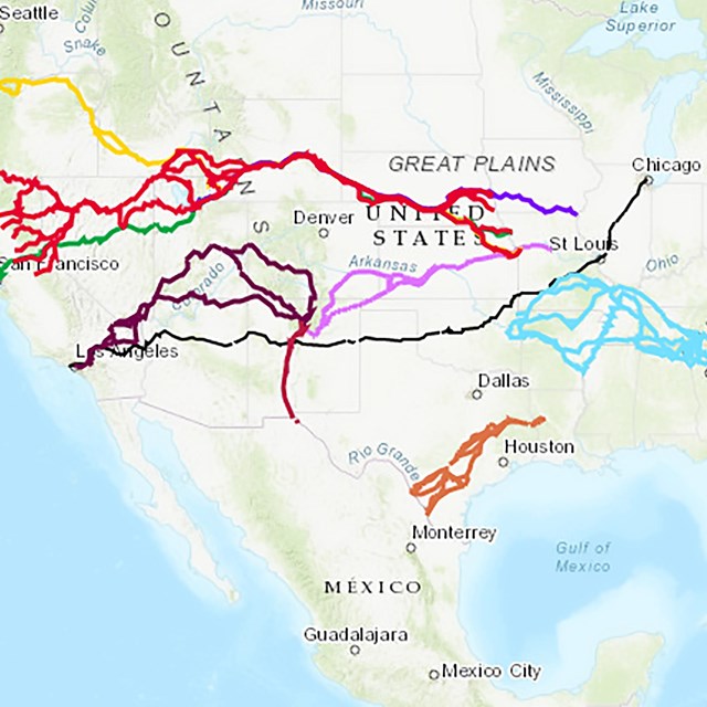
This 46-mile backcountry route follows pavement south along the trail corridor for about 17 miles from exit 77, I-80 to Iosepa, Utah. Beyond Iosepa, the route follows 29 miles of unpaved road, normally passable when dry for high-clearance 2-wheel-drive vehicles, along the original route of the Hastings Cutoff through the Cedar Mountains at Hastings Pass. The backcountry route rejoins I-80 at Aragonite (Exit 56).
If continuing on unpaved roads:
- Carry a fully inflated spare tire in good condition.
- There is no opportunity to buy gas, water, or food along the way
- Most of the route is out of cell phone range.
- Consider traveling with a second vehicle in case of breakdown.
- This is open range country: watch for livestock and wildlife along the highways and back roads.
Call the BLM Salt Lake Field Office at (801) 977-4300 to inquire about conditions on the unpaved roads beyond Iosepa.
Directions
Take Exit 77 to begin the optional backcountry tour from I-80. Zero your trip odometer at the Salt Lake. stop sign at the end of the exit ramp and turn south (left) onto UT-196, following the directional sign for the California Trail. Now the Stansbury Mountains and the Hastings Cutoff trail are to the left; the Cedar Mountains and Hastings Pass are across Skull Valley to the right.
As you start your drive south, look left toward Timpie Point. A few willows show the location of Big Springs, a source of brackish water that was used by some travelers along the Hastings Cutoff. Many emigrants, though, bypassed Big Springs and headed directly to Horseshoe Springs or Hope Wells. The trail runs along the higher ground to the left, but crosses to the right side of the highway about 4 miles south of Big Springs.
As you start your drive south, look left toward Timpie Point. A few willows show the location of Big Springs, a source of brackish water that was used by some travelers along the Hastings Cutoff. Many emigrants, though, bypassed Big Springs and headed directly to Horseshoe Springs or Hope Wells. The trail runs along the higher ground to the left, but crosses to the right side of the highway about 4 miles south of Big Springs.
Horseshoe Springs and other waterholes along the margins of Skull Valley were important resources for the Goshute Indians long before the arrival of emigrants. Wildlife and trail ruts are abundant around the springs today, and interpretive wayside exhibits are in development. The Bureau of Land Management manages this area for protection of wildlife and wetlands. Please keep vehicles on designated roads.
Directions
At odometer reading 9.6 miles (south of milepost 28) is a sign for Horseshoe Springs. Turn right onto the gravel entrance road. Just ahead, look to the left for a white fiberglass trail post marking wagon swale. Nearby, a brown T-shaped marker made of railroad rail provides an emigrant’s observations concerning a fork in the trail there. Pause here to explore wagon swales on both sides of the road; then continue to parking at the springs.
Return to UT-196 and turn south (right). Zero your trip odometer upon re-entering the highway. The main trail corridor continues along the right side of UT-196.
Iosepa Polynesian Settlement. The ghost town of Iosepa (1889-1917) post-dates the emigrant trail by 20 years but is a fascinating part of Utah history. The Church of Jesus Christ of Latter-day Saints established this settlement for Polynesian converts from Hawaii, Samoa, Tahiti, and New Zealand who wished to immigrate to Utah to be near the Mormon temple at Salt Lake City. A historical marker tells the story. A small cemetery remains. The site has a picnic pavilion and restrooms (closed winters). Each Memorial Day weekend, the Iosepa Historical Association sponsors a luau there for Utah Polynesians and others who are interested in Polynesian history. Visitors are welcome.
Directions
On the left side of the highway at highway milepost 23, about 4.5 miles south of Horseshoe Springs, is a blue directional sign on the left for Iosepa. Turn left onto the entrance drive, crossover the cattle guard, and following the road to the right for about a mile to the picnic pavilion.
Return to UT-196 heading south.
On private land south of Iosepa is Hope Wells, where the Donner-Reed Party discovered the shredded remains of a note left by Lansford Hastings. “2 days – 2 nights – hard driving – cross – desert – reach water,” the beleaguered emigrants read. One more brackish waterhole, Redlum Spring, lies ahead; from there the trail continues west 65 miles through the Cedar Mountains and across the salt flats to Donner Springs, at the foot of Pilot Peak.