Last updated: March 10, 2025
Article
Sea Level Rise Impact on DC Parks

NPS Photo / Graphic by 4C
Sea level rise is occurring on a global scale as the result of many climate change-induced factors. It is impacting 111 National Park Service (NPS) sites nationwide. In the National Capital Region, sea level rise is occurring at a particularly rapid rate because the land bordering the Potomac and Anacostia rivers is simultaneously sinking as the water levels rise.
Sea level rise is caused by two primary factors:
- Thermal Expansion: As global temperatures rise, ocean water warms and expands, taking up more space as a result.
- Glacial Melt: The melting of glaciers and polar ice caps increases the amount of liquid water flowing into the ocean. Water that was previously frozen on land, like in Greenland and West Antarctica, melts and drains into the ocean, adding to its total volume.
Global sea level was steady for the last two millennia, but it is now rising at a rate faster than it has in the last 6,000 years. As of December 2019, the sea level in D.C. is projected to increase by about 2–6 feet by the end of the century. Even if the sea level only rises 2 feet, communities and national parks will be forced to adapt or relocate. In fact, the NPS has already had to relocate a historic lighthouse in Cape Hatteras. Although those numbers sound small, these rising sea levels are already causing flooding and impacting coastlines and ecosystems.
- Extreme Storms: When sea levels rise, water fills into lower elevation areas and storm surges become more powerful and can devastate entire coasts. Sea level rise and more extreme precipitation events will contribute to an increase in the frequency and severity of flooding events. [Link to Storms page]
- Impairment to Ecosystems: Rising sea levels can worsen erosion, permanently inundate wetlands, and destroy habitat for diverse wildlife and plants.
- Flooding Infrastructure: Higher sea levels pose a major risk to communities and parks on the coast. Gravelly Point, a popular place to watch airplanes land and take off over the Potomac, is projected to be entirely underwater with only small rises in sea level. Even for areas elevated enough to remain above rising water levels, increased flooding means infrastructure (i.e., bridges, walkways, parking lots, etc.) will have to be rebuilt in order to maintain access to important cultural and recreational resources.
The NPS believes it is important to educate and engage visitors about the threats posed by sea level rise, as its impacts will have far reaching effects on the sustainability of parks.

NPS Photo
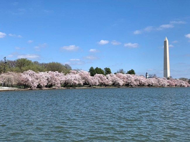
Tidal Basin at the National Mall
The Tidal Basin and surrounding land was created in 1882 when the U.S. Army Corps of Engineers dredged the Potomac mudflats to remove silt and improve ship traffic in the area. The land created during this project is now slowly sinking.
Severe flooding has already happened in the nation’s capital and the area will continue to experience extreme flood damage as global temperatures warm and sea levels rise. Combined with the sinking of land created during the reclamation project, this will increase the intensity of flooding and create a need for more flood adaptation and prevention.
A floodplain projection produced by the Federal Emergency Management Agency indicates that the Dr. Martin Luther King Jr. Memorial and the iconic Reflecting Pool, where 250,000 people once stood to witness Dr. King’s “I Have a Dream” speech, are both vulnerable to severe flooding and flood damage in the future

NPS / JIM SCHMIDT
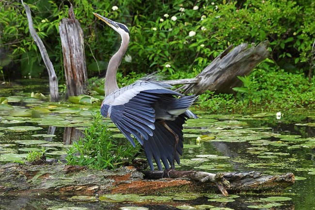
Fort Washington Wildlife
Fort Washington Park’s low-lying natural areas provide habitat for birds of regional and continental conservation concern such as five different species of warbler. Sea level rise is already decreasing the amount of coastal land area in the park available for these birds to use as habitat. The NPS is working at Fort Washington to continue supporting these species and the broader biodiversity and ecosystem productivity of the region.

NPS Photo
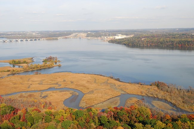
Dyke Marsh at George Washington Memorial Parkway
Dyke Marsh is one of the most recognized resources of the George Washington Memorial Parkway (GWMP) and most vulnerable to flooding and erosion. Because of its unique low-lying location, the rate at which sediment or soil builds up will not be able to keep up with the rate of sea level rise. This will likely transition the marsh from primarily high marsh to low marsh, changing the vegetation and affecting the marsh’s threatened species, including birds such as the marsh wren and the least bittern as well as rare plants like river bulrush.
Due to gravel mining operations in the mid-20th century, the marsh has experienced an accelerated rate of tidal erosion. Sea level rise may further accelerate this erosion process, amplifying concerns for the land. Moreover, marsh habitat will move further landward and threaten forested habitat.
The health of GWMP and the biodiversity it provides depends on Dyke Marsh’s important ecosystem. Fortunately, the NPS and the U.S. Army Corps of Engineers are committed to restoring Dyke Marsh. In 2013, Congress recognized the serious threat of sea level rise on the marsh and allocated $24.9 million to restore the site.

