Last updated: November 13, 2023
Article
Old Spanish Trail: Colorado Western Slope Itinerary
NPS Image
Explore the Old Spanish Trail on the Western Slope
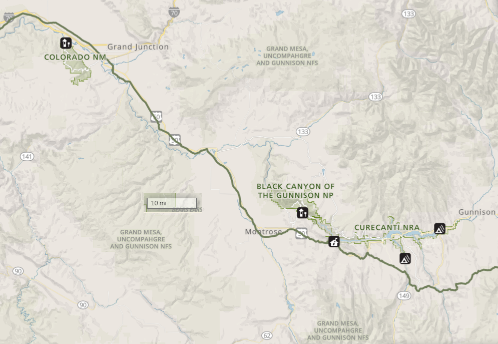
Planning a trip to the western slope? As you drive on Highway 50 between Black Canyon of the Gunnison National Park and Grand Junction, Colorado, you will be traveling near the Old Spanish Trail. The modern roadway was constructed over or near the national historic trail, giving you a unique opportunity to take a view back in time!
Do you want to learn more? Would you like to hike on the Old Spanish Trail? Check out these trail sites:
(Please contact site managers before visiting for current information on hours, conditions, etc.)
- Old Spanish National Historic Trail
Cerro Summit
- Locations: Old Spanish National Historic Trail
- Old Spanish National Historic Trail
Curecanti National Recreation Area, the Old Spanish Trail
- Locations: Old Spanish National Historic Trail

As you travel on Highway 50, past the Curecanti National Recreation Area, you will reach the Cimarron Visitor Center and Historic Cimarron. The Old Spanish Trail mirrors the Highway in this area and passes through the National Recreation Area near the visitor center. Stop at the Visitor Center for information and to visit the Morro Point Dam overlook.
- Old Spanish National Historic Trail
Rabbits Ear Trailhead, McInnis Canyon National Conservation Area
- Locations: Old Spanish National Historic Trail
Rabbit Ears Trail gives the sense of how harsh an environment Old Spanish Trail travelers would have contended with, as the national historic trail passes through the vicinity. The McDonald Creek Trail accesses McDonald Creek. While the creek is south of the trail, historic travelers may have explored this area. Explore the campground to learn more about the history of Rabbit Valley.
- Old Spanish National Historic Trail
Montrose Public Lands Center
- Locations: Old Spanish National Historic Trail
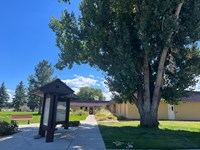
The Visitor Center is a great place to get information about the area and how to explore the Old Spanish Trail. You will find helpful Bureau of Land Management and US Forest Service staff that will help you plan your trip, answer questions, acquire any needed permits, and shop at the educational and area oriented gift store.
- Old Spanish National Historic Trail
Kokopelli's Trailhead, McInnis Canyon National Conservation Area
- Locations: Old Spanish National Historic Trail
Located just below the Old Spanish National Historic Trail, the Hawkeye trail is a part of Kokopelli Loops within the McInnis Canyons National Conservation Area. The area is popular for mountain biking, but is a great opportunity to get out on a trail and take a step back in time!
- Old Spanish National Historic Trail
Colorado Welcome Center, Fruita
- Old Spanish National Historic Trail
Museum of the West Old Spanish Trail North Branch
- Locations: Old Spanish National Historic Trail

The Old Spanish Trail, North Branch has a full and rich history dating back to the Native American trade and migration routes and continues to be of use today. Visitors can explore the trail by hiking, mountain biking, or on horseback. Mountain men traveled the Old Spanish Trail for trading and guiding explorers eager to chart the unknown West. Guests can learn more about The Old Spanish Trail at The Museum of the West and get their Passports stamped.
- Old Spanish National Historic Trail
Fort Uncompahgre Interpretive Center
- Old Spanish National Historic Trail
Dominguez-Escalante National Conservation Area
- Locations: Old Spanish National Historic Trail
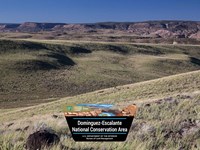
Dominguez-Escalante National Conservation Area (NCA) comprises 210,172 acres of protected public lands, and includes the 66,280-acre Dominguez Canyon Wilderness. Known for its breathtaking scenery, Dominguez-Escalante NCA is a fine example of the spectacular canyon country of the Uncompahgre Plateau. Red-rock canyons and sandstone bluffs hold geological and paleontological resources spanning 600 million years, as well as many cultural and historic sites.

