Last updated: August 13, 2021
Article
Mount Rushmore National Memorial Cultural Landscape

NPS
Mount Rushmore National Memorial, located in the ecologically-diverse Black Hills region of South Dakota, contains the monumental American sculpture displaying four presidential figures. After its construction commenced in 1927, the Memorial became known as a controversial symbol of American values. Some celebrated the project, while others criticized its environmental impact and location on sacred land. The entire Black Hills hold cultural and spiritual value for several Native American tribes and are considered by many of these tribes to be a Traditional Cultural Place (TCP).
Per its National Register nomination, the Mount Rushmore cultural landscape remains significant for its ability to yield prehistoric information, artistic value, and association with historic figures and events. The period of significance stretches from 3500 BC to 1967 AD.
Landscape Description
The Mount Rushmore cultural landscape in Pennington County, South Dakota contains 1,278 acres. The rugged topography is characteristic of the Black Hills region, which is the easternmost extension of the Rocky Mountains. The Black Hills began forming approximately 60 million years ago when the landform began uplifting. Erosion removed sedimentary rock at the surface to reveal the granite mass beneath.
Numerous plant communities thrive in the microclimates created by the varying Black Hills topography. Forest types include: Paper Birch/Beaked Hazel, Ponderosa Pine/Kinnikinnick Woodland, and Ponderosa Pine/Common Juniper Woodland. Ponderosa Pine constitutes the dominant forest species. A specific Black Hills Rock Outcrop Sparse Vegetation community thrives in both soil pockets and breaks in rock outcrops.
Three main drainage basins exist within the landscape boundaries: the Starling, Lafferty Gulch, and East Boundary basins. Creeks include Battle and Grizzly Bear Creeks. Historically, these sources provided water for native tribes and European settlers, and the Memorial’s current water supply is drawn from wells in Lafferty Gulch.
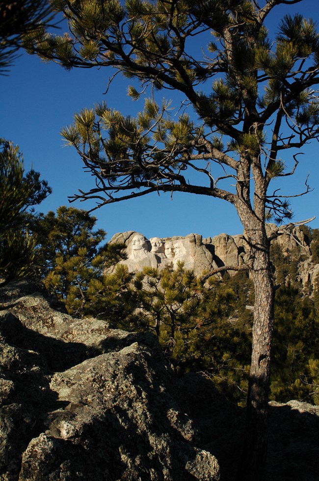
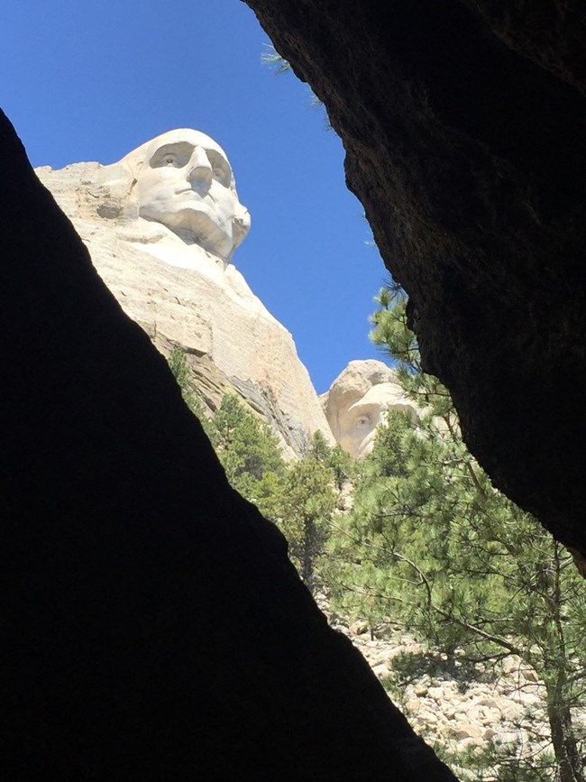
Major redevelopment also occurred in 1998 using a “see, approach, arrive” design concept. The concept was intended to improve visitor navigation and circulation, increase the time visitors were on site, and maximize opportunities to experience the sculpture and setting. Controlled views and framed vistas of the sculpture from various locations feature prominently in the design within the core area. The most prominent viewshed was created at the top of the amphitheater (the “Grand View Terrace”) which serves as the terminus or “arrived” portion of the redevelopment concept.

NPS / R. Young

Photo by Rise Studios, courtesy of NPS
Historic Use
Recovered artifacts indicate that early peoples, likely hunter-gatherers, occupied the Black Hills area around 7000 BCE. By the late 1700s, the Lakota controlled the territory in their defeat of the Cheyenne. The name of the Black Hills derives from the Lakota term “Paha Sapa,” meaning hills of black. This is in reference to the dense shadow cast by the coniferous trees along the range. Historically, religious ceremonies were performed at Paha Sapa annually, and the landscape continues to hold significant cultural importance for many tribes.
The United States government recognized the Black Hills as Lakota territory under the 1868 Treaty of Fort Laramie. However, the discovery of gold in 1874 motivated prospectors and settlers to violate the treaty and occupy the area. The Lakota Sioux and Northern Cheyenne resisted the United States Government in the Black Hills War/Great Sioux War of 1876, in which the Battle of Little Bighorn occurred. The Sioux, led by Sitting Bull, won this battle. However, ongoing conflict and a diminishing food supply weakened resistance and many Lakota Sioux were forced on to reservations by the end of the 1800s.

NPS
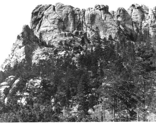
The concept for the sculpture was presented by South Dakota authorities in the 1920s as a means to bolster tourism. The state historian of South Dakota and two other individuals originally proposed a carving at the Needles, a concentration of granite formations in Custer State Park, depicting Native Americans and pioneers. Artist Gutzon Borglum was selected to carve the sculpture. He decided the Needles site was inadequate and selected a 400-foot cliff in the Harney National Forest. The selection of this cliff site, located on what the Lakota Sioux called the Six Grandfathers Mountain (translated), completely disregarded the site’s existing cultural significance. Stakeholders approved the location and decided to change the subject of the carving to four United States presidents. The presidents chosen for the design were intended to represent certain values rather than the individuals.
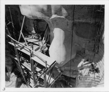
Borglum considered viewsheds and the experience approaching the sculpture in his design. The Iron Mountain Road was constructed in 1933 to connect Custer State Park and the Rushmore area. Early on, funding for the project was largely private until President Coolidge extended federal support and, later, the transfer of authority to the National Park Service. The busts of the presidents were dedicated individually. After Borglum’s passing in March 1941, his son oversaw the remaining construction, which was completed on October 31, 1941.

NPS / R. Young
In the 1970s, the American Indian Movement (AIM), a grassroots organization that advocates for American Indian interests, held demonstrations at Mount Rushmore. AIM sought recognition of tribal sovereignty and restoration of United States treaty agreements. They also brought attention to civil rights violations inflicted on indigenous people, including the Wounded Knee Massacre.
The complexity of meaning attached to the memorial began at its inception and continues into contemporary times. Some see the sculpture as a representation of colonialism, racism, and a patriarchal society, while others praise its symbology of American democracy and freedom. Gutzon Borglum’s design intent to celebrate the history of the United States is manifest in the monumentality of the sculpture and skill of its execution. Visitors today can experience the historic designed landscape and layers of cultural history and significance, as well as the unique environmental features of the region.
Quick Facts
- Cultural Landscape Type: Designed / Vernacular
- National Register Level of Significance: National
- National Register Significance Criteria: A, B, C, D
- Period of Significance: 3500 BCE - 1967

