Last updated: August 1, 2023
Article
Maps of the Missouri River

Library of Congress, Geography and Map Division
In 1803, most settlers living near St. Louis spoke French.
John Hay, the postmaster at Cahokia Courthouse, spoke both French and English. He became an important connection for Meriwether Lewis and William Clark. Hay had worked in the fur trade for nearly twenty years. He introduced Lewis and Clark to James Mackay, whose map of the Upper Missouri River became an important resource for the expedition.
Mackay had emigrated from Scotland to Canada in the 1770s. He found work with a British fur trading company. In 1787, the company sent him on an overland trade expedition to Mandan and Hidatsa villages on the Upper Missouri River. By the early 1790s, Mackay was operating his own trading company out of Cahokia.
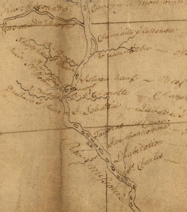
In 1795, the Missouri Company, a Spanish trading company, hired Mackay to lead an expedition up the Missouri River. The company’s investors wanted to establish trade with the Mandan villages he had visited a decade earlier. Mackay sent his assistant, John Evans, in his stead. Evans took extensive field notes, documenting what he learned from the Indigenous people who had traveled this stretch many times. Upon his return to Cahokia, Evans and Mackay used that information to create a map. It covered an area stretching from St. Charles, Missouri, to Mandan territory in what is now North Dakota.
Mackay shared this map with Clark. It became an important tool for Lewis and Clark’s navigations of the Missouri River.
Clark would later make a map of this territory. Like Mackay, he relied on Indigenous knowledge of rivers, mountains, streams, and trails.
About this article: This article is part of series called “Pivotal Places: Stories from the Lewis and Clark National Historic Trail.”
