Part of a series of articles titled Lewis and Clark Trail 2021 Annual Report.
Previous: AmeriCorps VISTA Volunteers 2021
Article
About this article: This article was originally published in the Lewis and Clark National Historic Trail 2021 Annual Report.
By Tara Cuvelier | Visual Information Specialist Detailee
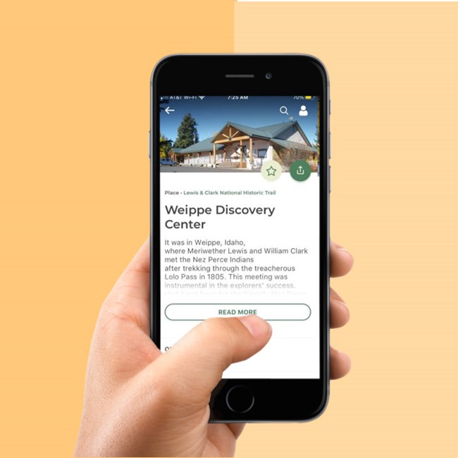
During my detail as a Visual Information Specialist for the Lewis and Clark National Historic Trail, I was tasked with adding partner sites as place assets in preparation for the launch of the National Park Service’s (NPS) new app, the NPS App. I edited, researched and wrote content for Lewis and Clark Trail’s NPS webpage, tracked down hard-to-find images, and uploaded information for over 200 sites to the park’s content management system. Download the free NPS App in the App Store or on Google Play. (Check out the Omaha visitor center’s interpretive garden walking tour that I worked on!)
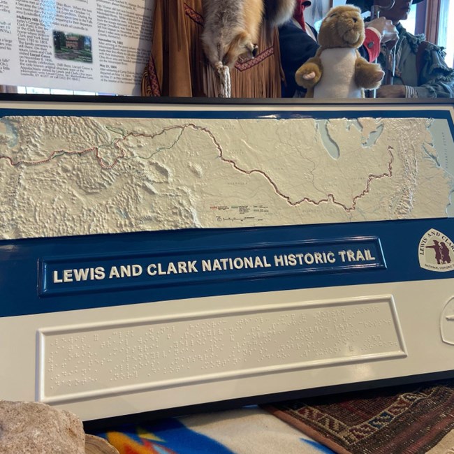
The Lewis and Clark Expedition covered a great expanse of the continent: 4,900 miles. The map of this route is essential to the expedition’s story. In 2021 we took a big step towards making the Lewis and Clark Trail map more accessible.
This year, custom tactile maps of the Lewis and Clark Trail were developed and distributed across the country. In addition to feeling the topographical relief of the United States, audiences can trace their way along the Lewis and Clark Trail, which is recessed or sunken. Coastlines are also recessed, or dropped a step. A braille caption lists the names of the states the trail passes through, and the names of the major rivers.

Brye Lefler is excited and honored by the opportunity to work with Indigenous communities as the Tribal Partnerships Specialist for the Lewis and Clark National Historic Trail. Brye has worked with Tribal Nations across the U.S. on collaborative projects including cultural and natural resource management, traditional ecological knowledge studies, and interpretation. In Brye’s previous work he has served as Cultural Anthropologist and Tribal Liaison at Yosemite National Park, Policy Analyst at the US Department of Agriculture (USDA) Office of Tribal Relations, and Deputy Trail Administrator for the Pacific Northwest National Scenic Trail with the USDA Forest Service, among other roles. Brye lives with his family on an urban homestead in Portland, Oregon, where he can sometimes be found paddling the last 100 miles of the trail on the Columbia River.
By Sarah Stannard | Visitor Center Manager
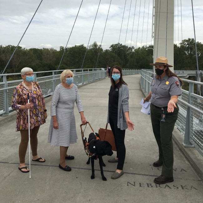
In July 2022 the City of Omaha will host the American Council for the Blind (ACB) Annual Conference. To ensure we provide accessible, engaging programming, visitor center and exhibits staff met with delegates from the group to showcase our resources and to plan programming for their group. Rangers will also work with ACB to ensure that all eligible conference attendees are able to receive their free, lifetime America the Beautiful Access Pass. While here, ACB delegates reviewed our new tactile map, which helps visitors with low or no vision to experience the magnitude of the Lewis and Clark Expedition and the country’s formidable terrain.
By Caitlin Campbell | Visual Info. Specialist
In December 2021, the Lewis and Clark Trail Junior Ranger Program won a first- place media award from the National Association for Interpretation (NAI). Each year, agencies and organizations engaged in public outreach submit publications, videos, digital campaigns, and exhibits for competition in NAI’s media awards. Entries are reviewed by a panel of professionals in the fields of interpretation, design, and media. The Lewis and Clark Trail Junior Ranger Activity Journal was awarded the first-place NAI Media Award in the book category after receiving top marks for thoughtful, inclusive messaging, and innovative online components.
Part of a series of articles titled Lewis and Clark Trail 2021 Annual Report.
Previous: AmeriCorps VISTA Volunteers 2021
Last updated: January 24, 2022