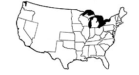
NPS Today there are fifty states in the United States of America. When the Civil War began there were only thirty-four states. When the nation divided over political issues, nineteen states remained in the Union and eleven states seceded. Those eleven states joined the Confederate States of America. Four states were called Border States. The Border States were slave states located between the North and South that stayed in the Union. Three states joined the Union during the war. Instructions Identify the states by writing the name (or abbreviation) with a ballpoint pen on or near the correct location. Click here to see a larger version of the map to print. Click the answer key below to see how you did. *Color the Union States blue *Color the Confederate States gray *Color the Border States green (Borrowed from Antietam National Battlefield Park - thanks.) |
Last updated: June 7, 2022
