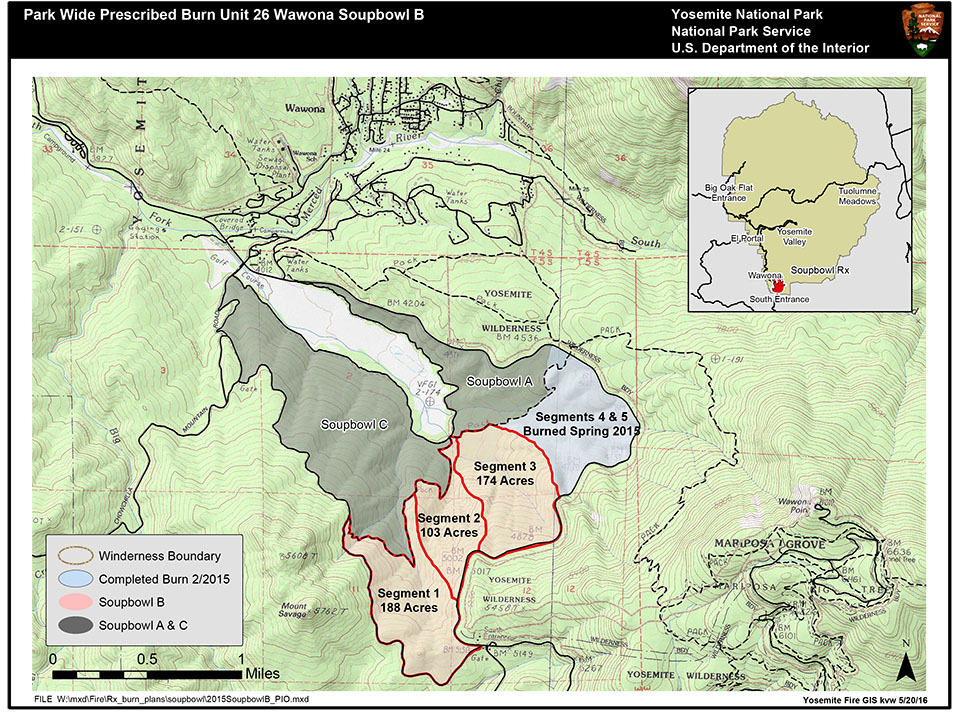
The primary objective of the project is to reduce hazardous vegetation (fuel) around the Wildland Urban Interface community of Wawona. This project will also help protect park infrastructure at the South Entrance station and reduce the threat of wildfires originating along Wawona Road that could adversely impact the Mariposa Grove of Giant Sequoias. This fuels treatment would help create a continuous fuel break between the community of Wawona and the south entrance of the park linking other burn areas, mechanical thinning projects, and previous prescribed fires.
Another objective of the Soupbowl prescribed fire is ecosystem restoration. Over 100 years ago, aggressive fire suppression policies resulted in fire exclusion across conifer forests throughout the Sierra Nevada Range. Applying fire under prescribed conditions mimics the frequent, low intensity lightning caused fires that occurred in the Sierras prior to the exclusion of fire. Historically, natural fires burned an average of 16,000 acres annually in Yosemite and played an integral role in shaping Yosemite’s ecosystems. In the absence of frequent fire, unnatural levels of forest fuel have accumulated which has put many of Yosemite’s natural and cultural values at risk. As climate and forest dynamics change, these values become increasingly vulnerable to catastrophic wildfire.
Park employees, community members, and visitors can expect to see crews from various federal and state agencies working along the Wawona Road doing prescribed fire preparation and burn operations. Traffic control will be in place during burn operations and delays should be short. Traffic will escorted by pilot car. Please use caution and follow signs when entering and exiting for firefighter safety.
Smoke will be present during the prescribed fire and in the Wawona area. Fire managers are working with the Mariposa County Air Pollution District (MCAPCD) to time the project to coincide with favorable weather that will facilitate good air quality, and disperse smoke into the atmosphere away from the community. Prior to ignition, smoke monitoring equipment will be installed in the community and a burn permit will be issued to the park by MCAPCD. Community members who are sensitive to smoke may want to close their windows and doors and/or consider leaving the area during active ignition of the project in order to reduce their exposure.
For additional Information
- Fire Information: e-mail us
- Yosemite National Park Fire Information website: http://www.nps.gov/yose/blogs/
fireinfo.htm - Facebook: http://www.facebook.com/pages/
Yosemite-Wildland-Fire/ 124632964255395 - Facebook: https://www.facebook.com/
YosemiteNPS/ - Twitter: https://twitter.com/
YosemiteFire

