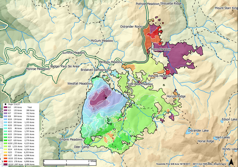
October 20, 2017
Location: East of Glacier Point Road, primarily in the Illilouette Basin.
Discovery Date: July 31st, 2017
Size: 8,094 acres
Containment: 85%
Cause: Lightning
Fire activity has increased this week due to warmer drier temperatures. The Empire Fire is burning into the 2004 Meadow Fire footprint in the Illilouette drainage. This area has shrubs and heavier dead and down fuel. With the expected warm and dry air and stable atmospheric conditions, expect poor dispersion of smoke, which means we are likely to have smoke in Yosemite Valley and the El Portal area throughout the coming week. The trajectory of the fire will likely take it in the direction of sparser fuels later in the week, which should reduce smoke production.
Crews will continue to monitor this fire, currently scouting for opportunities to reduce smoke production on the north end.
Glacier Point Road is open. Please exercise caution and drive carefully as there may be smoke impairing visibility along the road between Mono Meadow and Sentinel Dome trailhead parking areas.
The west and south flanks of the fire are contained and will continue to be monitored by aircraft and fire personnel. The east flank is continuing to burn in the Illilouette drainage. In Wilderness, lightning ignited fires are often allowed to burn if they do not threaten developed areas. The Yosemite Wilderness is a fire adapted ecosystem where past fire suppression has resulted in unnaturally high fuel levels. Allowing natural fires to burn produces a healthier, more diverse forest. By reducing the amount of fuel these fires reduce the severity of future fires.
The following trail and area closures are in place until further notice:
- Bridalveil Creek Campground
- Ostrander Trail
- Bridalveil Trail
- Alder Creek Trail
- Mono Meadow Trail
- Turner Meadow Trail
Fire Managers are working with the local Air Quality Districts and will be monitoring smoke impacts to the park and local communities.
Updates will be created on Friday of each week, unless there is significant change.

