Suppression Fire:
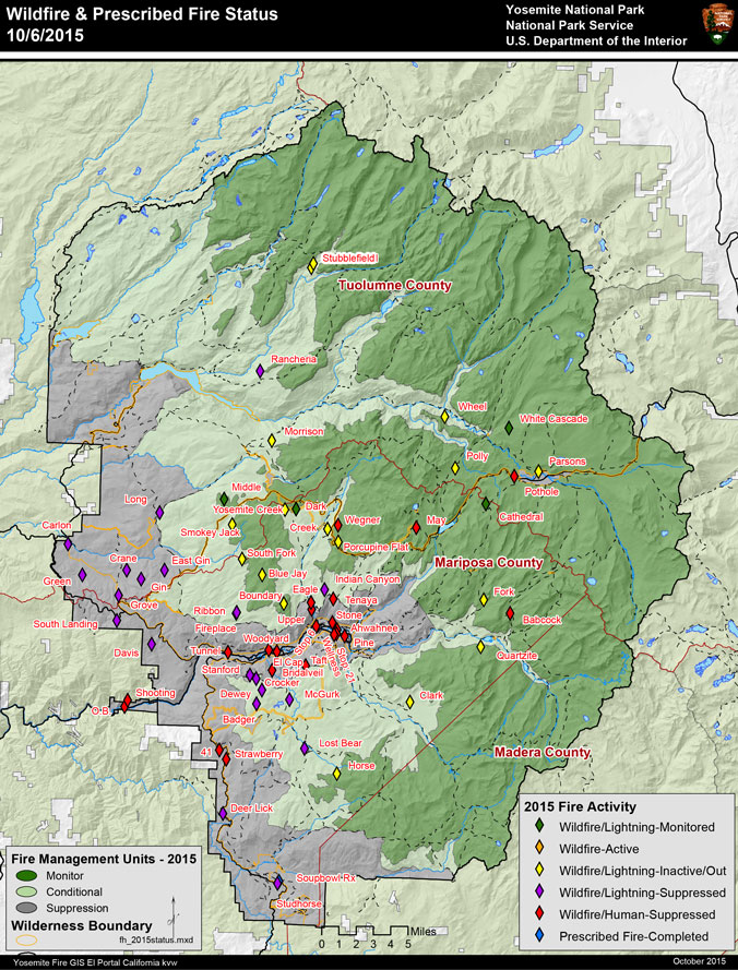
Bridalveil (37 42.412 x 119 38.389 – Mariposa Co., 6300 ft, 10/5). The Bridalveil Fire became more active and visible due to higher temperatures and lower humidities over the weekend. The cause of the fire remains unknown. The fire is estimated to be at 30 to 40 acres. The fire is running into rocks, gravel and sparse fuels.
It is estimated fire operations to suppress this fire may take a 5 days to a week. Minimum Impact Suppression Tactics are being employed as much as possible by fire crews by finding natural barriers to inhibit the spread of the fire. Helicopters are securing the heal and flanks of the fire with water bucket drops preventing the fire from crossing the Bridalveil Creek.
Yosemite pack strings are supporting camped out fire crews with supplies.
Air quality has improved as smoke production has diminished. Most of the smoke accumulation occurred in the west Valley and down the Merced River Canyon.
The Pohono Trail between the junction of the Taft Point and McGurk Meadows trail to Dewey Point is closed.
Resources on the fire are Groveland IHC, Sierra IHC, E-32, Todd Ruffner as IC. Stanislaus Engine 46 is staffed in Wawona.
Other Wilderness Fires:
Middle (37 51.538 x 119 41.194 - Tuolumne Co., 8043 ft, 7/27). It is west of White Wolf and south of the Middle Tuolumne River. It is 260 acres. The fire is monitored by Yosemite fire crews. Smoke may be visible.
Cathedral (37 51.078 x 119 25.120 – Tuolumne Co., 9400 ft, 8/2). This is near the John Muir Trail to Cathedral Lakes. The perimeter may continue to smolder and creep through lodgepole pine needles and logs. The fire is 42 acres. Light smoke may continue to be seen.
White Cascade (37 54.926 x 119 23.780 - Tuolumne C., 9000’ el., 7/3). This remote fire is within Tuolumne Meadows and is approximately 76 acres, and backing into Conness Creek and to the south.
Fires in Patrol Status: The Wegner, Dark, and Tenaya.
All hikers are advised to hike through these areas quickly and stay on the trail through the immediate fire areas.
As with all fires, staff and visitor safety is of paramount importance. Each fire, regardless of size, is assessed for the appropriate course of action.
Please remember – Yosemite and California continue to experience very dry conditions. Although it is fall and days are cooler, all visitors are urged to be diligent in any use of fire, including smoking. And be sure all fires are out!

