Meadow Fire Safety Closure
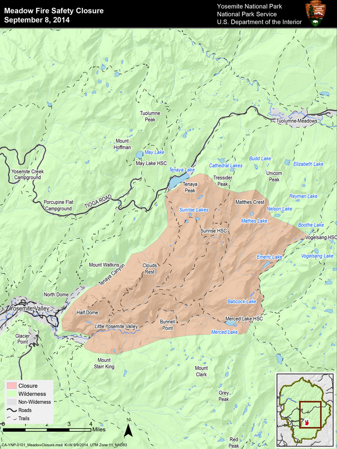
In order to maintain the safety of park visitors and allow fire management operations to continue unimpeded, the Superintendent of Yosemite National Park is designating a portion of Yosemite Wilderness as closed. The area will be closed until further notice is given.
The area marked as closed on the accompanying map entitled Meadow Fire Safety Closure dated September 8, 2014.
Features and facilities that are closed include, but are not limited to:
- Little Yosemite Valley
- The John Muir Trail between Little Yosemite Valley and Long Meadow.
- All routes on Half Dome including the Cables, NW Regular Route, and Snake Dike.
- Sunrise and Merced Lake High Sierra Camps and backpackers' camps.
- The Sunrise Trail south of the Tenaya Lake Trail junction.
- Clouds Rest, Sunrise Lakes, Emeric Lake, and Babcock Lake.
These trails and areas remain open:
- The Mist, John Muir, and Panorama Trails to the top of Nevada Fall.
- Vogelsang Backpackers' Camp.
- The Tenaya Lake Trail
- Fletcher Creek Trail between Vogelsang and Merced Lake Ranger Station

Download a PDF [400 kb]
