
The National Park Service Mobile App is a great tool for planning your trip, then it can be used as a guide during your visit. You can download the maps and content from Grand Canyon National Park for offline use. It’s especially handy if you’re exploring remote areas or concerned about data limits. Free and available now. 
A wide variety of Grand Canyon Maps, Trail Guides and Field Guides are available online from our non-profit partner Grand Canyon Conservancy. Your purchase goes towards protecting and enhancing Grand Canyon National Park for present and future generations. Grand Canyon Area Map(2.5 MB PDF File) revised 2/2015 Shows Grand Canyon National Park in relation to Las Vegas, NV, Flagstaff, AZ, National Forests, Indian Lands, and major area highways. 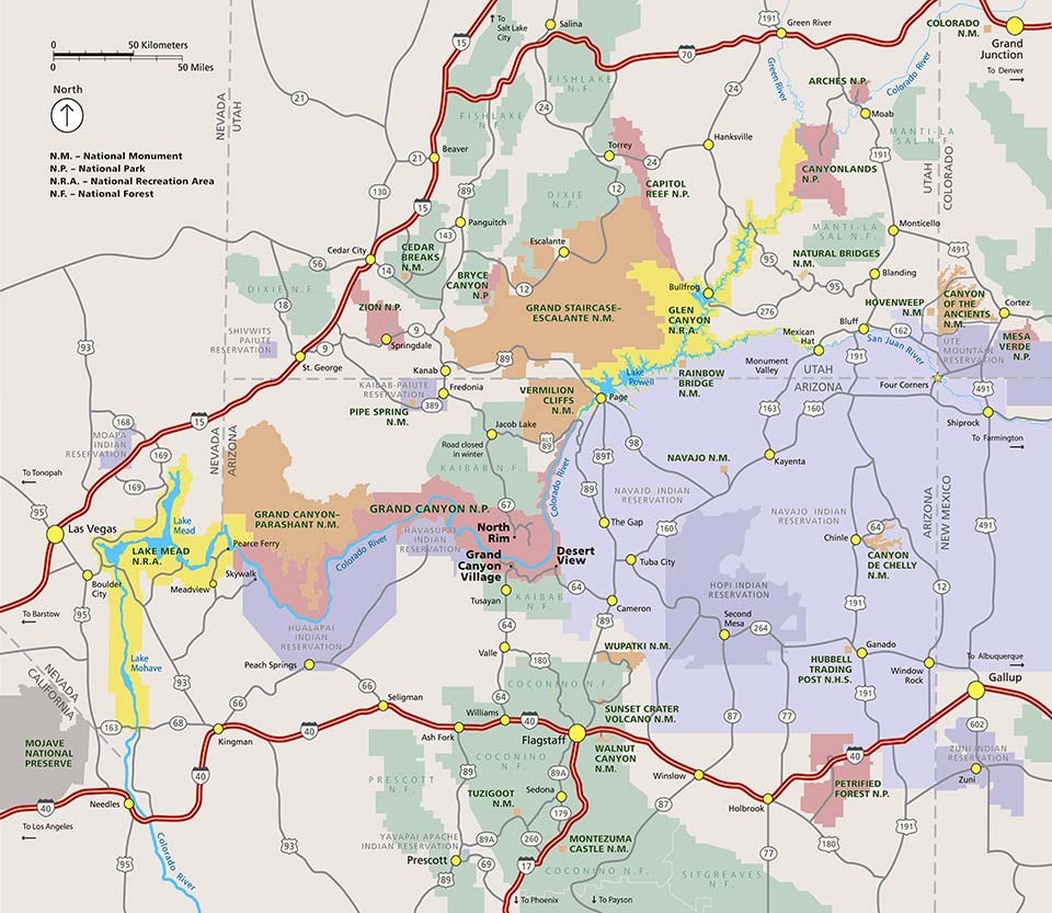
The region shown in this map includes 1) on the left edge of the map, Las Vegas, NV and Needles, CA 2) across the bottom, Interstate 40 from Needles, CA, east, through Flagstaff, AZ, to Gallup, NM. 3) on the right edge, starting at Gallup, NM, then, north to Colorado Nat. Monument, 4) Finally, bounded across the top by Interstate 70 crossing the state of Utah until it meets the intersection with Interstate 15.
Grand Canyon National Park is located east of Las Vegas, NV. North of Interstate 40 and the cities of Williams and Flagstaff, AZ. East of the Navajo and Hopi Indian Reservations, and south of the Utah state line. The Colorado River is shown through the entire 277 mile transect of Grand Canyon National Park. Public and tribal lands are show in different colors. Tribal lands are show in purple and reservation boundaries are shown for the following tribes: Navajo, Hopi, Hualapai, Havasupai, Kaibab Paiute, Shivwits Paiute, Zuni, and Ute Mountain. National forest lands are shown in green, and include, Coconino, Prescott, Sitgreaves, Kaibab, Dixie, Fishlake, and Manti-La Sal. National parks are shown in vermilion, and include, Petrified Forest, Grand Canyon, Zion, Bryce, Capitol Reef, Canyonlands, and Arches. National monuments are shown in orange and include, Wupatki, Sunset Crater, Walnut Canyon, Tuzigoot, Montezuma Castle, Canyon De Chelly, Navajo, Grand Canyon Parashant, Vermilion Cliffs, Grand Staircase Escalante, Pipe Springs, Rainbow Bridge, Cedar Breaks, Natural Bridges, Hovenweep, Canyon of the Ancients, and Colorado. National Recreation Areas are shown in yellow and include, Lake Mead, and Glen Canyon. Grand Canyon Panorama MapLinks to a higher resolution version of this map (3.2 MB jpg file) This map shows the South and North Rims with everything in between. This is the "big picture," generalized overview. Distant features on the North Rim are shown at a smaller scale than foreground South Rim areas. 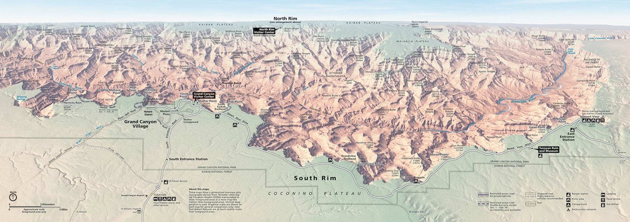
South Rim Pocket Map and Services Guide(4 MB PDF file)This is the map that you will receive when you enter the park and it shows the location of village parking areas, shuttle bus stops, and how to access scenic overlooks and visitor services. Information about services, facilities and overlooks are printed on the back side of the pocket map. 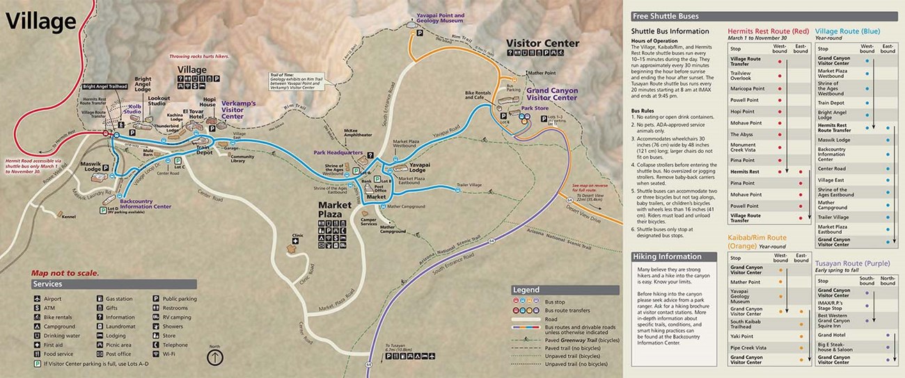
Desert View DriveThe Desert View Drive portion of SR 64 is a scenic road that begins near Grand Canyon Village on the South Rim of the park. Private vehicles can drive east along the canyon rim for 23 miles (37 km) to the Desert View Services Area and the East Entrance of Grand Canyon National Park. Details > . 
Backcountry Hiking Brochure and MapThis foldable brochure was designed for day and overnight inner canyon hikers. It gives information about hiking the Bright Angel, South Kaibab, and North Kaibab trails, as well as how to get a permit, trip planning, Leave No Trace, and Hike Smart information. It is distributed at park visitor centers, Grand Canyon Conservancy shops, and backcountry information centers. 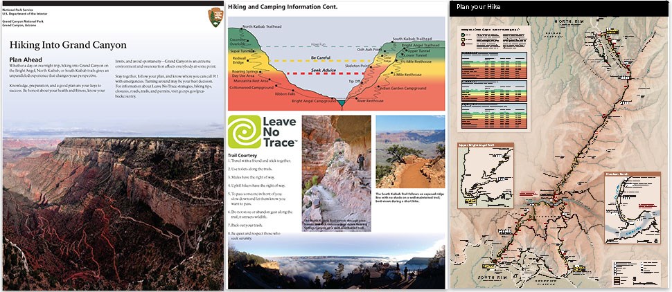
North Rim Pocket Map and Services GuideInstead of a newspaper, the North Rim Pocket Map and Services Guide is being distributed at entrance stations, visitor centers, lodges, campgrounds, stores, and out-of-park locations. 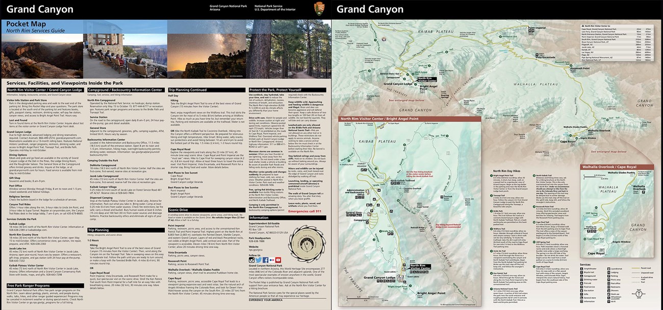
Interactive Grand Canyon Geologic MapBy Arizona Geological Society and United States Geologic Survey (USGS) 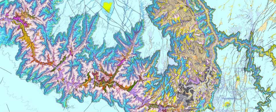
Additional National Park Service MapsThe National Park Service map siteThe National Park Service GIS site |
Last updated: October 17, 2024
