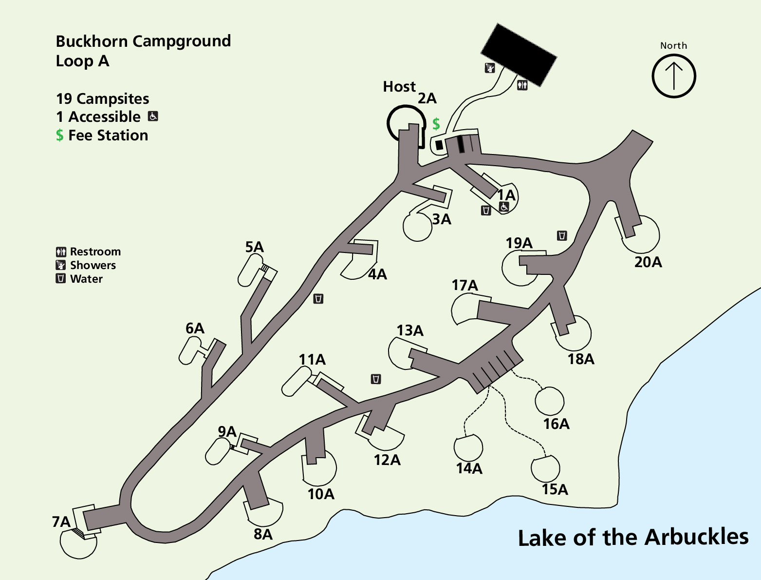
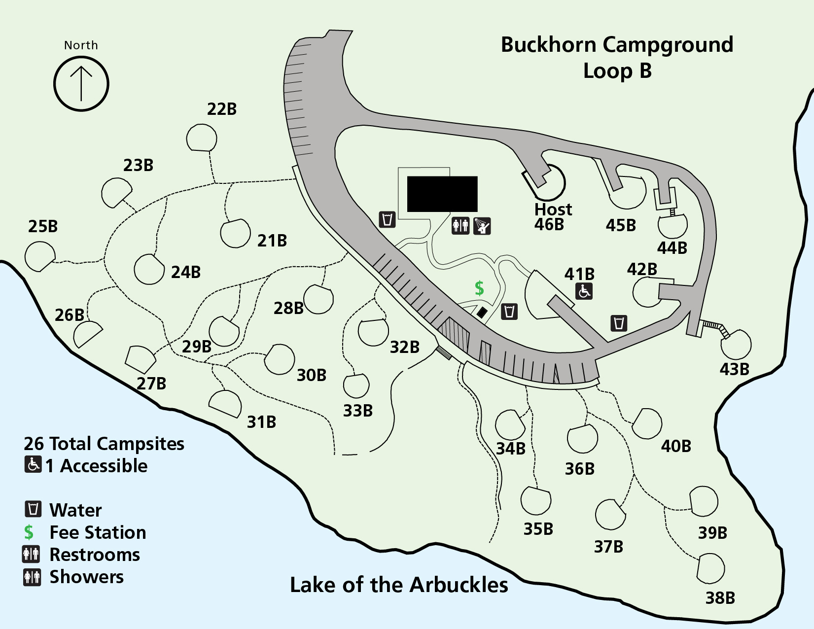
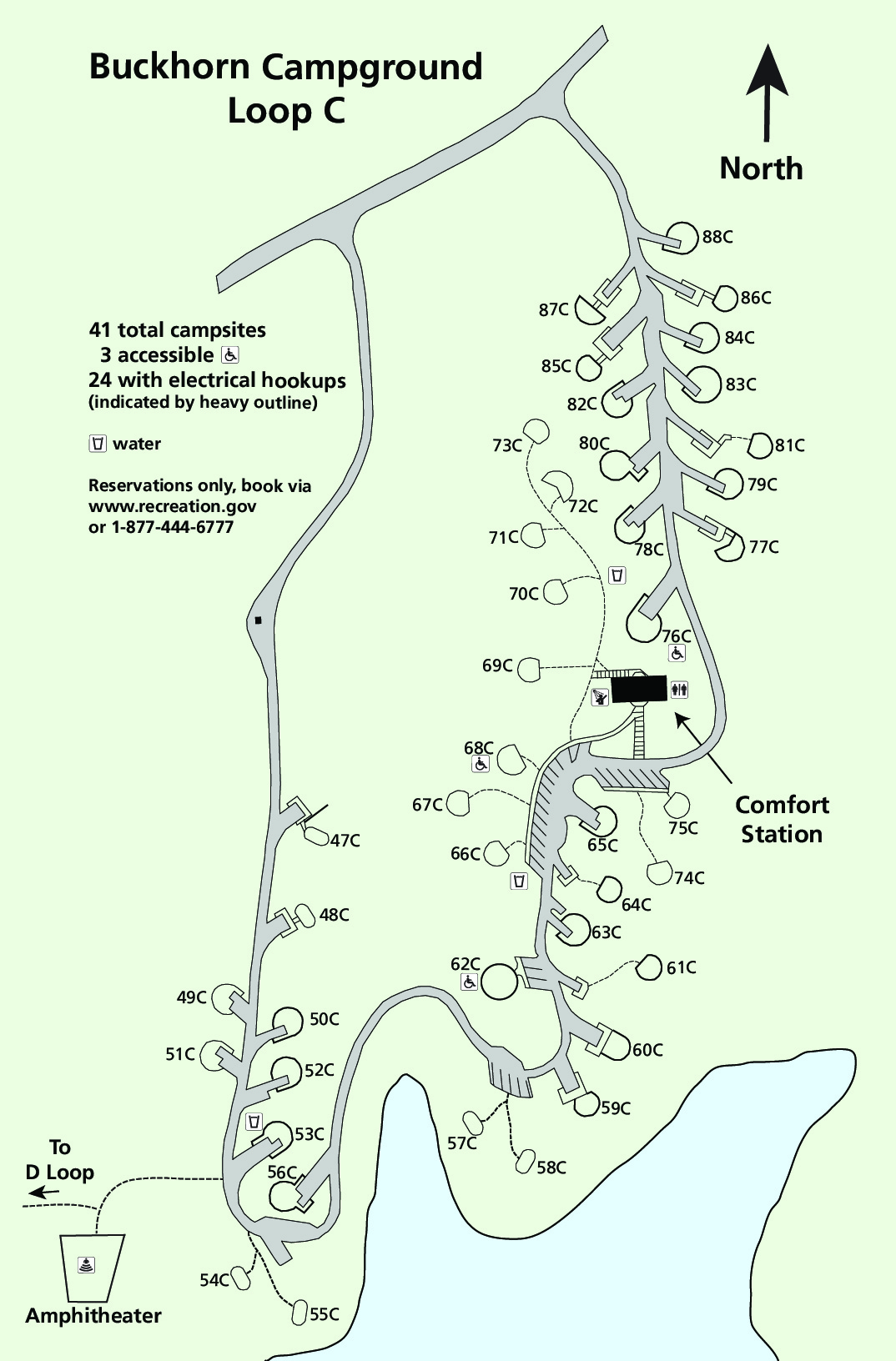
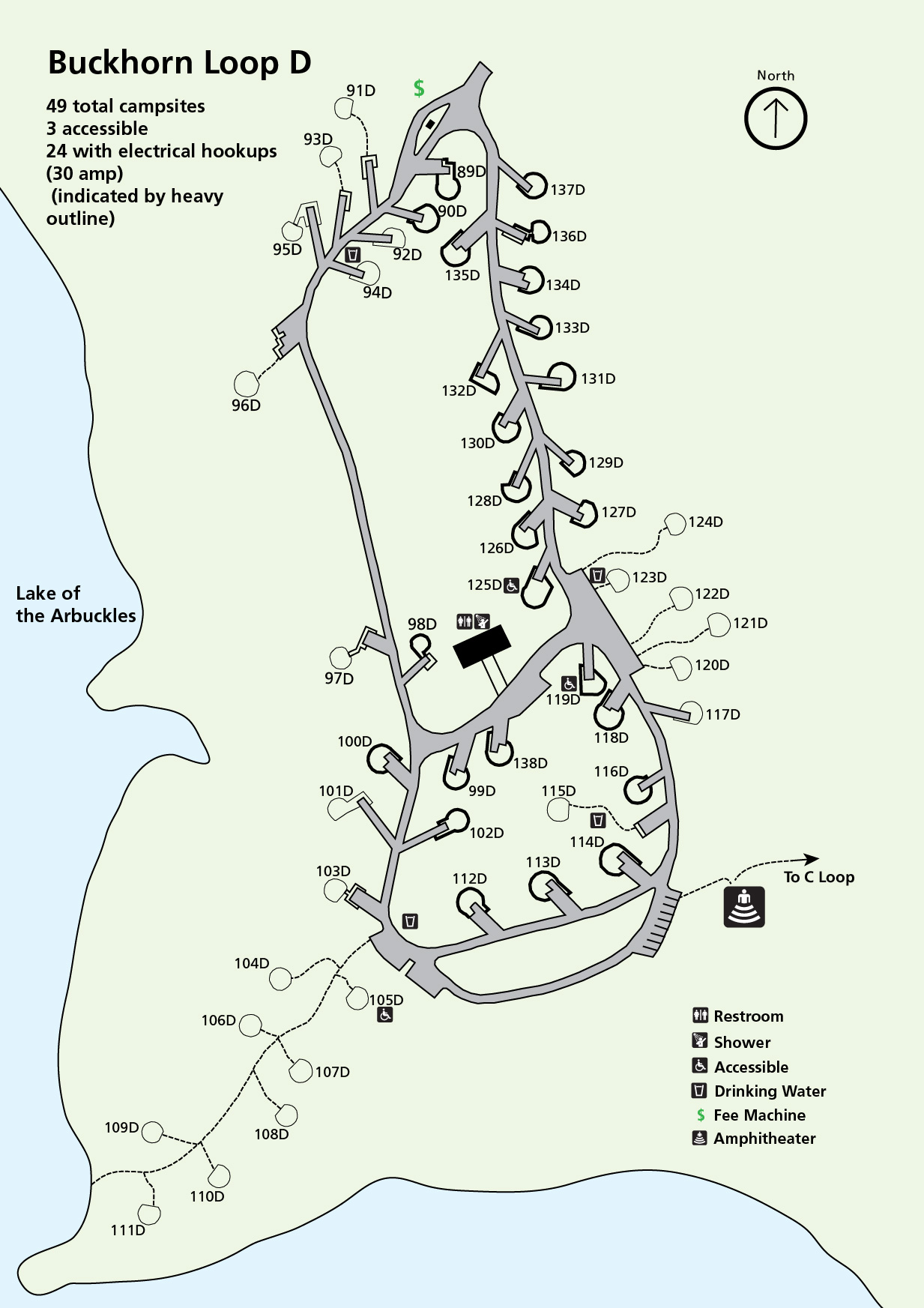
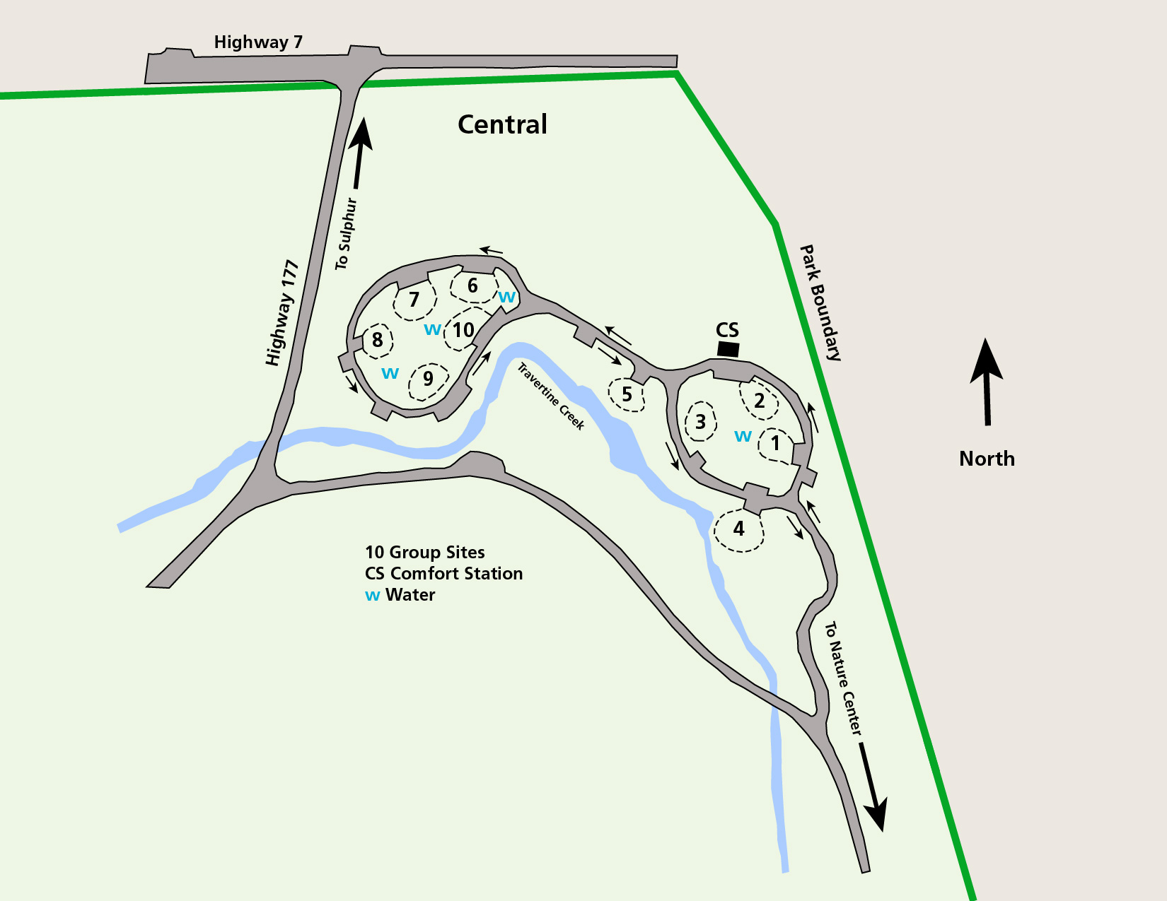
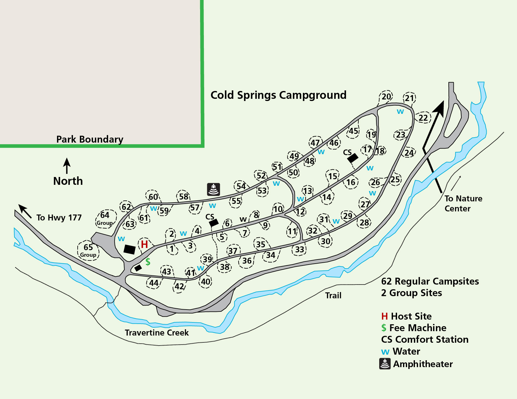
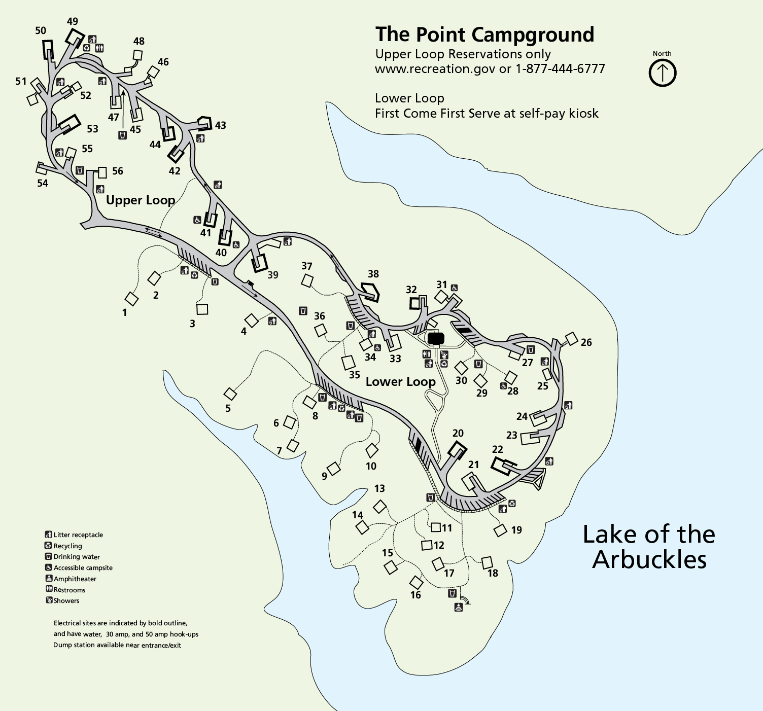
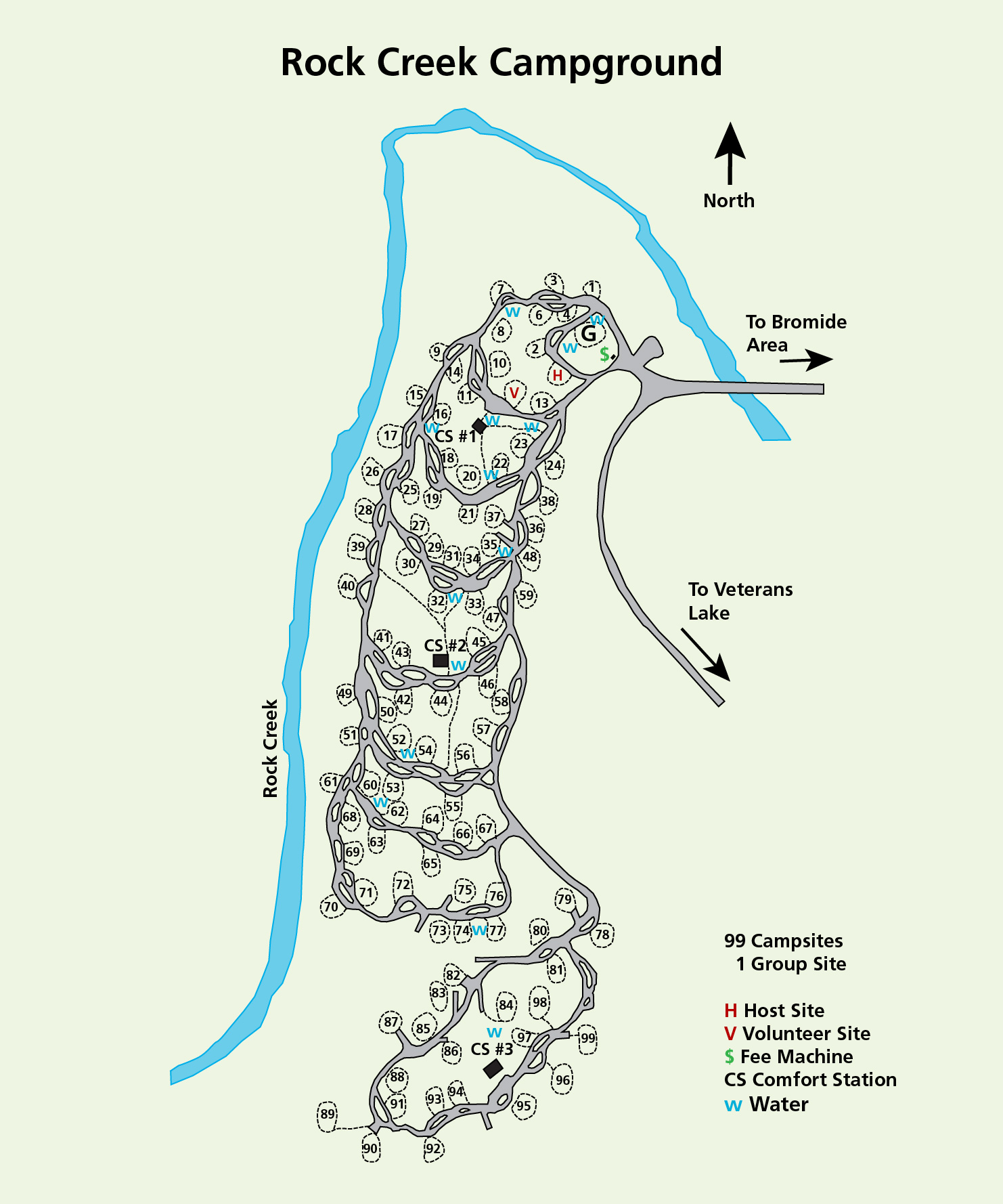
National Park Service LogoU.S. Department of the InteriorNational Park ServiceNational Park Service
National Park Service:  U.S. Department of the InteriorNational Park Service Arrowhead
Chickasaw National Recreation AreaSteam rises from the Vendome Well in winter
view map
text size:largestlargernormal
printer friendly
Chickasaw National Recreation Area
Maps
 
1916 map of Platt National Park
 

Park Map - 1.5 MB PDF file
Full-color basic park map showing the location of visitor centers, trailheads, campgrounds, and other facilities.

Area Map - 82k PDF file
A travelers map showing the immediate area of the park and all all routes to and from Chickasaw National Recreation Area.

Arrowhead logo
Find a national park map
Maps of the National Park System in a searchable format
more...
The Bromide pavilion  

Did You Know?
Originally established in 1902 as the Sulphur Springs Reservation, Chickasaw National Recreation Area is one of the oldest national park areas in the United States.
more...

Last Updated: August 09, 2008 at 16:09 EST