An official website of the United States government
Here's how you know
Official websites use .gov A
.gov website belongs to an official government
organization in the United States.
Secure .gov websites use HTTPS A
lock (
) or https:// means you've safely connected to
the .gov website. Share sensitive information only on official,
secure websites.
A number of maps are available to help you better plan your visit to Cape Lookout National Seashore. For more detailed directions to park sites and ferry gateways, please see the Directions page.
Park Map (pdf, 1 MB) The Cape Lookout National Seashore official park map shows the locations of key points of interest, visitor centers, and ferry landings.
The Road to Cape Lookout (pdf, 97 Kb) Many roads lead to Cape Lookout National Seashore, check out the area map showing the main access routes to the park.
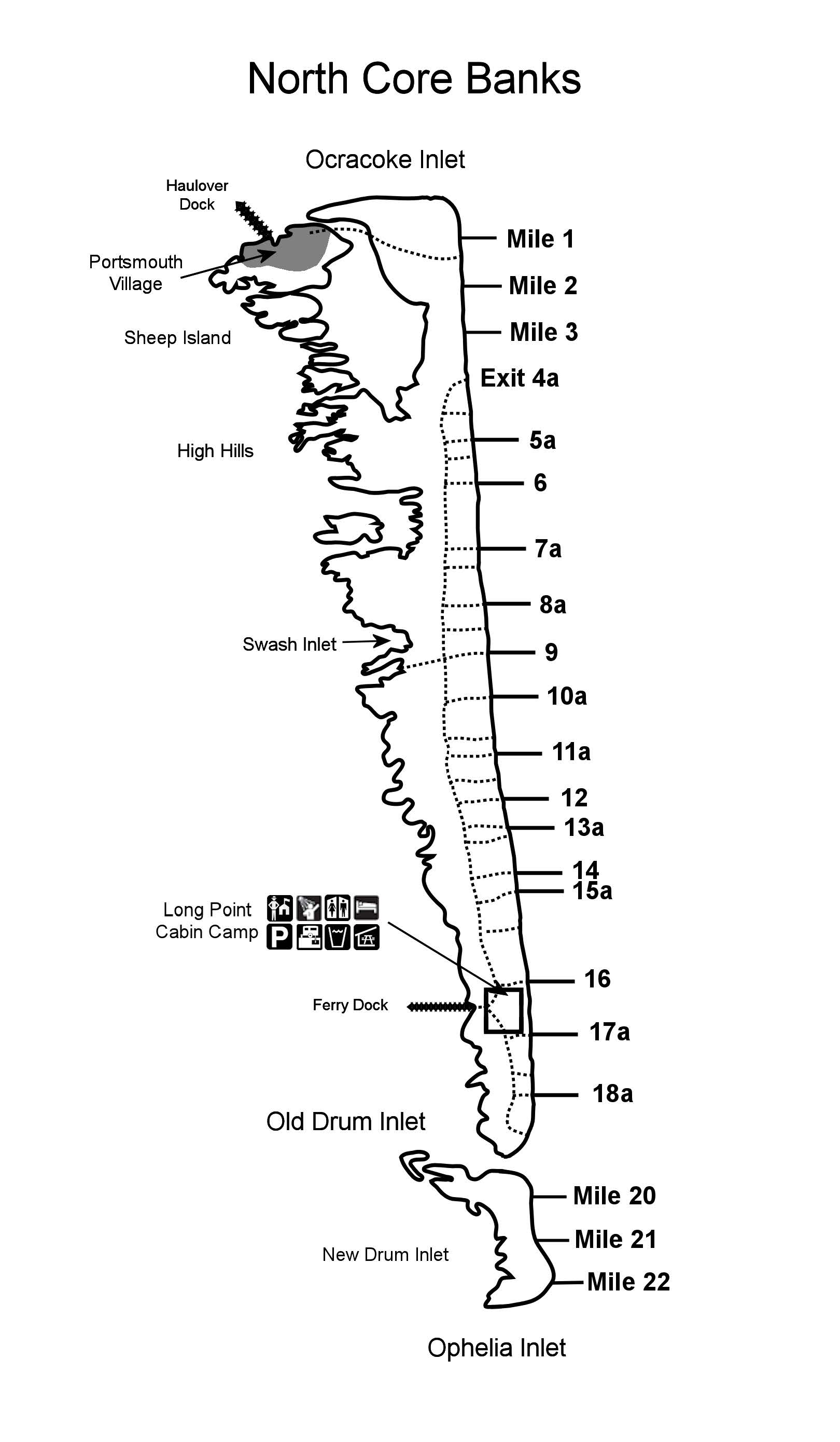
Driving Map: North Core Banks (jpg, 195 Kb) Use this North Core Banks driving map to find exit ramps off the "back road" for the former Long Point Cabin Camp (Long Point Cabin Camp is closed due to heavy damage inflicted by Hurricane Dorian in 2019), Portsmouth Village, (Portsmouth Village is now cut off from the rest of the barrier island by Evergreen Inlet at about mile 3 on North Core Banks. Evergreen Inlet was formed by Hurricane Dorian in 2019.) and other areas
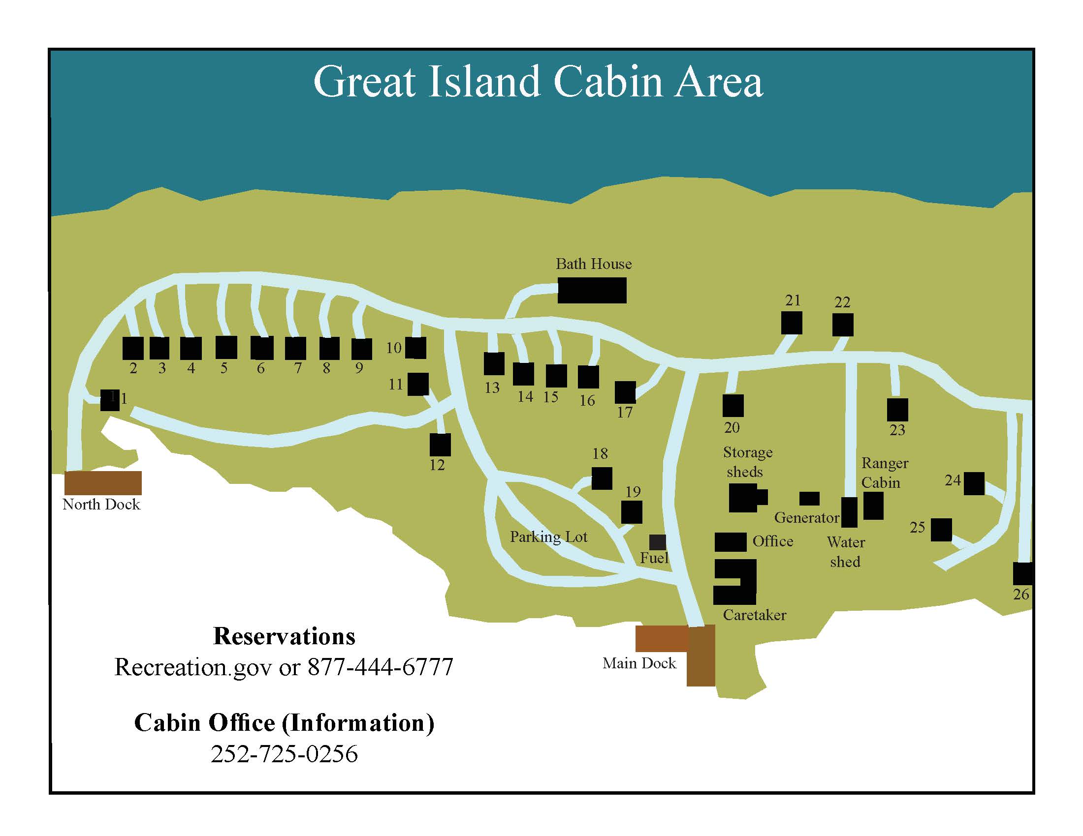
Great Island Cabin Camp Map (jpg, 171 Kb) This map of the Great Island Cabin Camp shows the location of the office, volunteer caretaker's cabin, bathhouse, and each of the 25 rental cabins.
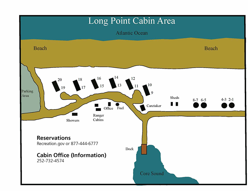
Long Point Cabin Camp Map (jpg, 115 Kb) NOTE: Long Point Cabin Camp is closed until further notice due to the heavy damage inflicted to the camp by Hurrican Dorian in 2019. However, the bathhouse and RV dump station are operational during the season. This map of the former Long Point Cabin Camp area shows the location of bathhouse within the camp area.
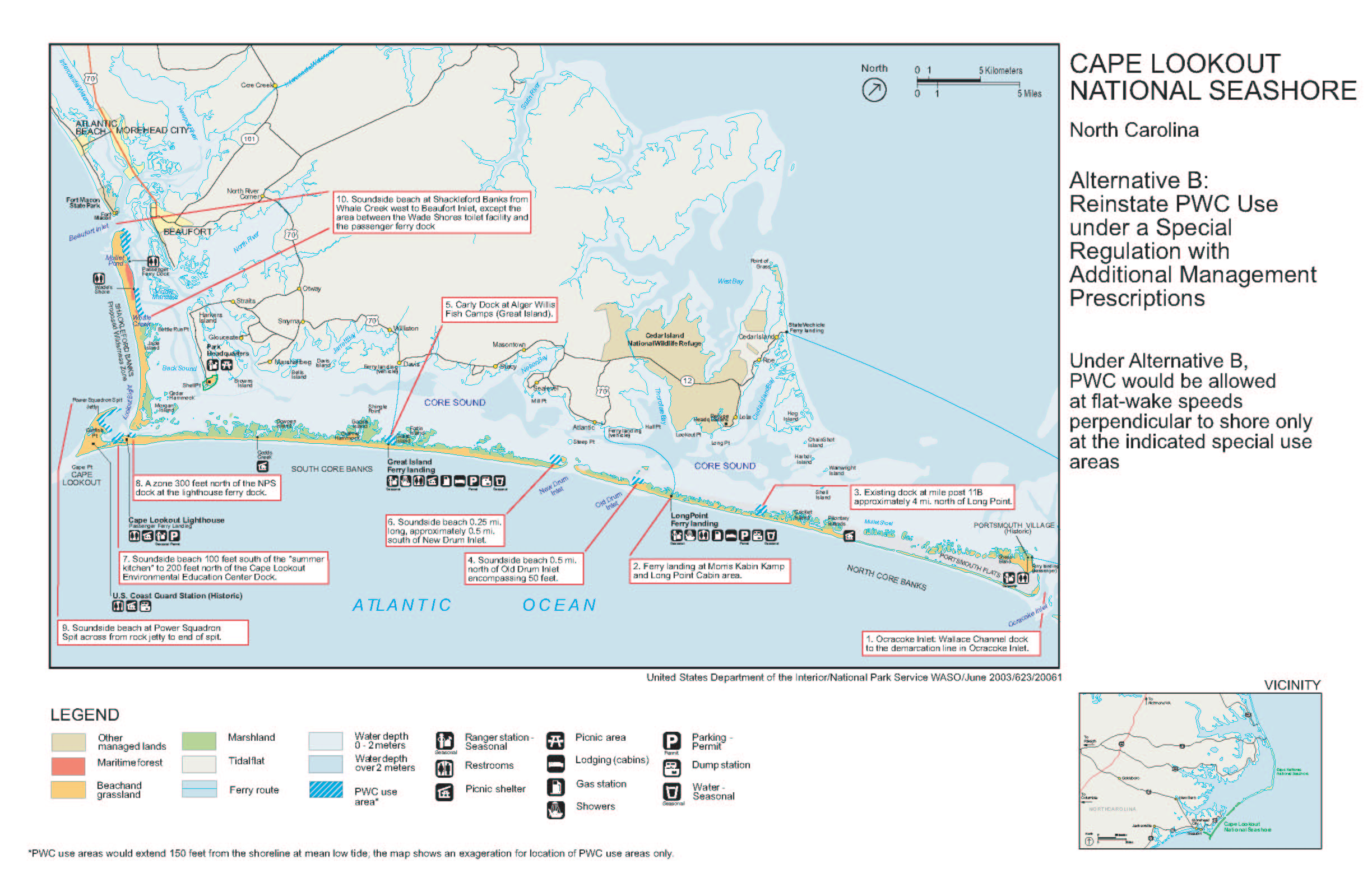
Personal Watercraft (PWC) Landing Map (jpg, 667kb) There are 10 areas on the soundside where PWCs may land. Be sure to check the access map before riding out to the banks.
