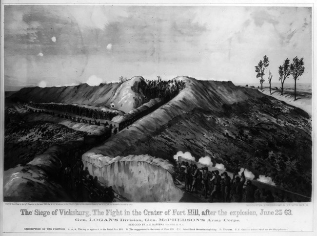
Can geology impact history? When you look around you, you might not think of the soils, rocks, streams and rivers as anything other than landscape features, however, factors such as these contributed greatly to local history and to the outcomes of the Vicksburg Campaign. The loess soils provide the biggest geological contributor to historical events at Vicksburg. Well before the Civil War, in the early 1800s, settlers from the east were attracted to the area between Vicksburg and Natchez due to the rich loess soils on the bluffs. This soil is rich in bases and nutrients, its silt-sized particles allowed for easy access to water for plants and it drained well making it easily ready for plowing and spring planting. These qualities combined allowed for land prime for growing cotton. In fact, the cotton fields of the loess hills rivaled those of the Delta during much of this period, typically out-producing them. During the war, another characteristic of the loess soils played an important role. The loess soils of Mississippi tend to remain extremely stable when cut vertically. This changed the terrain of the battle. Trenches were constructed by both the Union and the Confederate soldiers to provide shelter from cannons and artillery. The loess was stable enough that the Union troops were even able to create tunnels, allowing them to plant explosives under Confederate defenses. 
In the nearby town of Vicksburg, civilians made impromptu caves in the loess to seek protection from the bombardment of the siege. Some of these caves were simple one room structures, while others were multi-roomed and fairly elaborate. While these caves were not true geological caves, they did provide underground shelter from the heavy Union artillery battering the city. 
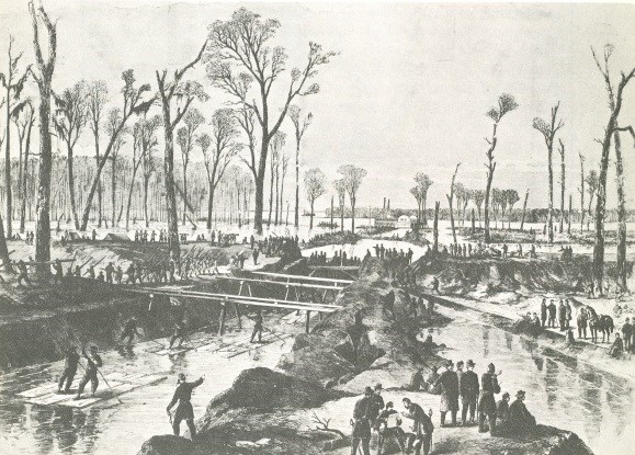
The Mississippi River also played a role at Vicksburg, especially in the earlier days of the campaign. During the Civil War, the course of the river was different than it is today. At that point in time the river formed a loop known as the Tuscumbia Bend and flowed directly past the battlefield, whereas today the waterway flowing past the battlefield is the Yazoo Diversion Canal, which meets with the river just south of the town of Vicksburg. Originally, Union troops attempted to take Vicksburg from the Mississippi River, however, Vicksburg’s position high on the loess bluffs, gave the Confederates a strategic advantage. The Union attempted to construct a canal, that would divert the waters of the Mississippi, changing the course of the river, and causing it to no longer flow past Vicksburg. Two attempts were made to create this canal, known as Grant’s Canal, however, exhaustion, disease and the danger of Confederate artillery fire ultimately caused this project to be abandoned. A small section of the failed canal can still be seen today. 
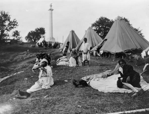
In addition to the Mississippi River, smaller sources of water impacted the outcome of the battle. These water sources include seeps, springs and streams. After Grant gave up on a river approach to taking Vicksburg, he diverted his troops first to Jackson, to take the capitol, before heading west and approaching Vicksburg by land. Union troops blocked off the town from the outside world. The siege of Vicksburg lasted over 40 days. During that time water supplies became scarce, especially for Confederate troops and Vicksburg civilians. Part of General Grant’s plan for the siege was to destroy several of the scarce sources of fresh water the town relied on. Because the loess soil of the area is well drained and porous, it is a poor ground reservoir, which meant that there were very few water wells in Vicksburg. When the town’s cisterns dried up during the siege, citizens and soldiers alike lost their supply of fresh water. This led to outbreak of disease throughout the city as well as made it nearly impossible to properly treat the wounds of injured Confederate soldiers. In the years since the Civil War, the Mississippi River has been a driving factor in several historic events. In 1876, the Mississippi River naturally changed its path, in the process, it left the town of Vicksburg with no river access, severely impacting the economy. It wasn’t until the early 1900s and the completion of the Yazoo Diversion Canal, that Vicksburg was once again a port city. In 1927, the Mississippi River made history again, this time in the form of one of the most devastating floods in U.S. history. The Great Flood of 1927 ravaged western Mississippi, affecting towns up to 60 miles away from the banks of the river. Near Vicksburg, the river reached a width of nearly 80 miles. In addition to destroying thousands of homes and business, the flood also contributed to the already heavy tensions regarding race relations in the early 20th century. Segregated refugee camps were set up. These camps ranged in size and quality of living conditions. There were also issues of forced unpaid labor and unequal distribution of food in many of the refugee camps. After flood waters receded, thousands of African American families left the south forever to seek a better life in the north. This significantly accelerated the Great Migration. |
Last updated: February 26, 2018
