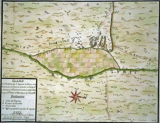

How It WasA revolt in 1751 led by O'odham warrior Luis Oacpicagigua caused the Spanish government to realize that the frontier mission system could not be successful on its own. A military presence would be needed for protection of the frontier. In 1752 a fort was established near the site of the abandoned O'odham village at Tubac. Though open revolt had ended with a peace agreement, tensions were still high. The new garrison of Tubac would continue campaigning against rebel holdouts, delaying construction. By February of 1753 San Ignacio de Tubac was constructed. The Tumacácori Mission enjoyed the protection of nearby soldiers until the garrison was moved north to Tucson in 1776. 
Courtesy of British Library 1767 Map of San Ignacio de Tubac by José de UrrutiaThe legend says: Plan of the Presidio of San Ignacio de Tubac in the Province of Sonora, located at 32 degrees and 3 minutes latitude north, and 252 degrees and 24 minutes longitude counted from the Tenerife meridian. How It Is NowThe site of the Tubac Presidio is now the Tubac Presidio State Historic Park, where you can explore the timeline of human settlement in the Santa Cruz River Valley, dating back to the O'odham settlement in the 1500s. It protects museum exhibits, artifacts, original artwork, and excavated portions of the original adobe foundation, walls, and plaza floor of the 1752 Commandant’s quarters. Tubac Presidio State Historic Park was due to close in March 2010 due to the loss of state funds. The community of Tubac came together and succeeded in crafting a Public-Private Partnership that allowed the park to remain open to the public. Now operated by the Friends of the Tubac Presidio and Museum, the park features a museum, underground display of the Presidio ruins, Arizona’s first printing press, a picnic area, and access to the Juan Bautista de Anza National Historic Trail. Learn More |
Last updated: May 6, 2025
