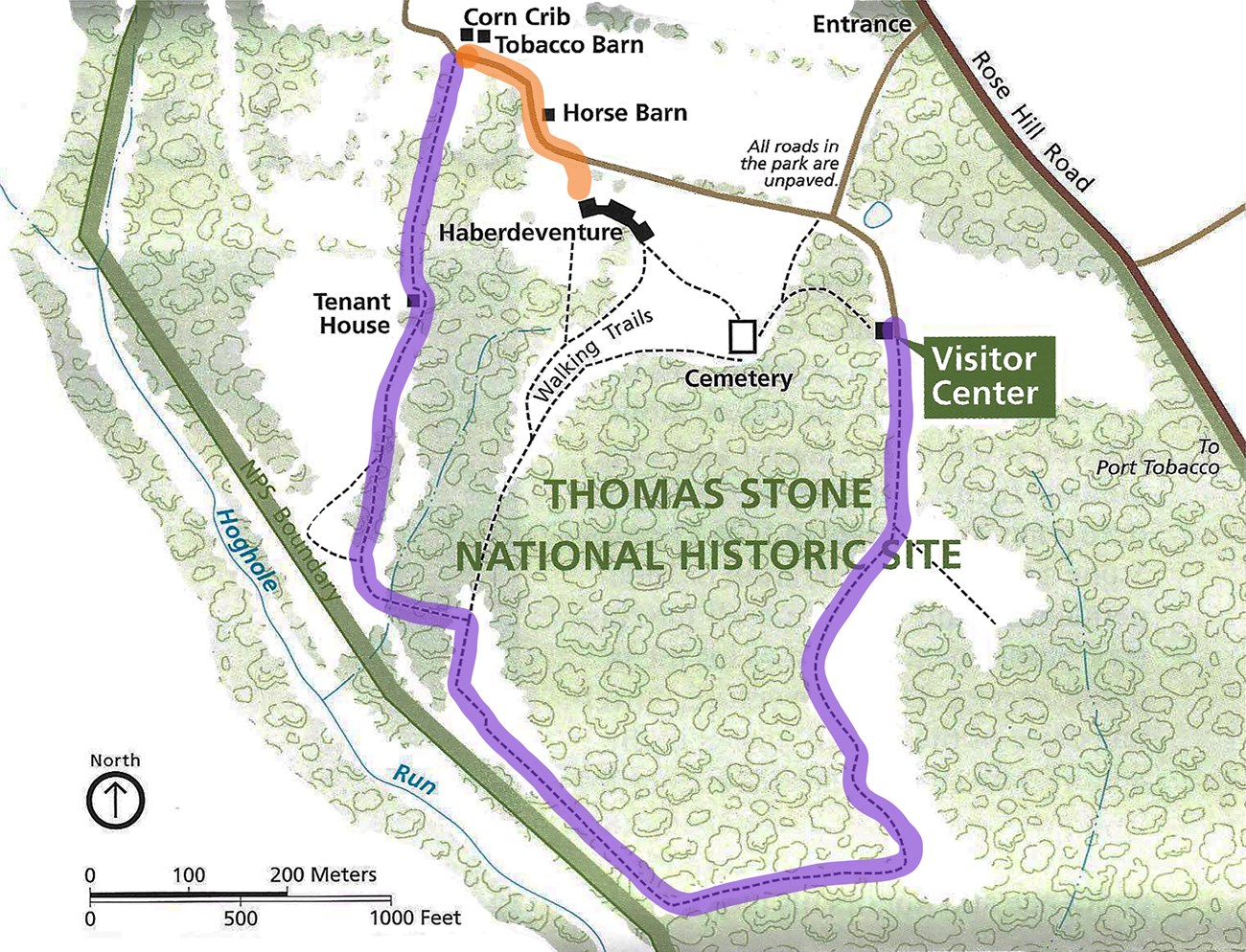
This trail starts at the Horse Barn and passes the Tenant House, the Corn Crib, and the Tobacco Barn. It connects with the Stone Family Cemetery trail. A spur called the Hog Hole Run Trail will travel up a steep, old farm road and return to the Visitor Center.
Quick Details
- Distance (round-trip): 1.5 miles
- Duration (round-trip): 60 - 90 minutes
- Difficulty: moderate
Description
From the Horse Barn, follow a moderately steep gravel road to the right (northwest) before turning sharply to the left (west) for 600 feet. Off to the right are the Corn Crib (small, whitewashed building) and the Tobacco Barn (large building on a small hill). Be careful around the historic structures.
At the wayside, turn left (south) and follow the trail for 250 feet to reach the Tenant House. The Tenant House is a 19th-century structure and due to its condition, is not open for visitation.
From the Tenant House, continue south along a narrow grass trail for 1000 feet. There is a footbridge over a small tributary called Hog Hole Run. According to oral tradition, Hog Hole Run in the 18th century was used to convey hogsheads of tobacco down to Port Tobacco to load on vessels bound for European markets. Today, Hog Hole Run is not an active travel route.
At the intersection with the Hog Hole Run Spur Trail, turn left (north) to take the very steep, dirt trail that leads to the Stone Family Cemetery. Use caution as erosion may make the road surface uneven. Follow this trail for 600 feet. At the top of the trail, take the right-hand (east) trail to head to the Stone Family Cemetery. Follow this trail for 500 feet.
Continue east on the Stone Family Cemetery trail for 200 feet to reach the Visitor Center Parking Lot.
Hog Hole Run Spur Trail
At the intersection with the Outbuildings Trail, continue straight over a second footbridge for 600 feet until reaching an intersection. The left-hand (east) segment follows a grassy trail and continues for 800 feet until reaching a very steep, old farm road. Follow this road for 250 feet and turn left (north) to reach the Visitor Center Parking Lot. The right-hand segment heads along a more moderately sloped grassy path for 600 feet until reaching the very steep, old farm road. Follow this road for 250 feet and turn left to reach the Visitor Center Parking Lot.
Trail Map

