Current Air QualityView live air quality data, webcams links, and more. 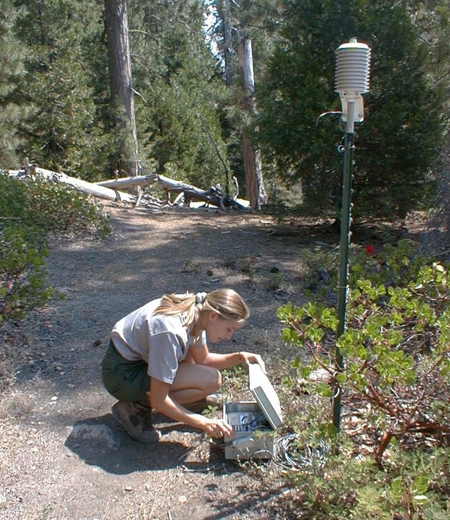
NPS photo What's In the Air?Sequoia and Kings Canyon National Parks experience some of the worst air pollution of any national parks in the U.S. The parks are downwind of many air pollution sources, including agriculture, industry, major highways, and urban pollutants from as far away as the San Francisco Bay Area. Air pollutants carried into the park can harm natural and scenic resources such as forests, soils, streams, fish, frogs, and visibility. Ozone levels in some park locations periodically exceed human health standards. These parks are part of a network of air monitoring stations in almost 70 national parks. This Air Quality Monitoring Network focuses on the following air quality components:
Limited research and monitoring also occur on toxics. Learn more about these monitoring programs below.
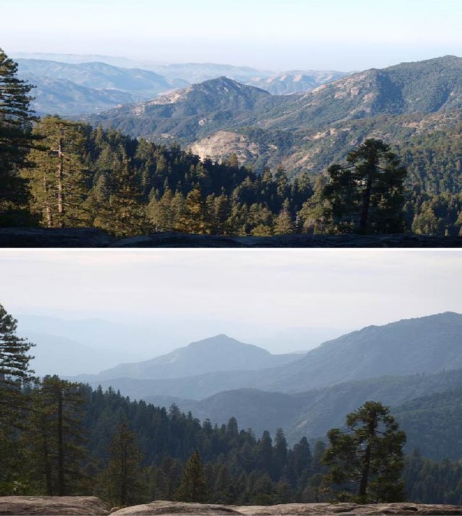
NPS photo VisibilitySequoia and Kings Canyon National Parks have stunning vistas: alpine lakes, granite peaks, mountain meadows, and more. To see these views, we must be able to see clearly through the atmosphere. Human-caused pollution as well as wildland fires or blowing dust can result in small particles being suspended in the atmosphere. These create a haze over the scenery that reduces the vibrancy of the colors and fades forms and details. Visibility (or the average visible range) can be reduced from about 145 miles without pollution to about 35 miles because of pollution at or near the parks. To monitor visibility, the National Park Service monitors fine and coarse particulate matter in air samples, the appearance of a scene under different conditions using digital images and video, and optics (or the ability of the atmosphere to scatter or absorb light). Learn more about how scientists developed the methods to monitor visibility by viewing the National Parks in the History of Science: Visibility video listed at the bottom of this page. Visit a webcam in Sequoia National Park to see the current visibility near Giant Forest.
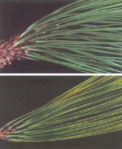
Lower photo: needles with yellowing (or chlorotic mottlling) as a result of ozone impacts. NPS photo OzoneWhile naturally occurring ozone in the upper atmosphere helps protect life on earth by absorbing harmful ultraviolet rays from the sun, in the lower atmosphere ozone is a pollutant. Ozone forms when nitrous oxides from vehicles, power plants, and other sources combine with volatile organic compounds from gasoline, solvents, and vegetation in the presence of sunlight. Ozone causes respiratory problems in people and can injure plants. Ozone is monitored at two sites in Sequoia National Park (Ash Mountain Headquarters in the foothills and at the western edge of Giant Forest). Air quality monitoring staff issue health advisories during the summer season when ozone levels can exceed human health standards.
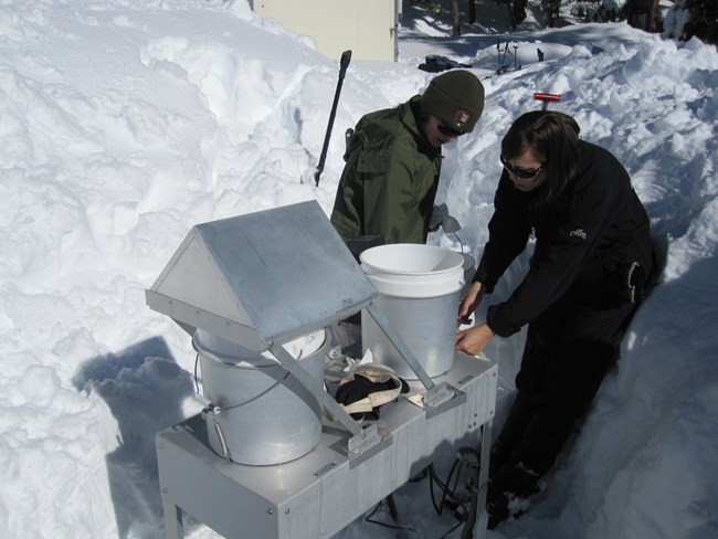
NPS photo Atmospheric DepositionAirborne pollutants are deposited in the parks via precipitation (wet deposition) and airflow patterns (dry deposition). These pollutants include, but are not limited to, nitrogen and sulfur compounds. In these parks, sulfur occurs at low levels, but nitrogen occurs at higher levels and its effects can be widespread. While nitrogen is a fertilizer and occurs naturally, too much nitrogen can disrupt plant communities (favoring weeds) and alter aquatic communities by changing species composition. Some high elevation ecosystems in the parks are particularly sensitive to nitrogen deposition. The shorter growing seasons and shallow soils limit the capacity of soils and plants to absorb nitrogen. Sequoia National Park has a wet deposition monitoring site at Giant Forest and a dry deposition site at the Ash Mountain Headquarters in the foothills. For more detail about air monitoring at these parks, visit the National Park Service air quality monitoring web page. 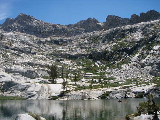
NPS photo Additional Research - ToxicsToxic air pollutants (also called "contaminants") include pesticides, industrial by-products, heavy metals like mercury, and flame retardants for fabrics. Certain toxic contaminants are known or suspected to cause cancer or other serious health effects in humans and wildlife. These can include reproductive problems, impaired growth and development, behavorial abnormalities, and reduced immune response. Sequoia National Park was part of a study that examined airborne contaminant impacts at 20 national parks from the Arctic to the Mexican border. This study focused on Emerald and Pear Lakes and surrounding areas, and assessed air, vegetation, fish, and lake sediments for presence of airborne contaminants. At the Sequoia National Park sites, air, vegetation, and snow had among the highest concentrations of current-use pesticides, compared with other parks studied. A few of the fish sampled exceeded mercury or pesticide thresholds for human health. The primary source of these compounds is likely regional agriculture that occurs throughout the Central Valley of California, within 100 miles of the park. Visit the National Park Service Western Airborne Contaminants Assessment Project web page to learn more about studies of airborne contaminants in national parks and download a fact sheet or the full report. |
Last updated: October 17, 2023
