Directions

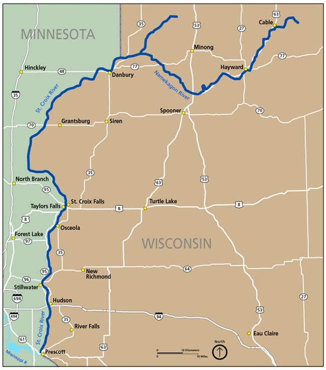
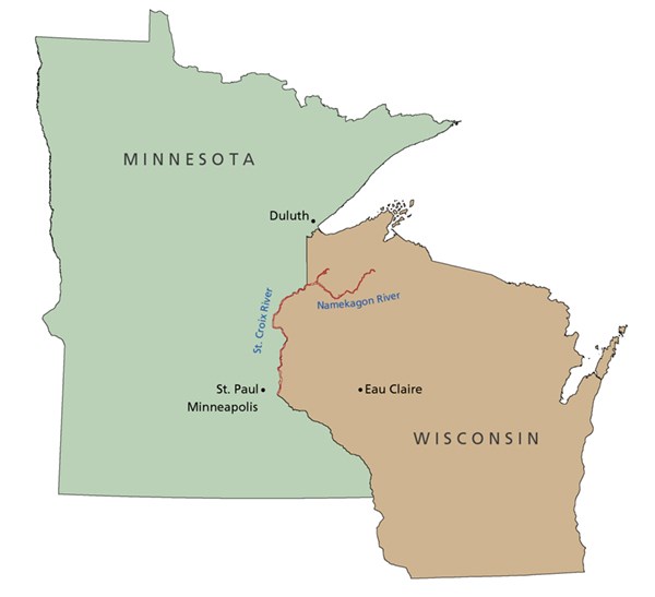
A map shows the location of the St. Croix and Namekagon rivers in Wisconsin and Minnesota.


The St. Croix National Scenic Riverway stretches over 200 miles in northwest Wisconsin and eastern Minnesota. There are many access points on the St. Croix and Namekagon rivers with no particular "right place" to begin a river adventure.
 

To help along the way, please check:

The state departments of transportation for more details:

For Wisconsin: www.511wi.gov.
For Minnesota: www.511mn.org.

Information on the Road Construction page.


Two visitor centers operate seasonally on the Riverway. Check link to find out current hours.

The St. Croix River Visitor Center and Park Headquarters
Located in St. Croix Falls, Wisconsin, at the corner of Hamilton and Massachusetts off Highway 87.

401 North Hamilton Street, St. Croix Falls, WI
GPS coordinates: 45.416284, -92.070422

The Namekagon River Visitor Center
Located in Trego, Wisconsin, just east on Highway 63 from Highway 53.

W5483 US Highway 63, Trego, WI
GPS coordinates: 45.905403, -91.816304

Getting Here

By Car:

  • Minnesota Highway 95 and Wisconsin Highway 35 parallel the lower stretches of the St. Croix River. Highway 95 is a state scenic byway.
  • Wisconsin Highway 63 parallels the upper Namekagon River.

Public Transportation: Take a taxi or bus to Stillwater, Minnesota, from Minneapolis/St. Paul. There is no public transportation along the Riverway.

Plane: Minneapolis/St. Paul or Duluth, Minnesota are the nearest commercial airports.

 
A map of the St. Croix and Namekagon rivers.
Major roads near the St. Croix National Scenic Riverway.
Download detailed maps for river trips.

Last updated: September 3, 2024

Park footer

Contact Info

Mailing Address:

401 North Hamilton Street
St. Croix Falls, WI 54024

Phone:

715 483-2274

Contact Us