|
Mount Rainier National Park is actively improving roads, buildings, and campgrounds through a series of construction projects aimed at enhancing safety, accessibility, and overall visitor experience. Due to heavy winter snowfall, most of this essential work is limited to the short summer season. We appreciate visitors' patience as we work to make improvements to park infrastructure. These efforts will improve safety, accessibility, and the overall visitor experience. Please examine the schedule below to plan ahead. Last Updated: December 17, 2025Road Status MapFor the best viewing experience, click on the "View full screen" link in the lower left corner of the map. Click on any section of road or notification symbol for more information.Ohanapecosh Campground Construction ProjectOhanapecosh is a developed area in the southeast corner of Mount Rainier National Park. Work will include the rehabilitation of 185 campsites and nine restroom buildings, replacing the wastewater collection system, upgrading electrical and water systems, road repairs, and accessibility improvements.
Road Status
Find out current road conditions, including access to Paradise during the winter season. 
Directions
Need directions to get to different park entrances? Also includes information on driving times to park locations. 
Park Maps
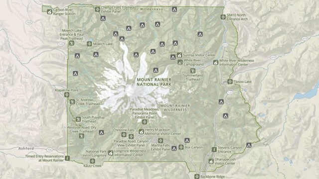
Maps of Mount Rainier National Park, including the Wilderness Trip Planner Map and area trail maps. 
Park Construction FAQs
Find detailed information about park construction projects that are underway or upcoming in Mount Rainier National Park. |
Last updated: December 17, 2025
