|
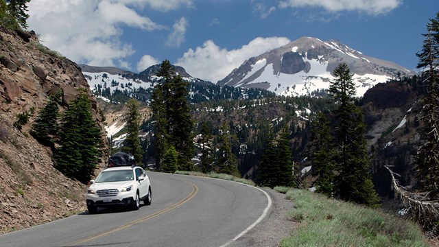
Lassen Volcanic National Park is located in northern California, approximately three hours northeast of Sacramento. The closest communities to the park are Shingletown (north) and Mineral (south), California.The park has two main entrances on either end of Lassen Park Highway (part of Hwy 89). Three additional unpaved roads provide access to remote areas on the eastern side of the park. Learn more about getting around the park. Limited Road Access, November to JuneDuring the snowy season (approximately November – June), park roads are closed and/or impassible due to heavy snowfall. Lassen Park Highway (Hwy 89) is closed at Kohm Yah-mah-nee Visitor Center (southwest entrance) and Loomis Plaza (northwest entrance). Roads to remote areas (Butte Lake, Juniper Lake, and Warner Valley) are not plowed or maintained in winter and become impassible. These roads may be gate-closed for public safety. Check current road status. Travel to Lassen VolcanicBy CarState Route (SR) 44/89 provides access to the Northwest Entrance / Manzanita Lake AreaState Route (SR) 36/89 provides access to the Southwest Entrance / Southwest Area Park AddressesFor navigation purposes, you can use the visitor center addresses:
See Getting Around for navigating in the park, accessing remote areas, and traveling around the park in winter. By Public TransportationThere is no public transportation to or within Lassen Volcanic National Park. By Commercial VehicleAnyone traveling through the park for business or commercial purposes needs a commercial travel permit. Nearest Airports
Fuel / EV ChargingFill Up Your Gas Tank Before VisitingFuel stations are limited in this remote area; we strongly advise filling up your gas tank before entering the park. The closest fuel stations are located in Shingletown and Old Station (northwest entrance) and Chester and Red Bluff (southwest entrance). Gas may be available in the park at the Manzanita Lake Camper Store (typically open mid-May to early October) in Manzanita Lake Campground. Rangers cannot supply fuel for vehicles low or out of fuel. Electric Vehicle ChargingTwo level 2 charging stations are available year-round in the Kohm Yah-mah-nee Visitor Center parking lot. View additional locations on the Alternative Fueling Station Locator from the Department of Energy (search on zip code 96063 or 96088). Winter ConditionsThe park and surrounding area are typically snow-covered between November and May. Lassen Park Highway is closed to through traffic and roads to remote park areas become impassible. Roads outside the park may be snowy, icy, require chains, or close in severe weather. To check for chain requirements, road closures, or other highway advisories before your trip, call the CalTrans Highway Information Network at 1-800-427-7623 or visit the CalTrans Highway Status webpage. Know Before You Go
Park Map
Explore the digital park map, including facilities, trails, and features. 
Getting Around
Learn more about Lassen's roads, how to access remote park areas, and alternate routes when the Park Highway is closed in winter. 
Park Alerts & Conditions
View current park conditions, including closures, alerts, and hazards. |
Last updated: December 3, 2025
