Below is a partial list of the historic and cultural sites along the 1,200-mile Juan Bautista de Anza National Historic Trail in California (see Arizona sites here). Each site is independently operated. Hours, fees, and use rules vary. Contact individual sites for details. For an interactive map of all Anza Trail resources, visit http://www.anzahistorictrail.org. Anza Expedition diary entries below are courtesy of Web de Anza.
Imperial CountyAnza followed the Colorado River south into what is now Mexico. The 1775/76 colonizing expedition remained south of the present border for several days to rest before crossing the desert in three groups (plus a fourth with the cattle). They looped back into what would become Imperial County, California 132 years later. They then continued north to the San Sebastian Marsh, turned west and followed San Felipe Creek.Sites of InterestMission Purísima Concepción and Expedition Camp #42 Expedition Camp #42 was just south of Pilot Knob. Along their way, Font and Anza paused at a granite bluff to view the Colorado River plain on December 4, 1775. Nearby, in 1780, Father Garcés founded Mission Purísima Concepción, only to have it destroyed by the Quechan uprising of July 1781. In the process, Father Garcés, Fernando de Rivera y Moncada, and many soldiers and settlers were killed. The mission site (32°43.833'N 114°36.937'W) is probably where the St. Thomas Indian Mission stands today (on Picacho Rd, Fort Yuma, 1 mile South of Winterhaven). Santa Olalla and Expedition Camps #43-46 (Baja California) Although these camps in Baja California are not part of the Juan Bautista de Anza National Historic Trail, they are marked as Ruta Histórica (Hwy 2). Camp #44 (Santa Olalla) was where Anza wrote a letter to Viceroy Bucareli during the 1774 expedition, telling of its difficulties and the trustworthiness of the Quechan and their chief (Palma). During the 1775/76 expedition, the secondfandango was held here, and Anza wrote five letters. In one to Bucareli, he tells of two births, the one death, and the expedition's difficulties. It was here that the local natives (probably the Cocopah and Cajuenches tribes) gave the colonists fish and watermelons which Anza thought improved the health of those who were sick. It was also here that the expedition split up into three groups to cross the desert without depleting the watering holes. Wells of Santa Rosa (Yuha Well) and Expedition Camps #47 and #48 The well, called Santa Rosa de las Lajas (Flat Rocks) by Anza, was used on March 8, 1774. On December 11-15, 1775, the three divisions of Anza's colonizing expedition used this site as the first good watering spot beyond the Colorado River. It is about 7 miles northwest of Mexico's Mount Signal, on the southwest side of Dunaway Rd. in the Yuha Desert. California State Historic Landmark No. 1008 plaque is found at the Eastbound Sunbeam Roadside Rest Area, between Drew and Forrester Rds., on I-8 near Seeley. The Vista de Anza Historical Marker is found off Hwy 98 northwest of Calexico, 6 miles south of Coyote Wells. Camp #48 was near the Plaster City OHV (Off-Highway Vehicle) area. San Sebastián Marsh/San Felipe Creek and Expedition Camp #49 San Sebastián Marsh is the site of prehistoric villages and represented a stable water source in the desert environment. It was a campsite for both the 1774 and 1775-76 expeditions. Named for Anza's Indian guide, Sebastián Tarabal, it is located 18 miles northwest of Westmoreland in the vicinity of the junction of state highways 86 and 78. Ironically, the nearby Salton Sea, formed when a canal broke in 1905, is today a 35 mile long desert oasis and includes a National Wildlife Refuge. 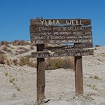
Yuha Well"The water of these wells is good but scanty; and in order to get water it was necessary to work from the time of our arrival until noon the next day." Diary of Pedro Font, Dec. 11, 1775. San Diego and Riverside CountiesThe expedition followed the San Felipe Creek (and Wash) from the marsh at San Sebastián to the Borrego Sink. Their horses and mules exhausted, some people continued on foot, and often there were two or three children on a horse. They opened wells at the Borrego Sink and continued onward under intense cold. Following the Coyote Creek, they passed into today's Anza-Borrego Desert State Park and encountered people of the Cahuilla tribes.The expedition continued up Coyote Canyon and camped at the top of Upper Willows on Christmas Eve. Here, they met the natives of the Cahuilla tribe whom they called the Danzantes (Dancers), and the colonists later held a fandango. Traveling on via Bautista Canyon, they followed the San Jacinto River and reached the Santa Ana River, where they camped on New Year's Eve. They then proceeded westerly toward Mission San Gabriel. Sites of InterestOcotillo Wells and Expedition Camps #50 and #51 After camping along a portion of the San Felipe Wash, they passed through a gap in the clay hills on December 19, 1775. Anza called the previous night's camp (at the Wash) Los Puertecitos, or the Little Passes. It is commemorated with California Historic Landmark No. 635, located on state highway 78, 1.6 miles east of the town of Ocotillo Wells. Nearby, the Ocotillo Wells State Vehicular Recreation Area has a marked trail that allows hikers to explore the area. Continuing northwest, Camp #51 was at San Gregorio, and is probably today's Borrego Sink located on another portion of the Wash about four miles southeast of the Borrego Valley airport. To the northwest of the airport, a peak named Font's Point can be seen that affords panoramic vistas of the expedition's path (access off of S-22). Anza-Borrego Desert State Park and Expedition Camps #52 and #53 From December 20 to 22, 1775, Camp #52 was made along the Coyote Creek at El Vado (The Ford). With plentiful water from the creek and a little pasturage nearby, the animals recovered and the colonists could rest. The site is within Anza-Borrego Desert State Park (33° 20.6´N, 116° 23.6´W), six miles northwest of Borrego Springs at the entrance to the Horse Camp. A short distance to the east is the Desert Gardens portion of the park created by the Anza-Borrego Foundation and Institute. Traveling up the creek and canyon, the expedition's next camp (#53) was at Santa Catarina, situated at Lower Willows (33° 22.28´N, 116° 26.38´W). The campsites are both marked with California Historic Landmark plaques. The park itself is the largest California State Park, and contains two stretches of Anza's route. These trails provide a rare opportunity to precisely follow in the footsteps of the expedition surrounded by terrain that has changed little since Anza's passage. Portions of the park's trails are open to 4-wheel drive vehicles from the south and north, but closed at Middle Willows, so there is no through-driving. The park's Visitor Center (200 Palm Canyon Dr., Borrego Springs) features interpretive exhibits on the desert environment and the local Native tribe. Presidio of San Diego and Mission San Diego de Alcalá (Camp #67) Although not an official part of the National Historic Trail, Anza, Font and a group of soldiers diverted here to offer their assistance after the expedition reached Mission San Gabriel (near Los Angeles). Members of the Kumeyaay (KumeYAAY) tribe had revolted, killing a priest and had burned the Mission San Diego. While there (January 11-February 8), Font used his quadrant to measure the altitude of the Sun and thus determine the latitude of the San Diego Presidio (32°44.5´N). Such readings, taken throughout the journey, were amazingly accurate and can be verified today using modern electronic Global Positioning Systems. Anza-Borrego Desert State Park and Expedition Camp #54 The expedition's Christmas Eve stop was at the "Fig Tree Spring" in the Anza-Borrego Desert State Park. A marker commemorates the birth of Salvador Ygnacio Linares on that night. Motorized vehicles are prohibited in this area of the park, but hikers can reach the area from the town of Anza, or from the south (San Diego County). Maps are available at the visitor center. Puerto de San Carlos (San Carlos Pass) and Expedition Camp #55 On December 26, 1775, Font writes "...at once I noted the change in the landscape, for now we saw some scrub live oaks and other small trees...This place has a spring of water and a small arroyo nearby, with plentiful and good grass." The pass is in Terwilliger Valley at the upper end of Coyote Canyon about seven miles southeast of the town of Anza. The area of the camp is now on a privately owned ranch, but can be accessed by hikers from the Pacific Crest Trail. In the nearby town of Anza, interpretive exhibits are found at the Hamilton Schools and Library complex (57550 Mitchell Road). San Bernardino National Forest and Expedition Camp #56 and #57 A broad, bowl-shaped valley between Cahuilla Mountain and Bautista Canyon, the area of Camp #56 at Tripp Flats can be viewed from the road. Take Cary Rd. north off Highway 371 outside of Anza. This joins Tripp Flats Rd. which then ends at Bautista Canyon Road. Most of the latter road is within the San Bernardino National Forest. Eight miles of it are unpaved and allow one to experience rare well- preserved chaparral and riparian landscapes on the historic route. San Jacinto Wildlife Area, Lake Perris and Expedition Camp #58 With the San Jacinto mountains at their right, the expedition traveled north and camped near a lake that Anza had named in 1774 after his supporter, Viceroy Bucareli. On December 30, 1775, Father Font noted "large white flocks" of geese. Today's Bernasconi Pass (along the Ramona Expressway) was used by the expedition to travel from their camp to the Alessandro Valley south of Riverside. Today, one can visit the Lake Perris State Recreation Area and the nearby San Jacinto Wildlife Area. An Anza trail marker is found at the southern end of the lake. Santa Ana River Crossing and Expedition Camp #59 Both Anza expeditions crossed the river here, and it was the New Year's Eve campsite for the 1775-76 expedition. Riverside County Regional Parks offers two Anza-related sites. The Camp #59 and river crossing sites are both within the Martha McLean/Anza Narrows Park (5759 Jurupa Ave.) in Riverside. At their Jensen-Alvarado Historic Ranch and Museum (4307 Briggs St. off Rubidoux Blvd.), living history programs describe how Anza expedition descendants lived. 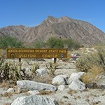
Anza Borrego Desert State Park(Passport Stamp Location)200 Palm Canyon Dr. Borrego Springs, CA 92004 (760) 767-5311 "This morning it was so frigid and the night before was so extremely cold that three saddle animals and five head of cattle were frozen to death, and the weather was so hard on our people that almost none of them slept, for they spent the night occupied in feeding the fires in order to withstand it." Diary of Juan Bautista de Anza, Dec. 20, 1775 America's largest desert park is also the scene where the Anza Expedition, after surviving the desert crossing and a fierce blizzard, birthed the first non-Native child to be born in present-day California. Los Angeles CountyThe expedition entered the county from the east past San Dimas and went on to Mission San Gabriel Arcángel. The colonists stayed at the mission for about six weeks while Anza, Font and some soldiers went to San Diego to help quell an American Indian rebellion there. Later, the colonists traveled west from the mission to cross the Los Angeles River, entering the San Fernando Valley and crossing the Simi Hills at Calabasas.Sites of InterestMission San Gabriel Arcángel and Expedition Camp #62 (and #71) On January 4, 1776, the expedition reached the mission, their first outpost of the Spanish empire in (Alta) California. Anza had visited the mission at its first site on his 1774 trip, and the current site on his colonizing expedition. He remained January 4-6,1776, and then went to San Diego. Camps #63 to #70 were therefore during that side-trip. Returning February 12, he continued to Monterey on February 21 with most of the colonists. The mission today (428 South Mission Drive, San Gabriel) is a working parish, with a museum and gardens. Nearby, take the City of San Gabriel historical walk and visit Smith Park (232 W. Broadway) to learn about the Gabrieliño-Tongva people. The Whittier Narrows Recreation Area (1000 N. Durfee Ave. in S. El Monte) features ranger tours and bird-watching walks. Near its southeastern edge at the Río (River) Hondo, a plaque (at the southwest corner N. San Gabriel Blvd. and N. Lincoln Ave.) marks the location of the first mission. El Pueblo De Los Angeles Historical Monument One contingent of settlers, led by Fernando de Rivera y Moncada, used the Anza trail in 1781 to found the pueblo of Los Angeles (L.A.). During that expedition (which was divided into three parties) Rivera and Father Garcés, were killed at Yuma by the Quechan tribe that had been so friendly to Anza. Now in downtown Los Angeles, the site of the original settlement includes the Plaza, Olvera Street, the Ávila Adobe Museum, and other historic buildings (125 Paseo de la Plaza). Elysian Park and Griffith Park to Expedition Camp #72 At Elysian Park (835 Academy Road, L.A.), a plaque (CA #655) placed at the North Broadway entrance to the park indicates that the Portolá party crossed the Los Angeles River (Río Porciúncula) at the site of today's Broadway Bridge. It's believed that the Anza expedition crossed here also. Along the L.A. River Trail, a large mural depicts abstract images of Anza and indigenous people along the concrete walls of the flood-control channel. The expedition's camp for February 21, 1776 (#72, Puertezuelo) was inside Griffith Park, where today can be found the Autry National Center / Institute for the Study of the American West (4700 Zoo Drive), where the 1772 Joseph María García Manuscript can be found that contains music of Anza's time. Malibu Creek State Park to Calabasas and Expedition Camp #73 Camp was made on February 22, 1776 at Agua Escondida (hidden water). Its exact location is uncertain. Today, nearby Malibu Creek State Park (34º 6.198' N, 118º 43.986' W) is within the Santa Monica Mountains and incorporates Las Virgenes Creek. Each spring, the Anza en Calabasas event is held at the former Soka University campus (26800 Mulholland Hwy, Calabasas) within Santa Monica Mountains National Recreation Area, which also includes the Satwiwa Native American Indian Natural Area and Culture Center. 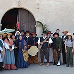
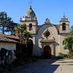
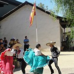
Mission San Gabriel(Passport Stamp Location) Mission San Gabriel marked the expedition's welcome arrival to the Spanish settlements that had been established in California in the previous seven years. Today, the mission museum has exhibits about the Native and Spanish history of the area. Local historic re-enactors share the legacy of the Spanish era. 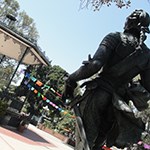
El Pueblo de Los Ángeles Historical Monument(Passport Stamp Location)El Pueblo de Los Angeles Historical Monument is near the site of the early Los Angeles pueblo or town where, five years after the Anza Expedition, forty-four settlers of Native American, African and European heritage followed a similar route more than one-thousand miles across the desert from present-day northern Mexico and established a farming community in September 1781.
Santa Barbara CountyMany colonists on the expedition marveled at Pacific Ocean. They saw waterspouts thrown up by whales, and passed through land of the Chumash peoples, whose skills impressed them. From these natives, they obtained some baskets, cups, trays, and many varieties of fish in exchange for glass beads. Going further, they crossed the Santa Maria River near the town of Guadalupe at the northern boundary of Santa Barbara County.Sites of InterestLa Rinconada and Expedition Camp #75 Traveling past a village they called La Carpintería, camp was made on February 24, 1776 at La Riconada near the border with Ventura County. Here, Font describes the Native Americans, their skills, houses, sweathouses (temescals), money and boats (called tomols). The site of the camp is preserved in Rincon County Beach Park. Carpinteria State Beach is a few miles to the west, and offers Chumash interpretive programs. El Presidio de Santa Barbara State Historic Park Encompassing the original site of the 1782 Presidio, the park interprets life in California under Spanish rule. Some soldiers of the original garrison were members of the 1775-76 Anza expedition. It offers exhibits on the history of the Spanish and Mexican periods, and includes the Buenaventura Pico Adobe built by Anza expedition descendants. The address is 123 East Cañón Perdido St. in Santa Bárbara. California State and County Beaches Expedition Camp #76-78 Goleta Beach County Park, the U.C. Santa Barbara campus, and the Santa Barbara Airport are the sites of the Chumash villages of Mescalitán (Camp #76). Font writes, "Here there are three large villages on the banks of the estuary, the largest one being on the road which we are traveling." Mescalitán is commemorated with a plaque along the Coast Route Trail at South Patterson Ave. and the Atascadero Creek Bikeway in Goleta. Along Anza's route, El Capitán, Refugio, and Gaviota State Beach Parks provide opportunities to interpret the natural environment and the native cultures at the time of the Anza expedition. Jalama County Beach offers an experience of the land and sea as the expedition might have seen it. La Purísima Mission State Historic Park This camp is at the mouth of today's Santa Ynez River and is within Ocean Beach County Park. Up the river to the east is Mission La Purísima. Although it's not on the historic Anza route and wasn't constructed until after the expedition, it's on the auto tour route. Visitors can see animals and plants of the missions and exhibits on the life that the Spanish settlers brought to the indigenous people. It is located at 2295 Purisima Road near Lompoc. Vandenberg Air Force Base and Expedition Camps #79-80 Camps #79 and #80 are on Vandenberg Air Force Base, and access is restricted. The base offers weekly bus tours of the facility, much of it on Anza's route. Amtrak's Coast Starlight route from Ventura to San Luis Obispo is on the historic route. From Gaviota through Vandenberg Air Force Base, the train is the only way most members of the public can see the landscapes that Anza saw. 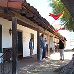
El Presidio de Santa Barbara State Historic Park(Passport Stamp Location)
San Luis Obispo CountyContinuing north from Santa Barbara, Anza and his colonists passed dunes near Pismo beach, and continued along the coast for several miles before turning inland at Price Canyon, finally reaching the Mission San Luis Obispo. While there, an Indian boy was baptized, with Anza serving as his godfather. Upon leaving, they followed San Luis Creek to the top of the Cuesta Grade, descended to the Salinas River and crossed it.Sites of InterestGuadalupe-Nipomo Dunes National Wildlife Refuge The sand dunes near a long lake are mentioned in the diaries of Anza and Font for their March 1, 1776 entries. The lake, southeast of Guadalupe, was called Laguna Larga by Anza and Laguna Grande by Font. During the 1769-1770 expedition, Gaspar de Portolá named Oso Flaco Lake for the "lean bear" killed there. The area still contains pristine wind-swept coastal dunes, wetlands, and rare plants. Visitors may hike the dunes from either the Rancho Guadalupe Dunes County Park to the south, or the Oso Flaco Lake Natural Area to the north. Access to the preserve is off State Highway 1 west of the town of Guadalupe, and more information is available at the Dunes Center at 1055 Guadalupe Street. Pismo Beach and Expedition Camp #81 On the coast to the north, but part of the same sand dunes, is Pismo State Beach and Oceano Dunes State Vehicular Recreation Area. The city names Nipomo and Pismo are Chumash words. The site of the Chumash village of El Buchón is located in Price Canyon, and it was at this village that camp was made on March 1. Nearby, the Price House grounds preserve several buildings of John Michael Price's Rancho Pismo in Price Canyon. It is located at 100 Rancho Pismo Drive in Pismo Beach and is on the walking trail at the end of Frady Lane. Mission San Luis Obispo de Tolosa Camp #82 Founded in September of 1772, the mission greeted the expedition on March 2 with bells, volleys and the singing of the Te Deum. The colonists rested here a day and Font baptized a native boy, with Anza serving as Godfather. Belonging to the Diocese of Monterey, the mission today serves as a parish church. The Mission is located at Monterey and Chorro Streets (35º 16' 54" N, 120º 39' 39" W). D. Cuesta Canyon County Park This five acre park in San Luis Obispo (35º 17' 36" N, 120º 38' 22" W) spans San Luis Creek, the route of the expedition. The Stagecoach Road trail west of Cuesta Grade is a rural, single lane road that climbs Cuesta Grade just north of the city limits of San Luis Obispo, and is quite probably the route of the expedition along San Luis Creek. It is currently the bicycle route over the grade as bicycles are not permitted on Highway 101. Santa Margarita River to Expedition Camp #83 Font mentions a village at Santa Margarita River. Going further along the Anza trail, the Atascadero Trail (via the Scenic Route) is a hike on level ground. Camp #83 was at Asunción (now called Assumption) located along the Salinas River near Ferrocarril Rd. in Atascadero. On March 5, the Anza party crossed the Nacimiento River near Camp Roberts, and Camp #84 was made at their first crossing of the San Antonio River, and so was called Primer Vado (First Ford). 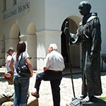
Mission San Luis Obispo(Passport Stamp Location) Monterey CountyFrom Toro Park, one can see the slender valley that the expedition passed through on March 10, 1776 on their way to Monterey. The Monterey Presidio was the interim destination of Anza's settlers. They rested here in this northernmost frontier outpost of Alta California while Anza and a small party of soldiers went north on March 23 to select the sites for the San Francisco Mission and Presidio.Sites of InterestMission San Antonio de Padua and Expedition Camp #85 The mission was founded in 1771. Along the entrance road to the mission, a large wooden sign describes the Anza expedition's visit to the mission on March 6, 1776. Today, it is a working parish managed by the Diocese of Monterey. Located on Mission Rd. on the grounds of Fort Hunter Liggett, it includes a museum featuring exhibits on the life of the Salinan people. On route to the Mission, travelers can visit the Lake San Antonio (located at 2610 San Antonio Rd.) and enjoy recreational activities such as picnicking, camping, fishing, hiking, and swimming. San Lorenzo County Park and Expedition Camp #86 The expedition followed Sulphur Springs Canyon into Kent Canyon near King City. Camp was made north of King City at Los Ositos on the banks of the Salinas River (then called the Monterey River). Nearby, travelers can visit the Monterey County Agricultural & Rural Life Museum (1160 Broadway in King City), and learn how farming developed after the first settlers arrived. San Carlos Cathedral and Expedition Camps #88 and #90 The current cathedral (at 500 Church St., Monterey) is on the former site of the Spanish Presidio and the site of the Royal Presidio Chapel known to the expedition as San Carlos de Borromeo de Monterey. Take a walk 1 block south-east and follow the shoreline of Lake El Estero to the flat, polished black stones of the Anza Walk sculpture that mark the expedition's path. San Carlos Borromeo del Río Carmelo and Expedition Camp #89 For March 11, 1776, Father Font writes, "...the fathers, who were seven, welcomed us with singular joy and festive peals of the good bells there…to which the soldiers replied with volleys and a salvo…entering the church in a procession, we intoned the Te Deum…". Father Junípero Serra, who is buried there before its altar, founded Mission Carmel in 1770. The church seen today was built after Anza's visit. Fort Ord National Monument (Bureau of Land Management) Basket making was still a tradition at the time of Anza's passage through the area. A wayside exhibit interprets the use of native plant materials such as Sedge (Carex barbarae), located near the exhibit, in Ohlone basket-making. Salinas and Expedition Camp #91 The colonists remained in Monterey, and Anza's exploratory troop set out for San Francisco, traveling a direct route north-east to Natividad. They camped near Natividad Creek Park, where today, a wayside interpretive panel describes the indigenous use of native plants located there. Its location is on Laurel Drive (accessible via Highway 101) at Constitution Boulevard. 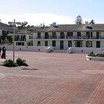
Monterey State Historic Park(Passport Stamp Location)
20 Custom House Plaza
Monterey, CA 93940
(831) 649-7118 San Benito CountyAfter delivering the colonists to the presidio of Monterey, Anza rested and then set out on March 23, 1776 with Lieutenant Joaquin Moraga, Father Pedro Font, a corporal and two soldiers from the Monterey Presidio and eight of his soldiers to explore the San Francisco Bay area. Camping their first night at Natividad (in Salinas), they continued the next day through the future site of Mission San Juan Bautista.Sites of InterestSan Juan Canyon Historic District The area of Font's arroyo of San Benito contains the Indian Canyon group on a site protected by American Indian descendants. A hiking trail exists at Old Stage Road (coordinates 36º 49' 49" N, 121º 32' 6.5" W). Off of San Juan Canyon Rd., are Fremont Peak State Park, at Gavilan Peak, and the Hollister Hills State Vehicular Recreation Area that overlook the trail. Mission San Juan Bautista Built in 1797, after the expedition passed through the area, the mission (located at Second and Mariposa Streets; coordinates 36º 50' 45" N, 121º 32' 03" W) is in the traditional Amah-Mutsun territory. The Mission features a museum, garden and working parish. To learn more about the Mutsun, visit Chitactac - Adams Heritage County Park in Santa Clara County (101 North to 152 to Watsonville Rd.). San Juan Bautista State Historic Park San Juan Bautista was once the largest town in central California and the hub of travel between Monterey and San José. José Tibúrcio Castro was the civil and secular administrator of the Mission. The Castro House was built between 1838-41 at the request of his son, José Antonio, who had become prefect of the northern district of Alta California. The town was temporarily known as San Juan de Castro. General José Antonio Castro's military headquarters can be viewed at the State Park. Neither General José Antonio Castro nor José Tibúrcio Castro descend from Joaquín Isidro de Castro's family who came with Anza. 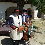
San Juan Bautista State Historic Park(Passport Stamp Location)19 Franklin St. San Juan Bautista, CA (831) 623-4526 Santa Clara CountyAnza's small exploratory group traveled past the area that is today Gilroy, encountering many American Indians along their route. After choosing the sites for the Mission and Presidio in San Francisco, they returned to the county again on their way to the East Bay. Lt. Moraga came through Santa Clara County again in June 1776 with the settlers to found the San Francisco Presidio. In November 1777, he and some of those settlers founded the Pueblo of San José near the Guadalupe River.Sites of InterestChitactac-Adams Heritage County Park and Expedition Camp #92 The camp for March 24, 1776 was at Llagas Creek in the city of Morgan Hill. Along the way, many natives (and a village) were encountered. At Chitactac-Adams Park (10001 Watsonville Rd., Gilroy), you can visit a Mutsun Ohlone village site along Uvas Creek to view petroglyphs, bedrock mortars and interpretive exhibits about the Ohlone culture. Nearby is DeBell Uvas Creek Park Preserve. San Joseph de Cupertino and Expedition Camp #93 On March 25, they camped at place that they called San Joseph de Cupertino, a name that is preserved today in the city of Cupertino to the east. From here, Font and Anza remarked that they could see the San Francisco Bay. Today, from McClellan Ranch Park (22221 McClellan Rd.) or on the "knoll" at Rancho San Antonio County Park (on Cristo Rey Dr.), visitors have vistas that extend to the bay. Loop Around to the East Bay via Expedition Camp #97 Anza and the exploratory group came back to Santa Clara county on their way back from S.F. en route to explore the East Bay. Father Font measured El Palo Alto by using a device that measures angles, together with some trigonometry. This 'tall redwood tree' still stands today (El Camino Real at Alma St., Palo Alto). After traveling south parallel along the shoreline from Palo Alto, camp for March 30 (#97) was on the banks of the Río de Guadalupe (Guadalupe River). At the 40 acre Ulistac Natural Area (37º 24' 09" N 121º 58' 04" W), currently being restored, visitors can see willows, sycamores, and elderberry. Trails in the San Francisco Bay National Wildlife Refuge near its education center near Alviso can also be explored. San José de Guadalupe and Adobes of Expedition Descendants Named after the patron saint of the expedition, the Virgen de Guadalupe, San José was the first civilian Spanish settlement in California. It was founded in November of 1777 by Lt. Moraga and a handful of Anza's settlers. Around 1797, the settlers built adobes around a central plaza that is today Plaza de César Chávez. Several abodes (including adobes) of expedition members and descendants can be seen in the Santa Clara Valley including: Joaquín Bernal's (at Santa Teresa County Park), Fernando Berryessa's (373 Jefferson St. near Mission Santa Clara), Luis María Peralta's (175 W. Saint John St.) (click to see photo of Peralta Adobe), José Higuera's (North Park Victoria Dr., Milpitas) and José Maria Alviso's (Piedmont and Calaveras Rds. in Milpitas). Henry Coe State Park and Expedition Camps #103 and #104 Los Cruzeros was a stop on Anza's southbound route getting back to Monterey from the East Bay. The camp is within Henry Coe State Park, as are campgrounds and a visitors center. To reach the park, take the East Dunne Ave. or Leavesley Rd. exits east and follow the signs to the park. 
El Palo Alto Park117 Palo Alto Ave.
Palo Alto, CA 94301
"I saw ... a very high redwood, which stands on the bank of the arroyo of San Francisco, visible from a long distance." - Diary of Pedro Font, March 29, 1776
Early Spanish explorations of the Bay Area used this palo alto (tall tree) as a point of reference for mapping the area. San Mateo CountyContinuing north from Santa Clara County up the San Francisco Peninsula, the exploratory expedition crossed into San Mateo county at San Francisquito creek, and camped at a dry watercourse about two miles beyond San Mateo Creek (Arroyo de San Mateo). They camped at the Arroyo on their way back from San Francisco, having killed, with bullets, a "monstrous" bear in the nearby hills. Moraga returned to San Mateo in June with the settlers on their way to San Francisco to found the Presidio and Mission.Sites of InterestEl Palo Alto Located on the San Francisquito creek (El Camino Real at Alma St.), this redwood tree's height was measured by Father Font using a graphometer. His method would be familiar to any student of geometry, trigonometry or surveying. The surrounding city takes its name from the famous tree. San Mateo Creek and Expedition Camp #96 Anza and a small group of soldiers camped here on the banks of the Arroyo de San Mateo (California Historic Landmark No. 47) on March 29, 1776 after exploring the peninsula and selecting the sites for the Mission and Presidio of San Francisco. It was also used from June 24-27, 1776 when Moraga brought priests, soldiers and their families north to found the Mission and Presidio of San Francisco. Heritage Park and Expedition Camp #94 On its way up the peninsula, the exploratory expedition camped in Burlingame on March 26, 1776 at a dry watercourse about two miles beyond the Arroyo de San Mateo. They camped at San Mateo creek to the south on their way back. One block west of El Camino at Ralston Ave. is Heritage Park (coordinates: 37º 34' 26" N, 121º 21' 1.3" W). This is California Historic Landmark No. 48. Crystal Springs Reservoir Trails Gaspar de Portolá and his men camped nearby (in 1769), as did Captain Fernando de Rivera y Moncada (in 1774). It was Rivera's chaplain and diarist, Father Palou, that named the Cañada (canyon) Andrés, which today applies to a reservoir and the San Andreas Fault. On their way back from San Francisco in late March 29, 1776, Anza's men shot a huge bear nearby. Located in the scenic Crystal Springs Watershed, Sawyer Camp Trail (Skyline Blvd. & Crystal Springs Rd.) is one of the most popular trails in the county. San Francisco Bay Trail The trail offers a walking and bicycling route for the Anza Trail from San José to the San Francisco Airport. Parks connected by the trail in San Mateo County include: Coyote Point Recreation Area, San Mateo Bayfront Park, Burlingame Bayside Park, and Belmont Marina Park. Coyote Point Recreation Area and Museum This park (located at 1961 Coyote Point Dr.) provides a wide variety of opportunities including picnicking, swimming, bicycling, and jogging. At the Coyote Point Museum, visitors can observe, and listen to, live animals such as river otters and foxes that members of Anza's expedition may have seen. 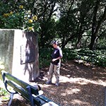
De Anza Historical ParkNear Corner of Arroyo Ct and Dartmouth Rd
San Mateo, CA 94402 This City of San Mateo park marks the Anza Expedition campsite and a State of California historical marker.
San Francisco CountyAfter traveling up the San Francisco peninsula, Anza, Moraga and Font and a small expedition of men made camp at Mountain Lake March 27-28, 1776. They selected the sites for the Presidio and Mission, and it was left to Lt. Moraga to return with the settlers on June 27. San Francisco was to become the new home for many of Anza's colonists.Sites of InterestLake Merced The expedition passed to the east of Lake Merced. Adjacent to a portion of the Golden Gate National Recreation Area and the San Francisco Zoo, this park is best accessed from Highway 1 via Font Boulevard. The Sutro Library branch of the California State Library is also located nearby (480 Winston Dr.). There, visitors can learn more about the history of the area. Golden Gate Park The expedition passed through what would become this long slender park. The man-made park found there today bears little resemblance to the drifting sand and stiff winds that Anza found there. Biking along its many trails is a good way to see the park. There are trails throughout the park, but it is several miles through a residential neighborhood and the Presidio to the Golden Gate Bridge. Mountain Lake Park and Expedition Camp #95 The exploratory expedition camped here (37° 47' 17" N 122° 28' 12"W) while they investigated the area, selecting the sites for the Presidio and the Mission. They noted lakes, lagoons and springs, since the colony needed a water source. This City of San Francisco park is a good place to stop and consider Anza's trek. There's an interpretive panel describing Anza's visit. Golden Gate National Recreation Area and Presidio of San Francisco Anza stood precariously at the edge of some white cliffs (near Fort Point, 37° 48' 38"N, 122° 28' 33"W) and decided where to build the Presidio for Spain's northernmost outpost. The beautiful forested recreation area is in stark contrast to the bare sand dunes found there in Anza's time. The area includes: Fort Point; the site of the original presidio around Pershing Square; a remnant of the presidio comandante's house; many trails; and the Visitor's Center (50 Moraga Ave.). Mission San Francisco de Asís (Mission Dolores) Anza, Moraga, and Font surveyed the area, and Anza selected the future mission site near a spring and lagoon and named it Nuestra Señora de Los Dolores. The mission was located near the Costanoan Ranchería (village) of Chutchui, and it was the tribes collected at the mission who built the structure seen today. It is the oldest intact building in San Francisco. To reach the Mission (3321 16th St.) from the Presidio, take Van Ness Ave./US-101 and turn right on 16th Street to Dolores Street. Here, and at the California Historical Society (678 Mission St.), visitors can learn of the changes to the city since Anza's time. 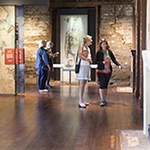
Presidio of San Francisco50 Moraga Ave.
San Francisco, CA 94129 (415) 561-4400 The Heritage Gallery at the Presidio Officers' Club features exhibits about the Anza Expedition and the founding of San Francisco. The Officers' Club shares adobe foundation walls with an early presidio built after the Anza Expedition's arrival.
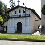
Mission Dolores(Passport Stamp Location)
3321 Sixteenth St. San Francisco, CA 94114
(415) 621-8203
The Spanish Empire sent the Anza Expedition to the Bay Area in 1776 in order to establish the presidio and this mission, around which San Francisco's Mission District would grow.
Alameda CountyAfter measuring the Palo Alto, and camping in the vicinity of the Guadalupe River at the southern tip of the bay, Font, Anza, Moraga and the exploratory band of soldiers made a sharp "U" turn to ascend into the low hills parallel to the eastern shore of the San Francisco Bay. At many of the creeks along the way, they encountered American Indians of the Chocheno (Costanoan) tribes. They continued north to San Pablo Bay.Sites of InterestDon Edwards San Francisco Bay Wildlife Refuge Anza tried to avoid the marshlands at the southern edge of the bay. Today, the visitor center for the Wildlife Refuge provides exhibits on the salt marsh ecosystem and its inhabitants. It operates an Environmental Education Center in Alviso, and has a segment of the Bay Trail. Mission San José Founded in 1797 on Ohlone land along the historic Anza route. The museum includes displays about Ohlone and mission life. The grave of Fulgencio Higuera, grandson of expedition member Ignacio Anastacio Higuera is also here. It is located at 43300 Mission Blvd. at Washington Blvd. in Fremont. Alameda Creek Here, thirty Chocheno natives raised an arm, extending their hand as a sign that the soldiers should stop. Yelling with great rapidity, they said: "Au, au, au, au, au…", and then they halted, vigorously slapping their thighs. In a peaceful encounter, they were given beads. Today, the Alameda Creek Regional Trail connects Coyote Hills Regional Park to the Bay Area Ridge Trail. San Lorenzo Creek and Expedition Camp #98 José Soberanes, who came as a guide from Monterey, told father Font this creek was called Arroyo de la Harina after a load of flour that got wet during the prior journey of Pedro Fages. Anza writes, "Today in passing we have seen six villages, whose inhabitants, not accustomed to seeing us, fled like wild beasts. Notwithstanding this, about forty heathen have come close to us and I have given them presents. The last one whom we encountered discovered us about forty paces away, and although less than five steps from where he was there was a place where he might have hidden, such was his terror that he lay down in his tracks…I tried to relieve his fright and to get him to stand up, but for a long time I was unable to succeed…I thought it best to leave the unfortunate fellow alone." A small park and interpretive display is located at the corner of Foothill Boulevard and City Center Drive in Hayward commemorates this day, March 31, 1776. Peralta Hacienda Historical Park Luis María Peralta came to California with Anza when he was 16 years old. In 1820, the last Spanish governor gave him a 44,800-acre land grant. He named it El Rancho de San Antonio and divided it among his three sons. It encompassed today's cities of Hayward, Oakland and Berkeley. In 1842, Antonio Maria Peralta received what became the San Antonio division on which this hacienda sits. Peralta Creek is adjacent to the museum, and the park is open to the public. It is located in the Fruitvale district of Oakland at 2465 34th Avenue; 37º 47' 16" N, 122º 12' 55" W). 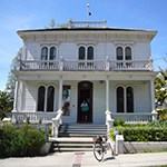
Peralta Hacienda Historical Park(Passport Stamp Location) (Certified Site)2465 34th Ave. Oakland, CA 94601 (510) 532-9142 This historic home is site of the first non-native homestead in the East Bay, established by Anza Expedition member Luis Maria Peralta. Contra Costa CountyAnza's exploratory group camped near Rodeo at the mouth of the San Pablo Bay. The next day at noon, they stopped on a hill just west of the Carquinez Bridge and noted Mare Island and the Puerto Dulce (Suisun Bay). They continued to the Martínez area and camped near Concord. They reached the site of Antioch, and encountering impassable Tule marshes, headed south back towards Monterey.Sites of InterestRodeo and Expedition Camp #99 Anza's men chased Tule Elk (Cervus elaphus nannodes) near Berkeley, and then continued north. On April 1st, the group camped at a small stream. Today, the campsite is at the conjunction of Parker and San Pablo Avenues and Rodeo Creek, a heavily industrialized area. A commemorative marker from the 1976 reenactment is on Parker Road between 4th and 6th Street in front of the post office in the town of Rodeo. The coast reminded Font of Sonora's Tierra Caliente (Hot Country). Selby Open Space Area and Anza's Midday Stop West of the Carquinez Bridge, their hillside vantage point can be reached via San Pablo Ave. through the East Bay Regional Park District's (EBRPD) Selby Open Space area across from Vista del Rio Road. A short, but steep, hike from the parking area takes you to the viewpoint. On April 2, 1776, Father Font notes, "…This Puerto Dulce [sweet harbor], indeed, is a gulf of fresh water, enclosed in a canyon by hills...In the bay and in front of the mouth there is an island [Mare Island]…" The location of the hill is close to 38º 03' 14" N, 122º 14' 37" W. Adobes of Expedition Descendants near Camp #100 Located within the grounds of John Muir National Historic Site, the Vicente Martínez adobe provides interpretation of the passage of the Anza expedition and the subsequent Spanish and Mexican periods. The wife of Vicente Martínez was Guadalupe Moraga, a great-granddaughter of the San Francisco founder. While in Concord, one can visit the Salvio Pacheco Adobe (1870 Adobe St.) or the Don Fernando Pacheco Adobe (3119 Grant St. within Hillcrest Park). Juan Salvio Pacheco, a grandson of Anza recruit Juan Salvio Pacheco and his wife, María del Carmen del Valle, received a 5,000-acre Mexican land grant for service to his government. Fernando was their son. Recreation Trails along Anza's Path The East Bay Regional Park District's (EBRPD) multi-use 20-mile Delta de Anza Regional Trail commemorates the route of Anza's 1776 expedition and is marked as a component of the Juan Bautista de Anza National Historic Trail. An interpretive stop located on the eastern side of Willow Pass describes the Puerto Dulce. EBRPD manages hundreds of miles of trails including the Skyline National Recreation Trail. This trail, and the Bay Area Ridge Trail parallel Anza's route, although at a higher elevation so that they offer panoramic views of San Francisco Bay. At both the Carquinez Strait and Antioch / Oakley Regional Shoreline parks give a closer view. At the latter, Camp #101 is commemorated with a plaque placed on the edge of the shore on the east side of the fishing pier. Near this camp on April 3rd, there was a friendly exchange with members of a Bay Miwok village. 
Martinez Abobe (Closed for Structural Repairs)(Passport Stamp Location)
For safety reasons, access to the Martinez Adobe is blocked off from the public and remains closed for all use until the structure is stabilized. Currently, there is no timeline for the repairs to be complete. We are creating a webpage with some of the content from the exhibit. We will post a link to this page here once it is created. Read the news release about this closure. John Muir National Historic Site
4202 Alhambra Ave
Martinez, CA 94553
(925) 228-8860
This 1848 Mexican-era adobe houses a permanent exhibit about the Juan Bautista de Anza National Historic Trail.
|
Last updated: April 7, 2022

