This document brings together a fascinating combination of people who lived and worked in St. Louis at the same time: two famous Civil war generals from opposing sides, the father of modern gastric study, and one of the best known explorers in American history.
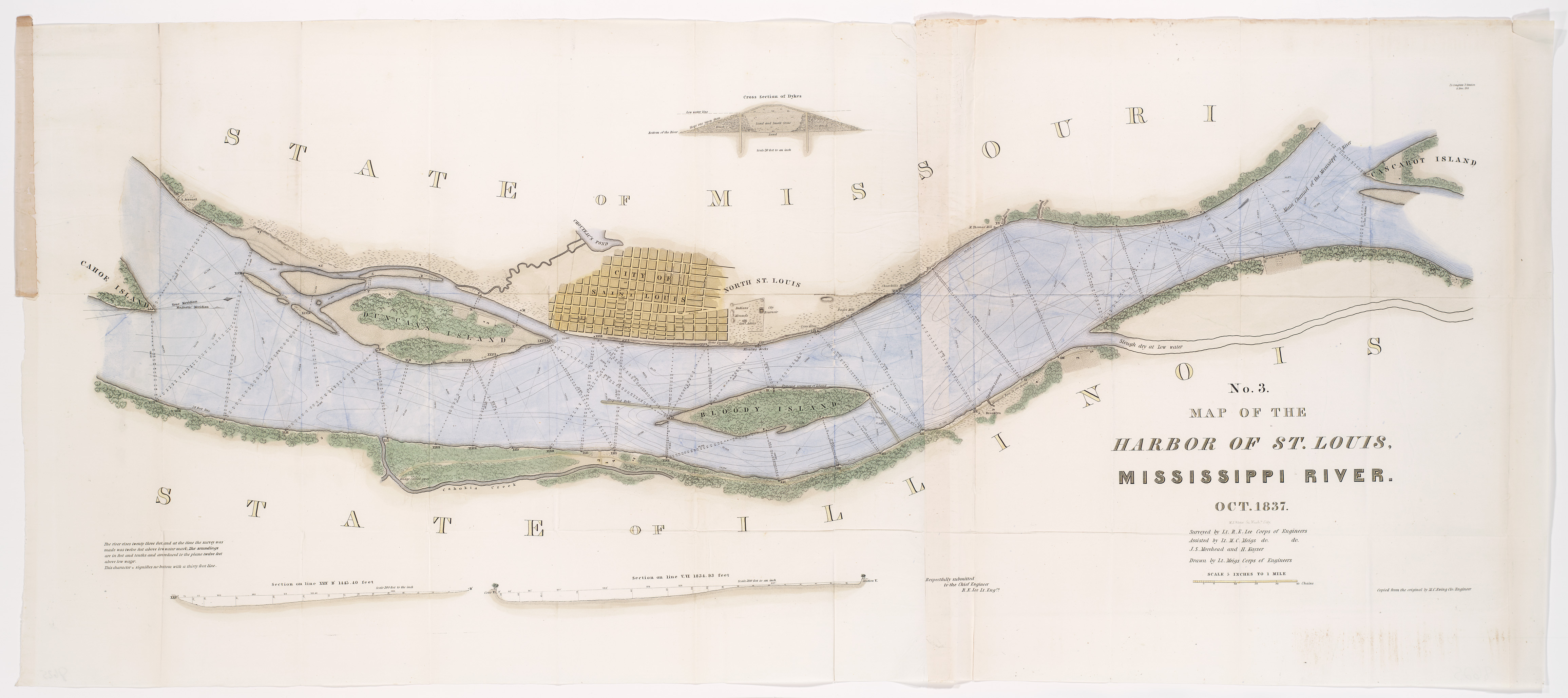
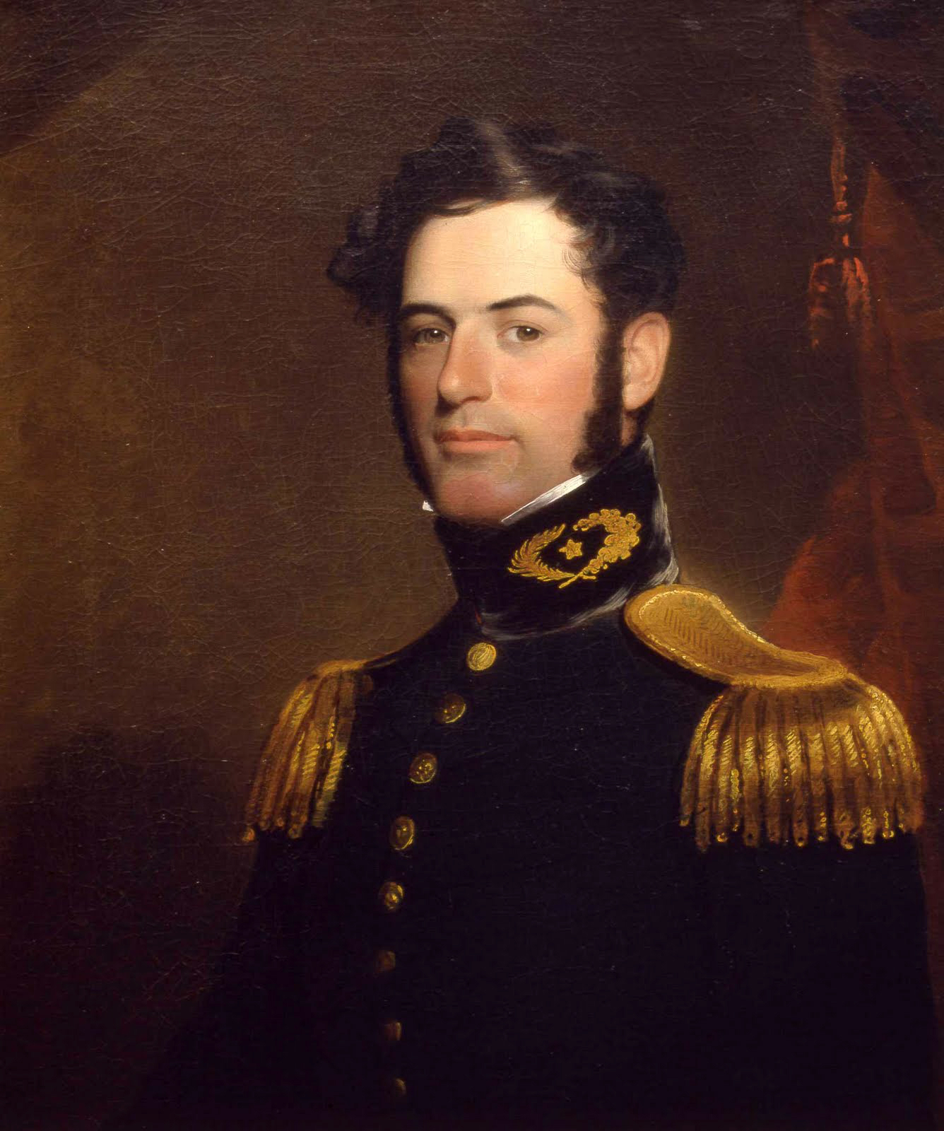
Long before the outbreak of the Civil War, Robert E. Lee served in the Army Corps of Engineers. In 1838, at the age of 31, Lt. Lee was assigned to St. Louis to study the river and make recommendations to fix the problem of silt filling the harbor and making it difficult for boats to use.

During part of the time that Lee was in St. Louis he lived, along with his family, on what are now the Arch grounds as a tenant on property belonging to William Clark, of Lewis and Clark fame. In this same area on the north end of the park ground, Clark owned the northern half of Block 12, located at First Street and Vine, a block south of the Eads Bridge. On this property he had built a large home, blacksmith shops and warehouses near the river, a small cottage for his son to live in, and a 100-foot long building housing his Indian Council Chamber and museum. During the early portion of 1838, Clark rented the cottage to the Lee family (Clark's son had acquired a home of his own), and the upper level of the museum building to the physician Dr. William Beaumont, known as the "Father of Gastric Physiology." Clark didn't get to spend much time with his tenants; he died later that year (on September 1) at the age of sixty-eight.

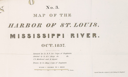
In this legend to the map, Lee's name is listed as the surveyor. The map was drawn by Lt. Meigs, also of the Corps of Engineers. Montgomery C. Meigs was a talented engineer who would be promoted to brevet major general and served as Quartermaster General of the Union Army in 1861.

Lee's system of dykes and barriers directed the river toward Duncan's Island, a creation of silt that was blocking the harbor. His river improvements washed the island away, making it easier for vessels to reach the harbor. The project was a success and trade in St. Louis benefited greatly from the work of the Corps of Engineers.
After working together in harmony on this project, Lee and Meigs would go their separate ways to serve on opposite sides of the Civil War. Although Meigs was a Georgian, he was a staunch Unionist, as was his son.Meigs lost his son in the conflict and was present for President Lincoln's death, becoming very embittered toward his former fellow engineer for betraying the union. During the war, Arlington House, the home of the Lee family, was used as a cemetery for the some of the war dead, but most burials were on the estate, not near the house. In 1864, Meigs authorized and encouraged burials on the land immediately surrounding the house, to make sure that the Lee family could never return. Meigs continued to work on the national cemetery at Arlington for years, designing memorials, a gate and an amphitheater.
As an artifact linking these two men who would go on to positions of leadership on opposing sides of a war, this map is a record of a peaceful project that brought great benefits to the people of St. Louis.
For more information on the development of Arlington House into the national cemetery, please visit the Arlington House website at:
