September 2023 Summit Eruption

Visit our keyboard shortcuts docs for details
Duration:
44.545 seconds

A chronological account of the geologic events during the September 2023 eruption.
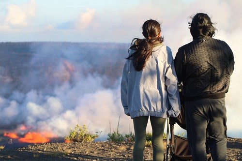
 
Image of a family viewing a crater filled with lava.
Visitors relish views of the eruption while maintaining a safe distance from the crater's edge.

NPS Photo

Around 3:15 p.m. HST on September 10, 2023, following increased seismic activity and ground uplift, scientists at the USGS Hawaiian Volcano Observatory (HVO) witnessed the beginning of an eruption. Fissures emerged from the eastern edge of Halemaʻumaʻu crater, extending into a sunken section of the caldera referred to as the down-dropped block by HVO researchers.

Since the 2018 summit collapse, Halemaʻumaʻu had gradually filled with lava in the last five eruptions. This most recent eruption concealed the remnants of the 1971 and 1982 Kīlauea eruptions under fresh lava flows. Within Halemaʻumaʻu crater, an area of 496 acres (201 hectares) was transformed by these lava flows, offering visitors breathtaking views.
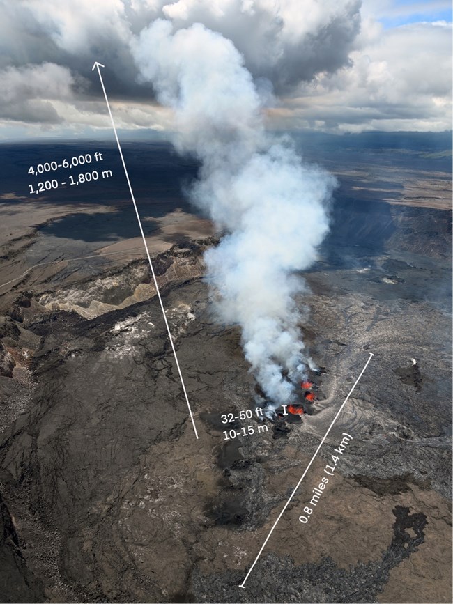
 
An aerial photograph of a crater filled with molten lava.

NPS Photo/M.Newman

The line of vents stretched approximately 0.8 miles (1.4 km) from the eastern section of Halema‘uma‘u crater floor into the eastern wall of the down-dropped block. At the beginning of the eruption, the main fissure's base, furthest to the west, measured about 230 feet (70 meters wide) and reached heights of roughly 65-82 feet (20-25 meters). As the six-day eruption progressed, the lava fountains gradually subsided to an average of 10-15 meters (32-50 feet). Initial volcanic gas emissions amounted to 190,000 tonnes of sulfur dioxide per day, with the eruption plume consisting primarily of sulfur dioxide and minor volcanic particles, rising to altitudes of 8,000-10,000 feet (2,400-3,000 meters) above sea level.

While the eruption remained confined within the summit caldera, safety concerns primarily focused on volcanic gas and delicate strands of volcanic glass known as Pele’s hair, which had the potential to be carried downwind and causing serious threats to human health. The USGS and the park advised everyone to minimize their exposure to these volcanic particles.
 
A eruptive activity map for September 2023. Map shows lava filling a larger portion of a volcanic crater in an area known as the down-dropped block. The lava filled 496 acres of the crater. A eruptive activity map for September 2023. Map shows lava filling a larger portion of a volcanic crater in an area known as the down-dropped block. The lava filled 496 acres of the crater.

Left image
Map showing the extent of the eruption in September 2023
Credit: Map courtesy of USGS

Right image
Map showing the extent of the previous eruption in June 2023.
Credit: Map courtesy of USGS

This eruption is part of an ongoing series of volcanic activity within the summit Halema'uma'u crater, and was the fifth eruption since the 2018 summit collapse. Lava has slowly filled in Halemaʻumaʻu, and as a result, the eastern rim of the crater is now nearly covered with lava flows.


This eruption marked the first time lava had reached an accessible area of the caldera floor since 2018, allowing geologists to collect molten samples near the erupting vents. These samples were rapidly cooled with water, transported to the University of Hawaiʻi in Hilo, dried in a warm oven for two hours, ground into a uniform powder, and then compressed into pellets under 25 tons of pressure for analysis in an Energy Dispersive X-Ray Fluorescence Spectrometer (EDXRF). After 24 hours of analysis, it was revealed that the temperature and chemistry of the lava from this recent eruption closely resembled that of the past four eruptions. This suggests that even if hotter magma from deeper sources enters the volcano, it undergoes mixing and cooling within a shallower magma body before reaching the surface.

 
A USGS geologist collecting a sample of lava.
Geologist, wearing protective equipment, collects a molten sample of newly erupted material. The sample provided information on magma storage and transport before it rose to the surface as lava. Access to this hazardous area is by permission from, and in coordination with, Hawaiʻi Volcanoes National Park.

Photograph courtesy of USGS

 
This eruption provided a valuable opportunity for scientists to study the eruptive dynamics of Kīlauea, from its onset to the eventual cessation of activity. On September 16, eruptive activity greated decreased and HVO webcams showed little or no fountaining. The area of active lava had retreated further towards the vents, with numerous ooze-outs visible over other parts of Halema‘uma‘u crater floor overnight.


Last updated: September 26, 2023

Park footer

Contact Info

Mailing Address:

P.O. Box 52
Hawaii National Park, HI 96718

Phone:

808 985-6011

Contact Us