|
Visit our keyboard shortcuts docs for details
The USGS Hawaiian Volcano Observatory detected glow in the summit webcam images at 4:44 a.m., confirming the eruption within Halemaʻumaʻu crater. Timelapse of the eruption within the first few hours of the eruption. Kīlauea Erupts After a 3 Month PauseA magnificent display featuring mesmerizing fountains of vibrant, molten lava bursting hundreds of feet into the air began on June 7, 2023 at 4:44 a.m. within Halemaʻumaʻu crater. According to USGS Hawaiian Volcano Observatory (HVO) geologist, the eruption was detected through webcam images showing glowing presence at the summit in the early morning. HVO geologist observed an increase in earthquake activity and ground deformation hours prior to the eruption, suggesting the movement of magna beneath the surface of Kīlauea. Fiery DelugeThe largest lava fountains during the onset of the eruption reached 200 feet (60 meters) high. Lava flows inundated much of the crater floor (an area of approximately 370 acres or 150 hectares). Within a few hours, 10 meters (33 feet) depth of new lava had been added to the crater floor.
Visit our keyboard shortcuts docs for details
Close up view (10x magnification) of the southwest eruptive vent in Halemaʻumaʻu crater at the summit of Kīlauea on Friday, June 16, 2023, as it spatters and feeds lava flows on the crater floor. The fountaining is continuous, with lava bombs being thrown at least 10 m (33 ft) upwards and at least twice that distance away from the vent. The eruption can be heard from a distance. 
Citizen-scientists may notice that this map's values for lava rise and volume since the eruption onset are slightly less than those provided with the first map last Wednesday, June 7. How can this be? In this case, HVO scientists believe that the lava lake was somewhat inflated during its early hours thanks to a massive amount of volcanic gas trapped within the erupted material. But over the coming hours and days, the gas escaped and the lake deflated somewhat. The dropping surface left a "bathtub ring" of crust around the edges, marking the initial high-lava level in many photos shared by HVO scientists. The full extent of new lava from this eruption—368 acres (149 hectares)—is also slightly less than reported last week, but this is simply due to revised and more detailed mapping. 
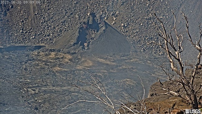
USGS Photo Eruption PausesEarlier in the day, there was a significant output of lava from large lava fountains from the south-west cone. However, within an hour, the lava in the crater started to slow and the surface of the lava lake went down several meters. The eruption at Kīlauea volcano paused on Monday, June 19 at 4:00 p.m. Overnight webcam views showed som previously erupted lava still flowing on the crater floor, but views of the lava diminished throughout the next day. |
Last updated: June 21, 2023
