Backcountry Camping Routes and Zones

BACKCOUNTRY TRIP PLANNER
 
A ranger pointing to the visitor center on the map of the park

NPS Photo

Map out your trip

For a successful trip is the combination of a great trail and the right amount of hiking to your next campsite. Have a good trip in mind, but be flexible with your route. If you are flexible, it is unlikely you will walk away without a great itinerary.

To start mapping out your trip, decide how far is reasonable for all your group members to hike each day, and plot this out using the point to point mileage map.


A map showing point to point mileages, camping routes, and zones.

NPS map

Suggested Routes

Teton Crest Trail (TCT)

The Teton Crest Trail is a 39-mile point to point route starting outside the park at Phillips Pass and ending at String Lake. This route climbs over 9000’ of elevation gain and is best enjoyed over multiple days. You can also start at the Granite Canyon trailhead and complete only hiking inside Grand Teton National Park or you can save approximately 4 miles and 2400’ of gain by taking the aerial tram from Teton Tillage. This route is very popular and the camping zones along this trail are full almost every night late July through early September.

  • Tram to Granite Canyon via Marion Lake
    15.0 miles. Trailhead: Teton Village - 1 night. Note: Fee charged for the tram.
  • Tram to Cascade Canyon
    28.6 miles. Trailheads Teton Village and String Lake. Note: Fee charged for the tram.
  • Death Canyon/Cascade Canyon
    30.1 miles. Trailheads: Death Canyon and String Lake – 2 to 3 nights.
  • Death Canyon/Paintbrush Canyon
    37.1 miles. Trailheads: Death Canyon and String Lake – 3 to 4 nights.
  • Granite Canyon/Paintbrush Canyon
    38.6 miles. Trailheads: Granite Canyon and String Lake – 4 nights.

Other Routes

Many loops can be made utilizing canyon trails and the Teton Crest Trail or Valley Trail. Loops are good for shorter trips.

  • Cascade Canyon/Paintbrush Canyon Loop
    19.0 miles. Trailhead: String Lake – 1 night.
    Note: This is an extremely busy trail July and August
  • Granite Canyon/Open Canyon Loop via Valley Trail
    20.2 miles. Trailhead: Granite Canyon – 1 night.
  • Tram/Death Canyon Loop via Valley Trail
    21.9 miles. Trailhead: Teton Village - 1 to 2 nights. Fee charged for the tram.
  • Cascade Canyon/Death Canyon Loop via Static Peak Divide
    25.8 miles (23.4 miles with Jenny Lake ferry). Trailheads: South Jenny Lake and Death Canyon – 1 to 2 nights. Note: Fee charged for the ferry.
  • Granite Canyon/Death Canyon Loop via Valley Trail
    24.2 miles. Trailhead: Granite Canyon – 2 nights.


View of the mountains from within a tent

NPS Photo

Choosing a place to sleep

Planning your trip requires the route and a place to sleep. Once you've determined how far your group can hike in a day, select zones or inidvidual sites to stay for the night.

  • Mountain Camping Zones are popular zones along the Teton Crest Trail and within canyons. Typically these zones are higher in elevation and take a longer time to hike to. When you select a campsite from the Mountain Camping Zones area you are permitted to camp anywhere inside that zone.
  • Individual Sites offer specific designated camping spots. These are marked by a sign and have tent pads.
  • Group sites are designated spots for groups of 7 or larger. Maximum occupants varies by site. These are marked by a sign.
  • Lakeshore sites are along Jackson and Leigh Lakes and are approachable either by hiking or boating. Many have campfire rings. These sites require a WAG bag.
 

Map of Backcountry Camping Zones and Sites


Mountain Camping Zones

Zones are large camping areas which vary in size, and are marked by a sign at the beginning and end of each zone. This area is where you will find campsites for the popular routes of the Teton Crest Trail (TCT) and the Paintbrush-Cascade Canyon Loop. Many trips on the Teton Crest Trail are completed by staying in the zones.

Some zones have marked “indicated sites” to help you choose where to stop, and some do not. Either way you are free to choose your campsite within the boundary of the zone, but whenever possible, camp at previously occupied sites out of sight of trails and other campers, and 200 feet from lakes and streams. Campfires are not allowed in any mountain camping areas.


Lakeshore Sites

  • Pitch tents on tent pads, where provided.
  • Bears are common. Proper food storage is required by federal law. Permanent bear-resistant storage boxes are provided at each site and must be used to store food and any item with an odor. You may check out a bear food canister for excess items. Items may not be hung from trees or left in boats.
  • Fires are only allowed in metal grates. When finished, please dowse your fire with water until it is cold to the touch.
  • Jackson Lake sites offers individual group and regular size sites.
  • Can stay three nights in the same site.
  • Pack out solid human waste, groovers encouraged
  • Most sites are boat in only. Exceptions: Spalding Bay (Drive in), South Landing, and Hermitage Point.
  • Pets are allowed on boats in Jackson Lake but are not allowed on the shores of Jackson Lake except at designated boat ramps and the Spalding Bay campsites. Pets must be physically restrained on a leash less than six feet in length at all times and are not allowed out of boats.
  • Leigh Lake sites 14a/b and 16 are boat in only.
  • On recreation.gov, the sites on Bearpaw Lake and Trapper Lake are in the Leigh Lake Area while the sites on Bradley Lake and Phelps Lake are in the Mountain Camping Zone Area.
 

Northern Canyons

These remote areas (Berry Creek, Owl Canyon, Webb Canyon/Moose Basin, Hechtman Horse Camp) provide a unique Grand Teton experience, but are known for having high bear activity and trails are not easily accessed or navigated. Any backpacker in this area must be confident in their abilities.

  • Bears, including grizzlies, frequent these areas. Hiking can include difficult and dangerous stream crossings without bridges. Safe travel requires good physical condition and experience with map and compass or GPS. Hikers must be self reliant.
  • Stock camping is permitted only at Hechtman Stock Camp.
  • Grassy Lake Road is closed until early June for grizzly bear activity. Obtain a permit at any backcountry office. Specify your camping itinerary by indicating the canyon you plan to camp in. Note that the northern canyons have permit limits similar to camping zones.


Surrounding National Forest Land

The Teton Crest Trail intersects into Bridger-Teton National Forest at Teton Pass and Caribou-Targhee National Forest at Fox Creek Pass and Alaska Basin. Since it is Forest Service land, different regulations apply.


More Backcountry Planning
 
Garnet Canyon with snow
Get Your Permit

Current pricing and tips for getting a permit

Two backpackers hiking up trail with the Grand Teton in the distance.
Backcountry Camping

Plan your backcountry adventure.

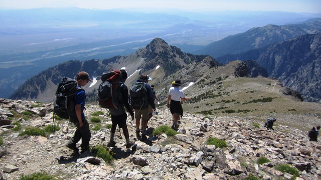
Hikers descend Static Peak
Know Before You Go

Learn when the snow melts and what the trail will be like.
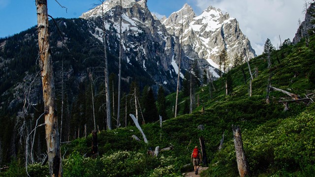
A hiker walks down a trail towards mountains.
Hike in Grand Teton

Explore hikes throughout Grand Teton National Park.

Hikers climb out of a valley in Death Canyon
Backcountry Camping FAQs

Answers to frequently asked questions about planning your backcountry trip.

Last updated: January 10, 2024

Park footer

Contact Info

Mailing Address:

P.O. Box 170
Moose, WY 83012

Phone:

307-739-3399
Talk to a Ranger? To speak to a Grand Teton National Park ranger call 307–739–3399 for visitor information Monday-Friday during business hours.

Contact Us