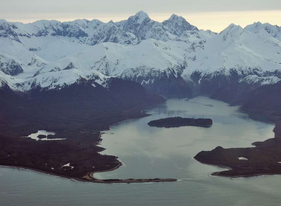
 Lituya Bay, on the west coast of Glacier Bay National Park. NPS Photo/B. Eichenlaub
Jim Moore, along with his family, has been commercial fishing the outer coast of Glacier Bay for half a century—so when he decided this past August to go anchor up in Lituya Bay, he knew how and when to do it. Along with his grandkids Malachi (14) and Danny (11), he ran his troller Aljak from Cape Cross to Lituya Bay the evening of August 15, aiming to ride a flood tide in through the narrow entrance. What he found surprised him: a brown muddy current of icebergs and root-wads pouring out into the open ocean against the rising tide. Over his career, Jim has watched the glaciers of Lituya Bay retreat from tidewater to their current grounded positions on the beaches, so he knew that this wasn’t from calving glaciers—something else, powerful and unusual, must have happened. Now, with the help of some sleuthing scientists and a pile of satellite imagery, we know what it was.
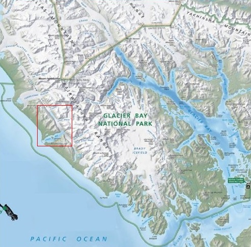
Lituya Bay in Glacier Bay National Park and Preserve. The red box indicates the area of the August 15, 2020 event.
On August 15, 2020, Lituya Bay was filled with the latest but also possibly the largest glacier lake outburst flood in the poorly-known history of such events from Lituya Glacier. Glacier lake outburst floods (also known by the Icelandic term jökulhlaups), occur when a glacier-dammed lake is able to suddenly (and usually unexpectedly) drain through a failure in or under the glacier dam. In this case, the lake in question is an unnamed lake in Desolation Valley, trapped by the northwestern end of the Lituya Glacier. When USGS published most of its Alaskan topographic maps in the 1950s, Desolation Valley was completely filled by Desolation Glacier, but in recent decades the thinning and retreat of that glacier allowed development of a proglacial lake. That lake has steadily increased in size as adjacent glaciers to the northwest (Fairweather Glacier) and southeast (Lituya Glacier) have shrunk, and the lake that drained this past August was the largest yet: about 11.5 square kilometers or 4.4 square miles!
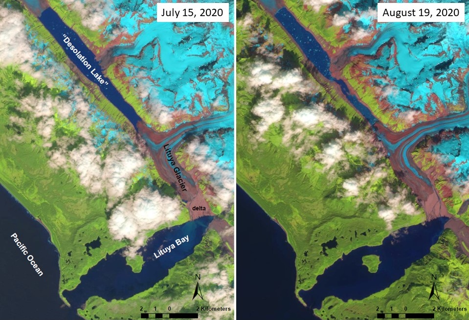
False-color satellite images of Lituya Bay, Lituya Glacier, and “Desolation Lake” showing the lake level and delta before (left) and after (right) the August 15, 2020 flood. Sentinel 2 image via https://earthexplorer.usgs.gov.
We don’t know how deep “Desolation Lake” is, but from examination of the satellite images before and after the recent flood (clear-sky images on July 15 and then again on August 19) it appears that the lake level dropped at least 60 meters, implying a total flood volume of well over half a cubic kilometer of water. For comparison, that’s nearly an hour’s worth of average flow from the world’s most voluminous river: the Amazon. Like most jökulhlaups, it appears that this massive outburst flood traveled underneath the Lituya Glacier, emerging from under the glacier’s south end onto the gravel delta that now separates the glacier from Lituya Bay. Satellite images show that the delta was completely reworked by the flood—two ice marginal lakes were completely filled in with gravel, the pre-existing river braids were replaced by a whole new drainage network, and the braidplain was littered with a new veneer of icebergs, boulders, and gravel. And while we don’t know the total duration of the flood, it was clearly quick enough to raise the waters of Lituya Bay faster than the tide—forcing Jim Moore and his grandkids to spend the night elsewhere.
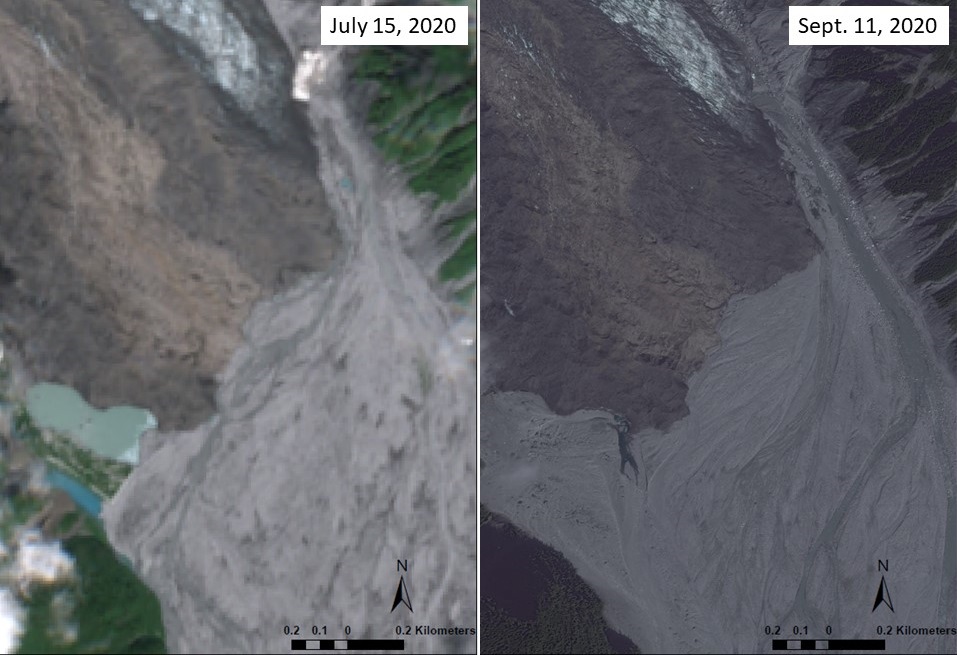 True-color satellite images of the Lituya Glacier terminus and delta, showing proglacial lakes and stream channels prior to the August 15, 2020 flood (left) and burial and resurfacing of proglacial lakes and stream channels by the August 15, 2020 flood (right). July 15 Sentinel 2 image via https://earthexplorer.usgs.gov and September 11 true-color satellite image Worldview2 image via https://evwhs.digitalglobe.com.
We believe this recent event was only the most recent of many outburst floods from the drainage of “Desolation Lake”. Canadian geomorphologist Marten Geertsma and other colleagues have found evidence in available satellite imagery of at least twelve drainage events since 2004, and there have no doubt been more. The aftermath of one such event was documented by three former Glacier Bay National Park and Preserve employees (Bill Eichenlaub, Chad Soiseth, and Nate Borson) who were fortunate to spend a few days camping in Lituya Bay after a flood in July 2009 <https://www.travelblog.org/North-America/United-States/Alaska/Glacier-Bay/blog-445853.html>. But the truth is we still don’t know much about these events because Jim Moore’s observations, from outside the Bay, are the closest thing we have to a first-hand observation of the flood in progress.
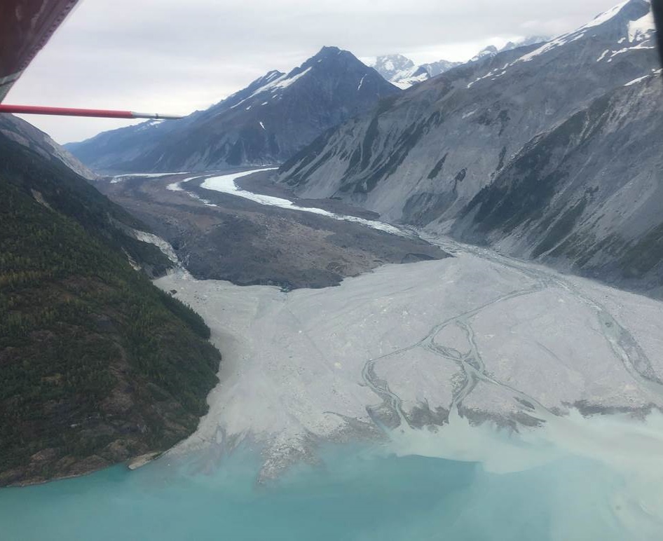 The terminus of Lituya Glacier on September 17, 2020, after the delta (foreground gravels) was completely resurfaced by the August 15 outburst flood. The source of the flood, “Desolation Lake”, is just visible under the aircraft’s red pitot tube, while the main body of Lituya Glacier emerges from the mountains to the right. NPS Photo/J. Capra.
Among many outstanding questions there is a prominent one for NPS: what kind of hazards do these events pose to the public? The “next” outburst from this lake could very easily destroy a campsite on the Lituya Glacier delta, but it is less clear what it would do to boats or campers elsewhere in the Bay. It would, at minimum, make for some bumpy seas, but the hazard to mariners might be very significant. One thing we know for certain is that Jim Moore’s observations have piqued the interest of a broad group of NPS and academic scientists, and we will soon know more about these landscape-altering events.
