|
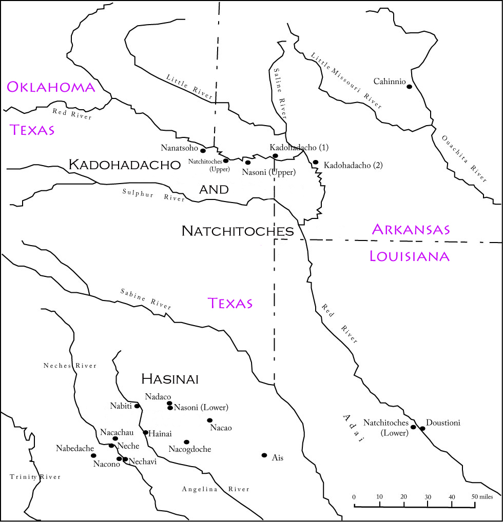
The Caddo originated in the lower Mississippi Valley and spread west along the river systems. Sometime between 700 and 800 they settled the area between the Arkansas River and the middle reaches of the Red, Sabine, Angelina, and Neches rivers and adopted agriculture. They grew corn and pumpkins as primary crops which, later combined with beans and squash, stimulated population growth. The name Caddo derives from a French abbreviation of Kadohadachho (“real chief”). The Caddo people in historic times (after 1535) comprised at least 25 distinct but closely affiliated groups centered at the Great Bend of the Red River and extending into the Piney Woods region.
The Caddo people differ from most other American Indian groups that lived in Texas because of their territorial stability. Settlement and use of lands had great permanence: the Caddo lived and sustained themselves in the same broad forested and well-watered landscape for over 1,000 years. By the time of contact with Europeans, the Caddo were organized into three kin-based affiliated groups. The Hasinai confederacy (called Cenis by the French and Teyas by the Spanish) occupied between nine and 12 communities in the Neches and Angelina river valley region of East Texas. The Kadohadacho and Natchitoches confederacies lived in the area of the Red River to the north and east in what are now the border regions of Texas, Oklahoma, Arkansas, and Louisiana. Check out the 1687 Map 
|
Last updated: April 23, 2025