Maps

 
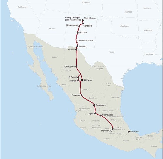
A map depicting a trail from Santa Fe south into Mexico.

El Camino Real de Tierra Adentro National Historic Trail extends 404 miles between El Paso, Texas to Santa Fe, New Mexico, while the historic trail extended all the way to Mexico City.


A map depicting a trail from Santa Fe south into Mexico.

Photo/NPS

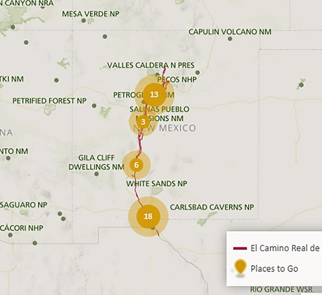
Places to Go along the Trail

The map highlights different sites that can be visited along the trail. You'll find museums, interpretive centers, and historic sites that provide information and interpretation.

Tip: Zoom in to find a location in New Mexico or Texas. Click on the yellow balloon of your choice to see the site name, address, access, image, and website.

 
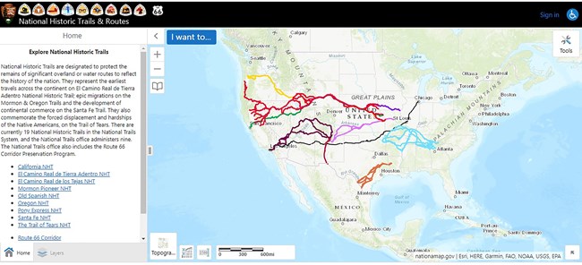
A map of the United States depicting trail from east to west.

GIS Interactive Map

The National Park Service Geographic Resources Program hosts an interactive trails map viewer.

Tip: Choose El Camino Real de Tierra Adentro National Historic Trail and then zoom in to find the details you need for trip planning.

 
A picture of a brochure cover, with a title and desert landscape scene.

Photo/NPS

National Historic Trail Brochure

El Camino Real de Tierra Adentro's official brochure (2016 revision) includes a map of the US portion of the trail that is administered by the National Park Service and Bureau of Land Management.

 
A map depicting a trail from Santa Fe, NM, south through Texas, to Mexico City.

Historic Map

The historic map shows the trail from Mexico City to Ohkay Owingeh (San Juan) Pueblo.

Last updated: January 21, 2022

Park footer

Contact Info

Mailing Address:

National Trails Office Regions 6|7|8
El Camino Real de Tierra Adentro National Historic Trail
1100 Old Santa Fe Trail

Santa Fe, NM 87505

Contact Us