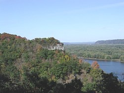
The Monument lies in a geologically unique area of erosional topography drained by an intricate system of rivers and streams. The erosional forces have cut through a plain leaving high divides and precipitous bluffs towering up to 500 feet above adjacent waterways. Five hundred million years ago warm shallow seas covered the area that was to become the midwestern part of the country. The seas laid down layer upon layer of sediments, shells from marine organisms, and lime deposits. As the seas advanced and retreated, the varying ocean depths deposited different types of sediment; limestone in the deeper areas and sand in shallow and shoreline areas. Sediment layers of limestone and sandstone form the bedrock of northeastern Iowa. The oldest layer exposed at the monument is the Jordan sandstone formation. Visible along the base of the east-facing bluffs, it serves as an important aquifer for the area. Overlying the Jordan sandstone is the Prairie du Chien formation of dolomite limestone, which forms the dominant geologic strata exposed along the river bluffs. The ability of water to erode and dissolve the limestone bedrock is responsible for the rugged terrain of northeast Iowa. During the Ice Age, the area known as the "driftless area” was left unscathed by the advance and retreat of the continental ice sheets for a million years. Although glaciers did not directly affect the area, their melt waters carved out the Mississippi River Valley. The river valley at the base of the bluffs was up to 150 feet deeper than what exists today, having been filled in with glacial debris and sediments. |
Last updated: April 10, 2015
