The trip started at the end- with the decision to end our patrol at Chelatna Lake. This allowed us to finish our trip and go onto our days off, and have friends fly in join us for a continuation down Lake Creek for some 4th of July fishing.
Next, we started looking at beginning points. Kahiltna Base Camp or The Pika would allow us to do a traverse through the Ramparts, staying on glaciers and ridgelines with little in the way of packraft terrain. But it had been done by some of the other rangers. Mt. Russel looked promising for a landing spot, and ridgeline walking, but there are some potentially show-stopping icefalls along the way, and with hot summer conditions, we didn’t have the confidence that there were routes that would go for us this time around. We kept looking west…
Kichatna to Chelatna just has a nice ring to it, and neither one of us had ever been to the legendary Kichatna Spires. But at first glance, you notice that it is so many miles, and involves all types of glaciers, steep slopes full of alder, huge rivers, and many unknowns. We had heard of hunting camps and outfitters in the area, and we knew that we could trace a line that roughly followed the park boundary. Were there ATV trails encroaching into the park? Were people accessing the park boundary and hunting inside the park? Were there actually cabins and trails near Midway Lakes? And how bad could the bushwacking actually be? All these questions needed answers. This made it sound like the perfect trip.
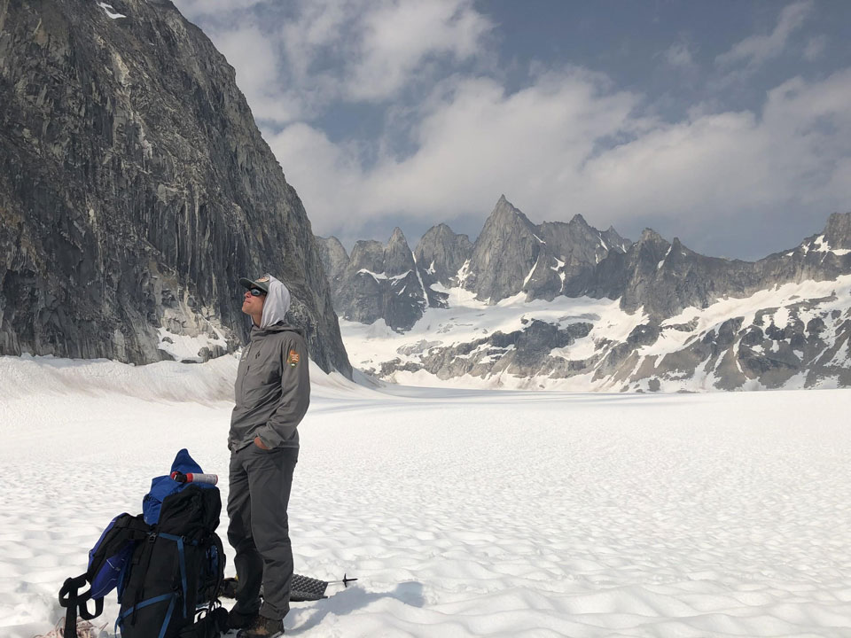
Admiring the Kichatna Spires before turning and walking down glacier.
NPS Photo / Chris Erikson
We landed on the Trident Glacier, which is not an official name that shows up on maps. But it is where teams have landed to access routes on Mt. Augustin and some of the other northeastern Kichatna Peaks. And, yes, the Kichatnas lived up to our expectations, and then blew those expectations out of the water. It is an incredible place with amazing-looking opportunities. With packs full of gear ready for a long traverse in the best weather system that many long time Alaskans had ever seen, we then realized that we were going to walk away from really nice looking granite in perfect weather. But, as it goes with these adventures, when the aircraft takes off and you and your partner now sit alone on a remote glacier with only what you brought, you evaluate your situation and act accordingly.
So we turned our backs to the Kichatnas and began walking down the Trident Glacier toward the West Fork of the Yentna River. Firn line was easy for us to navigate, with supportable snow giving way to bare late season ice with little challenge. We did encounter a knee deep slush pond on a flat section of the glacier that was colder than I thought possible for water in its liquid state. But we found a route through without having to swim, and proceeded to weave a route off the glacier to the west, accessing a north-running ridge between the Trident and the Shadows Glaciers. This ridge was easy walking with spectacular views, but despite the stable hot weather all over Alaska, the Kichatnas reminded us that they take the brunt of all bad weather, and we soon found ourselves getting pounded with heavy rain and 30 mile per hour wind.
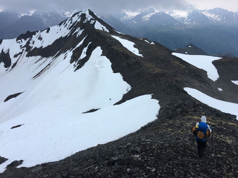
Ridge walk between the Trident and the Shadows Glaciers.
NPS Photo: Frank Preston
We picked a route to the West Fork of the Yentna River below the Shadows Fork, and were able to avoid bushwacking for the most part. We were really happy with the way the day had turned out, with great views on the way in, easy glacier travel, a fun ridgewalk, and an amazing gravel bar complete with fresh clear water for camping. We traveled somewhere between 8-10 miles, gaining 3000’+ and descending over 6000’ of elevation in day one, and we were excited to be camping at our next days put-in.
In the morning, the weather was beautiful, and we inflated our packrafts and put on the West Fork. The heatwave provided us with high water, which turned out to be less stressful than many would guess. The West Fork Yentna is big, silty, flat, and braided into many channels providing easy and fast floating even at high flows. We paddled for about 22 river miles, although it is hard to say how many with accuracy as there are so many new channels and braids forming all the time. Along the way, we stopped at a few spots to check for human use, access fresh clear water, and we even found some old trash that we picked up. With high hopes for a trail across the Midway Lakes section between the West Fork and the East Fork Yentna Rivers, we took off the river and deflated our packrafts. The mile-and-a-half crossing quickly deflated our hopes of an easy day.
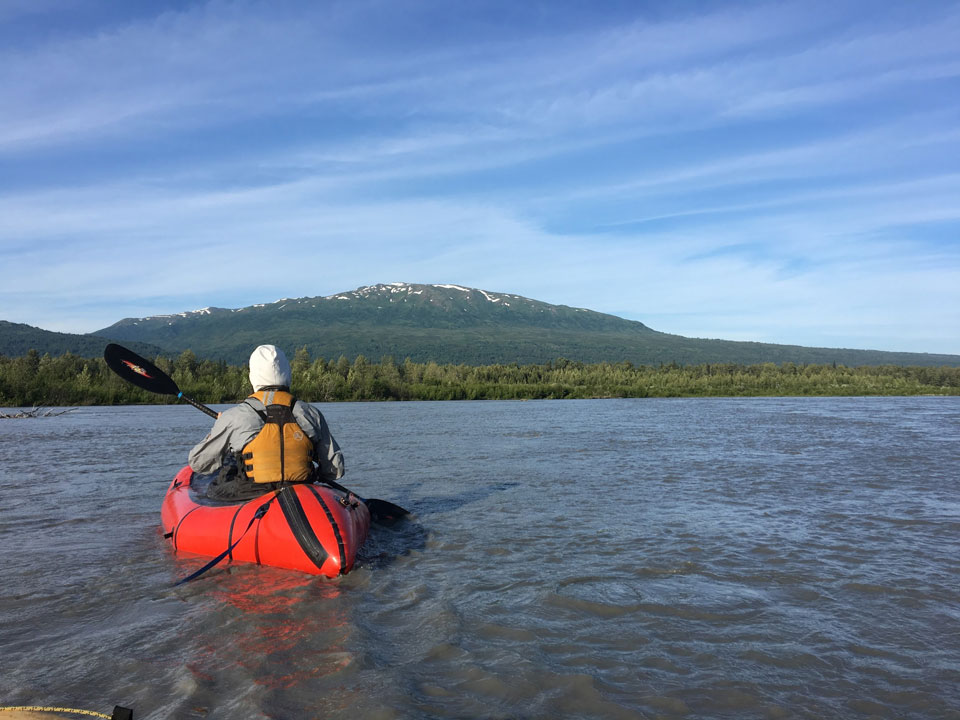
Easy floating on one of the forks of the Yentna.
NPS Photo: Frank Preston
This was the worst section of bushwacking that I have seen in Alaska. If you have ever thought to yourself, “I like traversing out of the Alaska Range, but there just isn’t enough challenge and misery in the routes I have found”, then this might be the trip for you. With no steep slopes in this section, the alder grows in all directions creating a spider web of strong woody stemmed plants. Just when you think it is getting hard, you find a patch of Devil’s Club in and amongst the alder that begins pin-pricking your hands and legs at the alder continues to bruise your shins. Then, you will likely run out of water on a hot day, as we did. Midway Lakes wasn’t much help, as the water was mainly mud, and the knee to waist deep swamp that surrounds the lake doesn’t provide for fast travel.
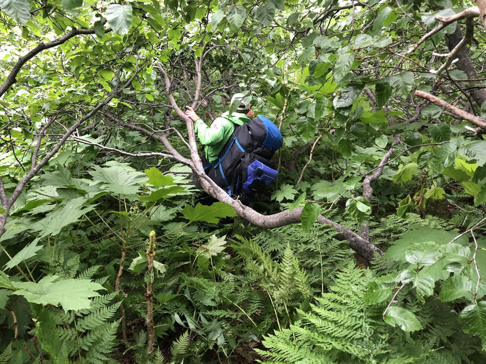
The bushwacking only got worse before it got better…
NPS Photo: Chris Erickson
Five hours after setting out on a mile-and-a-half hike to the East Fork Yentna, we emerged, with nothing left to do but laugh and inflate boats. I don’t know if there is a better route across this section of land between these two forks of the mighty Yentna. I don’t know if I actually care if a better route exists, because I don’t know if I would go back. We crossed the East Fork to get to the beginning of our next hike. The relief we felt from being done with the Midway Lakes section may have been overshadowed slightly by the thought that tomorrow’s move had 5 miles and 2000 vertical feet of what looked to be the same vegetation before we would get to the alpine.
Day three began with a walk up what we referred to as Kliskon Creek. This tributary of the East Fork of the Yentna flows off the north side of Mt. Kliskon and is a beautiful creek with open gravel bars for easy travel. We utilized Kliskon Creek for a couple miles until we decided we were ready to move up through vegetated slopes to get to the tundra above. We found good travel up steep alder-free slopes for much of our ascent, and kept the bushwacking mellow. The most challenging terrain was a steep, grassy, fern-covered slope that we were able to finally get above after slipping many times. Our destination for the day was a set of two lakes on the map, but one doesn’t exist, and the other has a lot of willow and other brush surrounding it, so we camped on a knob at about 3500’ north and west of Mt Kliskon. The views from our camp were next to none. From the Moose’s Tooth in the east, all the way to the Tordrillos in the west, the entire Alaska Range was spread out with Foraker at the center of it all.
The Kliskon Range, as we were now calling it, lived up to our expectations. We walked 10-11 miles along the tundra ridge, with peaks over 3800’ and saddles as low as 3200’. There were no technical sections, and the views were amazing every step of the way. Down in the basins below us, we saw large moose and lots of snow lingering despite the heat. We crossed the boundary from national park to land managed by the state, and only after leaving the park did we start to see evidence of humans. A telecom repeater of some sort, and a summit marker on the top of Mt Kliskon were the only signs, however, so it never felt developed.
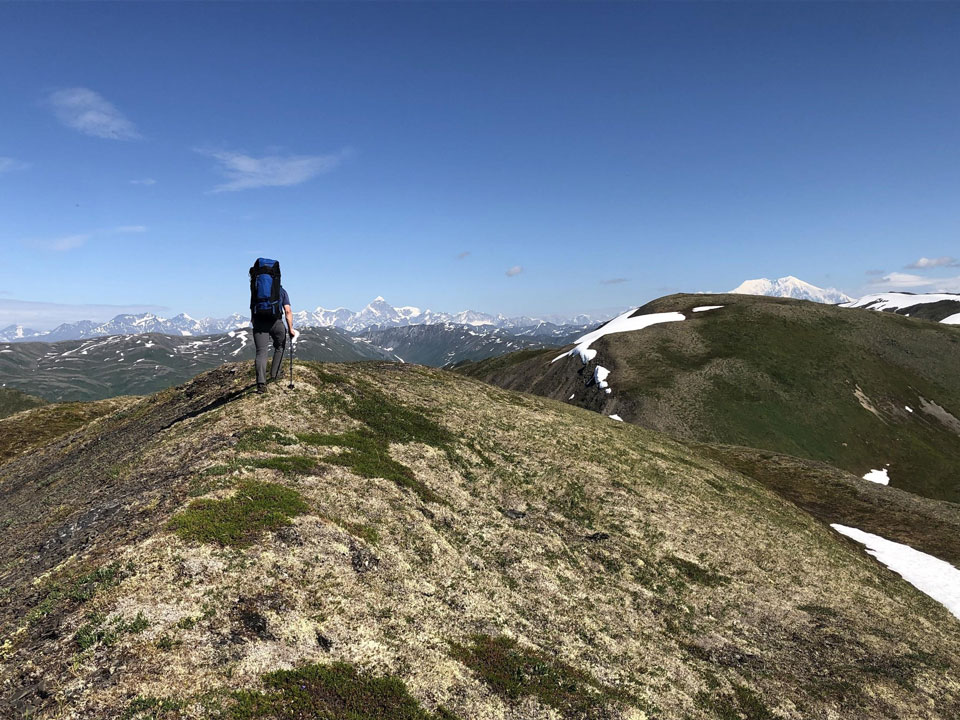
Miles of good tundra walking and amazing views on the Kilskon Ridge.
NPS Photo: Chris Erickson
We knew we would have to leave the ridge at some point, and fearing the worst in terms of bushwacking, we took our time to scout a route from our view as well as using satellite imagery that we had loaded on our phones prior to the trip. We found a nice descent into the California Creek drainage, and walked moose/human trails for a little bit to get to Sunflower Creek. Again, we found camping on a gravel bar at the confluence of Sunflower and California Creeks, where we could blow up packrafts in the morning to start our day on the water. Sunflower Creek is cold and clear, but jumping in was mandatory after +/- 3500’ elevation over 12 miles on the hot day we had along the shade-free ridge.
Sunflower Creek had plenty of water to float, and easy paddling led to a bend where we discovered that Sunflower Creek has one rapid in a small canyon. As we continued downstream, we chatted about the options for getting from Sunflower Creek to the airstrip at Chelatna Lake. Will there be a trail of any sort? Will we be wading through swamps, or bushwacking? Which would be worse- the swamps or the bushwacking if there isn’t a trail? We are both optimists, however, and manifested an ATV trail at what we thought was the logical spot for one if someone was to walk to Chelatna. The trail didn’t exactly go where we needed to go, and we ended up walking through swamps and bushwacking before arriving at the airstrip on Chelatna Lake. The lake was full, and the water looked inviting enough that I swam with all my clothes on.
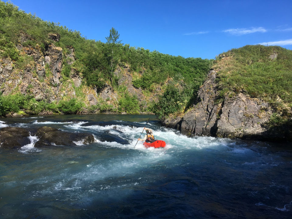
The only rapid on Sunflower Creek.
NPS Photo: Frank Preston
This trip had a little bit of everything we were looking for. It is an area that we don’t often have rangers on the ground, so we were able to gain some insight on how much use the area gets, and how impacted some of the areas are. We saw no evidence of climbing teams in the Kichatnas, and saw little in the way of recent activity in the areas that have hunting potential. The Yentna River was reported as being in “flood stage”, but this reach was easy to navigate and had no wood hazard when we floated it. There is no evidence of a trail across the Midway Lakes area, and no sign of human activity within the Park boundary on the western side of the Kliskon Ridge.
The route is amazing in many ways, and I am glad that we completed the trip. We covered somewhere between 60-65 miles from the Kichatnas to Chelatna Lake, with about half being on foot and half being on non-whitewater rivers. We took 5 days, with most of those days being full days on the move. We found some good routes through sections that could have made for slow bushwacking, and with some minor route-finding changes, some sections could have been much slower and more challenging. Potentially, there is a better route through the Midway Lakes area, but I would count on that area being a slow and frustrating move. It is hard to imagine either fork of the Yentna River being too low to make steady and easy progress, but if Sunflower Creek were too low to float it would make for an extremely long walk down a willow-filled valley. This route, unlike traversing out of the Pika or the Ruth, does not have a logical roadside ending point, so it necessitates a flight in to the range and a flight out from Chelatna Lake or somewhere down Lake Creek.
