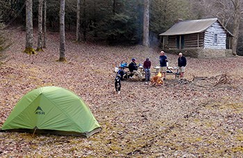
Adventure in the Backcountry

tent and hikers

Photo by park volunteer Jesse Henderson

With numerous camping areas, miles and miles of trail, and less visitation, the backcountry at Cumberland Gap National Historical Park provides an amazing opportunity to experience the great outdoors! Trips in the backcountry range from day hikes to multiple day adventures requiring appropriate gear and preparation. The 21 mile Ridge trail runs the length of the park and can be accessed from numerous trails with major trailheads. Hiking along the ridge can be an extremely rewarding experience with spectacular scenery, wildlife viewing opportunities, and travel through time when visiting the many historic sites in the park.

 
Hiking and Backcountry Camping map only440
Click on image for full size pdf file
 

Plan Your Backcountry Adventure!
Camping is allowed in designated backcountry camping areas. A backcountry permit is required and can be obtained, free of charge, at the park visitor center. Permits must be picked up in person and include the following information: trip itinerary, number in party, name and address, vehicle information and emergency contact information.

Designated Backcountry Campsites:

Gibson Gap, total capacity of 12 campers
GPS Coordinates: (Lat: 36.637601, Long: -83.603992)

Hensley Camp, total capacity of 20 campers
GPS Coordinates: (Lat: 36.669511, Long: -83.519581)

Chadwell Gap, total capacity of 12 campers
GPS Coordinates: (Lat: 36.668761, Long: -83.516715)

Martins Fork, total capacity of 25 campers
GPS Coordinates: (Lat: 36.671363, Long: 83.513477)

White Rocks, total capacity of 12 campers
GPS Coordinates: (Lat: 36.668766, Long: -83.447508)

For reservations and more information please call
(606) 248-2817, extension 1075.

Last updated: October 24, 2018

Park footer

Contact Info

Mailing Address:

91 Bartlett Park Road
Middlesboro, KY 40965

Phone:

606 248-2817

Contact Us