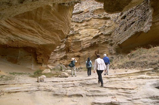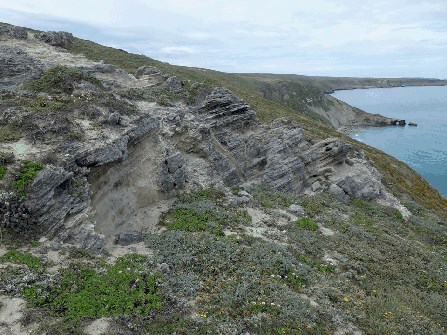
The story of the rocks that make up the islands goes back well over 100 million years and is a history of the changes wrought by plate tectonics in southern California. Up to about 30 million years ago, the western edge of North America was a place where two large plates of the Earth's crust converged. As the oceanic Farallon plate approached the continental North American plate from the west, it descended into a deep trench and was destroyed by melting in the mantle (subduction). Landward of the trench, a marine basin was formed and for many millions of years the sediments that washed off the land into this basin collected and solidified to become some of the 'basement' rocks that we see on the islands today. All of this changed about 30 million years ago when the Farallon plate ran out of material in southern California. The plate behind it - the Pacific plate - began to slide past the continent. Between 27 and 18 million years ago, the Pacific plate made contact with North America and continental pieces began to break off and join the Pacific plate, gradually establishing the modern San Andreas plate boundary where, in southern California, the two plates are sliding by each other, moving laterally in opposite directions along the San Andreas fault. Between 18 to 5 million years ago, compressive forces ceased, to be replaced by a slight extensional regime (transtension). The orientation of the islands and their uplift in the last five million years are directly attributable to the plate tectonic forces caused by the Pacific plate's arrival at the edge of the North American continent.
The Islands as Part of the Transverse Ranges East of the rotating block, a gap opened, creating the space now partially occupied by the Los Angeles basin. The space was filled from below by igneous rocks and the uplift and unroofing of mid-crustal metamorphic rocks like the Catalina schist. Submarine Volcanism Pillow lava, a type of lava found in some of the rocks, is evidence that much of the volcanic action took place underwater. In other places, oyster shells and other marine fossils are found embedded in the lava. At times, the outpouring of the lava was so great that the volcanic piles reached above sea level and formed volcanic islands, some of which were 5000 feet high. Evidence for this is the presence of volcanic 'bombs', where pieces of lava were thrown into the air and twisted into shapes of footballs as they fell back to the surface. Volcanic bombs have been found in the Conejo Volcanics and in the Santa Rosa Island Volcanics. These islands were probably short lived and were eroded to below sea level after volcanic action ceased. 
Randall Schumann, USGS Sedimentary Rocks Not all the sedimentary rocks were deposited below the surface of the ocean, however. As the last piece of the Farallon plate was subducted beneath the continent, the East Pacific Rise - an under-sea mountain range that separated the Farallon plate from the Pacific plate - came into contact with the North American plate. This probably led to an uplift of the area and the deposit of sediment in an alluvial plane, much like the present alluvial plain of the Santa Clara river in the Oxnard-Ventura area. The pink-colored rocks of the Sespe Formation were deposited about 30 million years ago in this uplifted area. Iron-rich minerals in terrestrial environments commonly are oxidized, giving them red, orange and yellow colors. This period of uplift was short lived, however, because the later sediments, which date between 25 and 5 million years ago, were deposited first in shallow marine environments, then in progressively deeper marine settings. Analysis of some of the sedimentary rocks provide additional evidence that the islands have rotated 100 degrees clockwise from their original position adjacent to the coast. On San Miguel Island, rocks dating 50-30 million years ago contain well-rounded pieces of rhyolite that are chemically identical to the rhyolite found in similar age deposits in San Diego county. The inference is that these pieces of rhyolite reached the islands in a submarine fan deposit when the islands were positioned off the coast of San Diego. Analysis of the direction of the currents flowing at that time shows that they came from a southerly direction. However, the only possible source of these sediments is from the mainland, which lies to the east of the islands, giving geologists one more reason to believe that the islands have rotated 90-100 degrees in the last 20 million years. Uplift of the Islands--Folding and Faulting One Large Island During the Ice Ages; Mammal Fossils and Marine Terraces Because of the continuing uplift of the islands during the last million years and the fluctuating sea level caused by glacial advances and retreats, there is evidence on the islands of ancient shorelines at different elevations. The rise in sea level over the last 10,000 years has caused many of the ancient shorelines to be lost below sea level, but others remain. These ancient shorelines form flat areas of land, called marine terraces. Marine terraces are found at many different elevations, from 20 feet above sea level to as much as 1000 feet above, giving graphic evidence of how the islands have changed in their configuration over time. Erosion The good news is that the islands have recovered their vegetation where the animals have been removed. On San Miguel Island, which has been sheep free for over forty years, vegetation has spread from the steep canyons, where it was able to survive during the grazing years, and has now recovered nearly the entire island, restoring the island's natural beauty. More recently, sheep and pigs have been removed from Santa Cruz Island, so we can look forward to a similar reversal of the extensive erosion that is currently in evidence on hillsides there. Caliche Caliche Casts: Caliche is calcium-carbonate cemented soil that is formed in semi-arid climates. Calcium carbonate is derived by the dissolution of shells and shell fragments that have blown across the island from the beaches, especially during the Ice Age when the sea level was much lower and the beaches were more extensive. Rain is a weak acid, formed by reactions between water vapor and carbon dioxide in the atmosphere, and it is this acid that dissolves the shell fragments. San Miguel has a semi-arid climate; so when it rains, the volume of water is too small to carry dissolved materials away from the area, and they remain in the topsoil. This groundwater dissolves the calcium carbonate from shells in the surface layer and re-precipitates it a little lower in the surface profile, where it will act as a cement, binding the soil material into a hard substance that is called 'caliche', or 'calcrete', or 'hardpan'. On San Miguel Island, the deep root system of trees that grew several hundreds of years ago decomposed, and the molds of the roots filled with the abundant sand that makes up much of the topsoil of the island. The calcium carbonate preferentially cemented the sand-filled molds, possibly because they were more porous and provided an easy pathway for the groundwater. Caliche Root Sheats: Another form of caliche is where living vegetation, generally a root in the soil, gets a 'sheath' of caliche. The living roots may exude a weak acid, or draw soil moisture towards them by capillary action. In either case, a solution of calcium carbonate from the soil is concentrated around the roots which, when precipitated later, forms a sheath of caliche. When the root dies and rots, the sheath will remain, either as a hollow form, or may be filled with sand, which may become a caliche cast, by the method described above. Many such examples of both hollow forms and filled sheaths can be found on San Miguel Island. The caliche 'forest' of San Miguel Island was created when strong winds blew away the uncemented sandy soil surrounding the caliche casts and the root sheaths. The visitor to San Miguel Island is treated to this rare glimpse of a landscape turned inside out -- the roots and lower trunks of these ancient plants now stand as 'forests'. Chert The Geologic Future of the Islands Sea level will rise and fall as ice ages come and go. At some times the islands will again be one, as they were during the last ice age. New marine terraces will be cut into the islands. Acknowledgements and Further Reading CSUN Department of Geological Sciences professors: Peter W. Weigand, A. Eugene Fritsche, and Vicki Pedone read a preliminary text and provided many valuable comments. Additional reading: Howell, D. G. ed., 1976, Aspects of the geologic history of the California Continental Borderland; American Association of Petroleum Geologists, Pacific Section, MP 24, 558 p. Weaver, D. W., Doerner, D. P., and Nolf, B., eds., 1969, Geology of the Northern Channel Islands; American Association of Petroleum Geologists and Society of Economic Paleontologists and Mineralogists, Pacific Sections, Special Publications, 200 p. Geologic maps of Santa Rosa Island and San Miguel Island are published by the Dibblee Geological Foundation and may be purchased at the Santa Barbara Natural History Museum.
Visit our keyboard shortcuts docs for details
Part one of a four part overview of the complex geologic processes that formed the Channel Islands.
Visit our keyboard shortcuts docs for details
Part two of a four part overview of the complex geologic processes that formed the Channel Islands.
Visit our keyboard shortcuts docs for details
Part three of a four part overview of the complex geologic processes that formed the Channel Islands.
Visit our keyboard shortcuts docs for details
Part four of a four part overview of the complex geologic processes that formed the Channel Islands. |
Last updated: June 21, 2016
