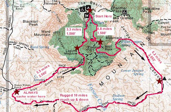


Suggested ItineraryThe following is a brief description of the most common itinerary used by Outer Mountain Loop hikers.

Day OneChisos Basin - Boot Canyon - Juniper Canyon Begin by caching water near the Homer Wilson (Blue Creek) Ranch. This scenic overlook is located at mile 8.1 along the Ross Maxwell Scenic Drive. Hike down the trail and cache your water in the storage box. Ensure your name and date are written on your bottles. Caching water will make the difference between a dangerous experience and a fun backcountry excursion. After caching water, head to the Chisos Basin Trailhead to begin the hike. From the Chisos Basin Trailhead (elevation 5,400'), hike up the Pinnacles Trail 3.5 miles to Toll Mountain Pass (elevation 7,000'), then follow the Boot Canyon Trail. After one mile you will pass Boot Spring (usually dry). Along the canyon bottom you may see stagnant pools of water left by any recent rains. In another 0.3 miles you willl arrive at the junction of the Boot Canyon and Juniper Canyon trails. Follow the Juniper Canyon Trail where you will soon leave the shade and descend steeply (3,000') for 6.2 miles to the desert below. After 2.6 miles you will arrive at Upper Juniper Spring (usually dry). Past the spring the trail drops into desert grasslands of lower Juniper Canyon where there are many nice places to camp. 
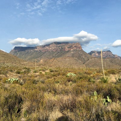
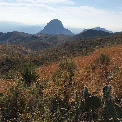
Day TwoJuniper Canyon - Dodson Trail - Blue Creek Canyon The Dodson Trail is the hottest and most exposed section of the loop. While hiking the Dodson Trail it is important to keep an eye out for the rock cairns that mark the route. Most people who have trouble on the Outer Mountain Loop run into problems on this section due to lack of shade, and the climbing and descending from drainage to drainage. You will be climbing (and descending) ~2,000' along the way. Follow the trail from the Juniper Canyon trailhead through Juniper Draw. After 3.6 miles you will reach the ruins of the Dodson Ranch and nearby Dodson Spring (usually dry). One mile further the trail crosses the Fresno Creek drainage. Any water collected should be treated before drinking. Please do not contaminate this water source as it is vital to wildlife in the desert. In another 0.5 mile is the junction of the Dodson and Elephant Tusk trails. If you have the time a 1-mile side excursion here leads into the Fresno Drainage below Tortuga Mountain (another potential ephemeral water source). From the Elephant Tusk junction the Dodson Trail climbs another 1.5 miles to a high pass then descends into the Smoky Creek Drainage. Look carefully for rock cairns that mark the trail through Smoky Creek. Be sure to watch for the junction where the trail leaves the wash or you may find yourself hiking down the Smoky Creek Trail. Three miles further is the remnants of the Homer Wilson (Blue Creek) Ranch. The Ross Maxwell Scenic Drive is only 0.25 mile away from this point. After collecting your cached water and rehydrating, continue up Blue Creek Canyon for at least 0.5 mile and begin searching for a campsite (remember, you must be at least 0.5 mile from the road, and out of sight of the road). 
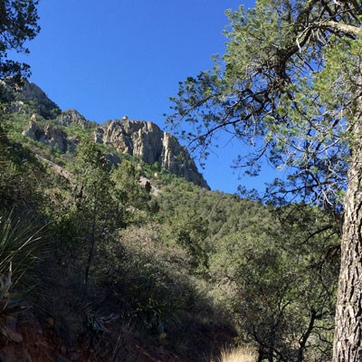
Day ThreeBlue Creek Canyon - Laguna Meadows - Chisos Basin The last day of your trek begins with the steep ascent up Blue Creek Canyon. The Blue Creek Trail climbs steadily 2,500' for 5.5 miles into the High Chisos woodlands. The beginning of the trail passes in and out of several sandy washes so watch for rock cairns marking the way. After two miles you will enter an area of eroded red rocks followed by a small pinyon-oak woodland. Three miles past the red rocks, you will pass both Blue Creek designated backpack sites, and immediately after, the Laguna Meadow Trail and flat ground. Some Outer Mountain Loop hikers choose to stay in one of the High Chisos Backpacking sites on their last night, before returning to the Chisos Basin. Those sites can be reserved in advance through www.recreation.gov The Laguna Meadow Trail winds around the western flanks of Emory Peak. After one mile you will arrive at the Laguna Meadow Trail summit. The Chisos Basin will lies below and the rooftops of the Chisos Mountains Lodge will be visible. The remaining 3.5 miles of the hike is a gradual descent to the Chisos Basin. 
|
Last updated: August 9, 2021
