
The Chihuahuan Desert covers about 80% of the park and surrounds the Chisos Mountains. Bare, rocky ground and sparse vegetation are hallmarks of the desert, but there is plenty of life here. Look for termite nests along plant stems, exoskeletons of millipedes, animal scat, and rodent and reptile tunnels. Bird life is plentiful, especially in the morning; look for nests hidden in yuccas and cacti. In the spring, bluebonnets, paintbrush, bi-color mustard, desert marigold, yucca, ocotillo, and cacti blossoms add color to the desert landscape.
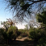
Chihuahuan Desert Nature TrailDifficulty: Easy; Distance: 0.5 mile round trip 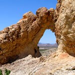
Chimneys TrailDifficulty: Moderate; Distance: 4.8 miles round trip A moderate hike (due to distance) to a series of prominent volcanic dike formations. The "chimneys" have always been an important landmark, and Indian rock art marks the base of these high pinnacles. The chimneys are 2.4 miles away and easily seen from the trailhead. The trail beyond the chimneys continues west another 4.6 miles and ends on the Old Maverick Road near Luna's jacal. This is an enjoyable 7-mile hike if you can arrange transportation on the opposite end. 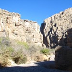
Dog CanyonDifficulty: Moderate; Distance: 4 miles round trip Dog Canyon is a pleasant, flat hike in the early morning or late afternoon hours when temperatures are moderate. The destination canyon is visible across the desert flats from the trailhead, and trail is well-marked with obvious cairns. At 1.5 miles the trail drops into a wash, and a left turn down the wash takes you through Dog Canyon about a half mile further. At the far end of the canyon, visitors should note that the horizontal rock strata have been folded vertically by the geological forces that formed the mountain ridge the canyon traverses. The narrow slot canyon to the right (south) of Dog Canyon is the Devil’s Den. A hike along the rim of Devil’s Den offers good views into the slot canyon and expansive panoramas of the surrounding desert, but it is NOT recommended that you attempt a trip through canyon without a companion and proper gear. Check at a Visitor Center for information on this route. 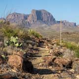
Lone Mountain TrailDifficulty: Easy; Distance: 2.7 Mile Loop 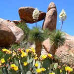
Grapevine Hills TrailDifficulty: Moderate; Distance: 2.2 miles round trip This trail leads to a group of balanced rocks in the heart of the Grapevine Hills. Initially, the trail follows a gravel wash, then climbs steeply for the last quarter mile into the boulders. The last section requires crossing steep, rough bedrock, and negotiating a challenging landscape of boulders. Stay on the trail, and watch carefully for the directional arrows that point the way to the balanced rock. Use extreme caution, especially coming back down. No shade, watch for snakes! 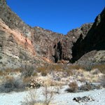
Lower Burro Mesa Pour-off TrailDifficulty: Easy; Distance: 1 mile round trip This trail leads through a gravel drainage, and ends in a narrow box canyon where water has carved a deep channel into Burro Mesa. The end of the trail is the base of a 100-foot pour-off. Usually dry, the smooth, polished pour-off attests to the power of water that floods this canyon during summer rains. 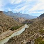
Marufo VegaDIfficulty: Strenuous; Distance: 12 mile round trip 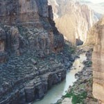
Mariscal Canyon Rim TrailDIfficulty: Strenuous; Distance: 6.5 miles round trip 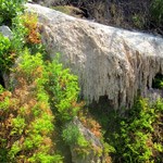
Mule Ears Spring TrailDifficulty: Moderate; Distance: 3.8 miles round trip This hike leads through the foothills of the Chisos Mountains, skirts Trap Mountain, and crosses several arroyos. Near the spring is an old rock corral. The spring itself is overgrown with shrubs, but ferns and cattails also grow there. Remember, no contaminating/bathing in backcountry springs. 
Panther PathDifficulty: Easy; Distance: 50 yard loop 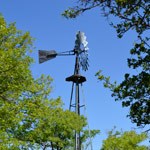
Sam Nail RanchDifficulty: Easy; Distance: 0.5 mile loop An easy, well-maintained trail leads through the old homestead of Jim and Sam Nail and Sam's wife, Nena. There are interesting historic remnants here, including part of the adobe walls of the house and two windmills, one which is still in operation. This is a beautiful desert oasis and a great spot for birding and wildlife viewing. 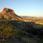
Tuff CanyonDifficulty: Easy; Distance: 0..5 mile round trip to 3 viewing platforms. Tuff Canyon's provides a glimpse into the violent volcanic past of Big Bend. Three viewing platforms offer great views into a spectacular canyon carved out of welded volcanic ash (tuff). 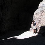
Upper Burro Mesa TrailDifficulty: Moderate; Distance: 3.8 miles round trip This route follows a dry wash downstream to the top of the 100-foot Burro Mesa Pour-off. The trail includes some large rocks to climb down, where some rock scrambling may be necessary. Total elevation change is 500 feet/150 meters. Pay attention on the return hike to ensure that you follow the same drainages. Trail subject to flash flooding. |
Last updated: March 8, 2024
