Part of a series of articles titled Copper River Basin Symposium - Wrangell-St Elias National Park and Preserve.
Article
NPS Geodiversity Atlas—Wrangell-St. Elias National Park, Alaska
Geodiversity refers to the full variety of natural geologic (rocks, minerals, sediments, fossils, landforms, and physical processes) and soil resources and processes that occur in the park. A product of the Geologic Resources Inventory, the NPS Geodiversity Atlas delivers information in support of education, Geoconservation, and integrated management of living (biotic) and non-living (abiotic) components of the ecosystem.

Introduction
Wrangell-St. Elias National Park and Preserve (WRST) is located approximately 275 km (170 mi) east of Anchorage and shares a border with Canada. It is within Yakutat Borough and the Chugach, Copper River, and Southeast Fairbanks Census Areas of the Unorganized Borough in southeastern Alaska. Originally proclaimed as Wrangell-St. Elias National Monument on December 1, 1978, the park and preserve were established on December 2, 1980 (National Park Service 2016). WRST is the largest unit of the National Park Service and encompasses 5,332,053 hectares (13,175,791 acres) of rugged, beautiful landscape at the convergence of the Alaska, Chugach, St. Elias, and Wrangell mountain ranges. The landscape of WRST is decorated with massive peaks, volcanoes, numerous glaciers, huge rivers, and a rich biological community. The rich diversity of natural and cultural resources at WRST has been recognized and designated as an International World Heritage Site in 1979 (National Park Service 2016).
Geologic Setting
Wrangell-St. Elias National Park and Preserve is a geologist’s wonderland, with a diverse landscape that attracts researchers from around the world in the fields of volcanism, glaciation, plate tectonics, geochronology, and Quaternary geology. Situated in one of the most geologically active regions of North America, WRST has experienced volcanic activity, subduction, and uplift resulting in massive mountain ranges. The geology of WRST is composed of a patchwork of accreted terranes (land masses added to a continent through plate tectonics) that have slowly built Alaska through geologic time. Each of these terranes is faultbounded and contains distinct structural, paleontological, and sedimentological features. The park and preserve contains a wide variety of Mesozoic and Cenozoic sedimentary and igneous units, with some of the oldest units represented by late Paleozoic metamorphic complexes.
Geologic Features and Processes
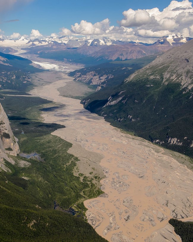
Wrangell-St. Elias National Park and Preserve is the nation’s largest national park unit (13.2 million acres), and designated wilderness (9.6 million acres). The park and preserve extend over a vast region with diverse environments, representing some of the most outstanding examples of Alaskan natural and cultural resources. Extensive high mountain terrain, enormous glaciers and ice-fields, active thermal features, large canyons, extensive wildlife populations, and major historic mining features represent the significance of the park and preserve. Wrangell-St. Elias National Park and Preserve, Kluane National Park in Canada, Glacier Bay National Park and Preserve, and British Columbia’s Tatshenshini-Alsek Park are, together, the world’s largest designated World Heritage Site—an area encompassing 28 million acres.
Geologically, the Wrangell-St. Elias National Preserve is significant because it contains:
-
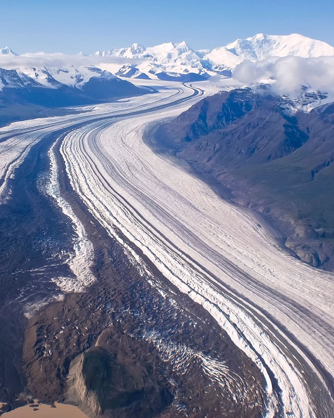
the largest assemblage of glaciers and greatest collection of peaks over 16,000 feet in the National Park System. The Nabesna Glacier is the world’s longest interior valley glacier (over 75 miles long), the Malaspina Glacier is North America's largest piedmont glacier (nearly 40 miles across), and the Hubbard Glacier is the longest tidewater glacier in Alaska (over 76 miles long with an open calving face covering over 6 miles),
-
The Bagley Icefield—the largest, subpolar icefield in North America,
-
Chitistone and Nizina Canyons which display many of the diverse geological features and processes of eastern Alaska in a relatively small area,
-
Wrangell Volcanic Field which contains active Mt. Wrangell, one of the largest andesitic volcanoes in the world,
-
active thermal features such as mud volcanoes and thermal springs, and
-
major historic mining features – Kennecott Copper deposits among others.
- Scoping summaries are records of scoping meetings where NPS staff and local geologists determined the park’s geologic mapping plan and what content should be included in the report.
- Digital geologic maps include files for viewing in GIS software, a guide to using the data, and a document with ancillary map information. Newer products also include data viewable in Google Earth and online map services.
- Reports use the maps to discuss the park’s setting and significance, notable geologic features and processes, geologic resource management issues, and geologic history.
- Posters are a static view of the GIS data in PDF format. Newer posters include aerial imagery or shaded relief and other park information. They are also included with the reports.
- Projects list basic information about the program and all products available for a park.
Source: NPS DataStore Saved Search 3202. To search for additional information, visit the NPS DataStore.
A NPS Soil Resources Inventory project has been completed for Wrangell-St. Elias National Park and can be found on the NPS Data Store.
Source: NPS DataStore Saved Search 3227. To search for additional information, visit the NPS DataStore.

Related Links
Related Articles
Wrangell-St. Elias National Park
National Park Service Geodiversity Atlas
The servicewide Geodiversity Atlas provides information on geoheritage and geodiversity resources and values within the National Park System. This information supports science-based geoconservation and interpretation in the NPS, as well as STEM education in schools, museums, and field camps. The NPS Geologic Resources Division and many parks work with National and International geoconservation communities to ensure that NPS abiotic resources are managed using the highest standards and best practices available.
Last updated: July 18, 2024
