Last updated: July 5, 2024
Article
NPS Geodiversity Atlas—White Sands National Park, New Mexico
Geodiversity refers to the full variety of natural geologic (rocks, minerals, sediments, fossils, landforms, and physical processes) and soil resources and processes that occur in the park. A product of the Geologic Resources Inventory, the NPS Geodiversity Atlas delivers information in support of education, Geoconservation, and integrated management of living (biotic) and non-living (abiotic) components of the ecosystem.

Introduction
White Sands National Park (WHSA) is located in Dona Ana and Otero Counties, New Mexico. The park was originally established as a national monument on January 18, 1933 and was upgraded to national park status on December 20, 2019. White Sands National Park encompasses 58,987.8 hectares (145,762 acres) and preserves a significant portion of the world’s largest gypsum dune field, hosting about 200 km2 (115 mi2 ) of the entire field. The glistening white dunes can reach 18 m (60 ft) tall and have been sculpted by eolian (wind-related) processes. The White Sands dune field is situated within the Tularosa Basin between the San Andres and Sacramento Mountains. Major geomorphic features of the region include extensive floors of intermontane basins, contiguous piedmont slopes (or bajada), and upland areas including mountain ranges (e.g., San Andes and Sacramento) and high plateaus bounded by steep escarpments (KellerLynn 2012).
Geologic Features and Processes
The White Sands dune field, including portions in both the missile range and national park, is situated within the Tularosa Basin between the San Andres and Sacramento mountains. Major geomorphic features of the area include extensive floors of intermontane basins, such as the Tularosa Basin; contiguous piedmont slopes, or bajada; and upland areas, including mountain ranges (e.g., San Andes and Sacramento) and high plateaus, with steep bounding escarpments. Present-day basin floors are characterized by discontinuous ephemeral drainageways, widespread eolian deposits, and numerous closed depressions with ephemeral lakes called “playas.” In the recent geologic past, however, basins were occupied by extensive perennial lakes and/or large fluvial systems (Hawley 1993).
The Tularosa Basin is a “closed basin,” without an outlet for surface drainage. Some groundwater discharges into the Hueco Basin to the south. Rates of groundwater discharge are slow enough that the water table is near the surface (McLean 1975; Basabilvazo et al. 1994). Structurally, the Tularosa Basin is part of the Rio Grande rift, which is “the single most striking topographic feature of New Mexico” (Price 2010, p. 13). This deepseated tear in Earth’s surface stretches for more than 1,000 km (620 mi), from Colorado to Chihuahua, Mexico, intersecting New Mexico and Texas along its length. The Rio Grande rift represents an ongoing episode of east–west crustal extension that began about 40 million years ago (Price 2010).
The Tularosa Basin is one of nine basins along the Rio Grande rift. In general, each basin is made up of half grabens (down-dropped blocks) that formed as a result of the pulling apart of Earth’s crust. Crustal movement along the rift exposed Precambrian (4.6 billion–542 million years ago) and Paleozoic (542 million–251 million years ago) rocks on the edge of the Tularosa Basin in the uplifted Sacramento Mountains to the east and the San Andres Mountains to the west. These same rock units underlie the basin. When crustal movement exposed the strata along the graben perimeter, meteoric waters (derived from precipitation) began dissolving the soluble evaporite rocks, such as gypsum, and transporting the solutes (dissolved material) into the basin (Allmendinger and Titus 1973).
During wetter conditions of the Pleistocene Epoch (2.6 million–11,700 years ago), the Tularosa Basin was the site of a sequence of large pluvial lakes, the most recent known as Lake Otero. Infilling of the Lake Otero basin left sediments, including laminated clays and silts, gypsum-rich marls, limestone, and massive silts containing large gypsum crystals. Progressive changes in climate to present-day arid conditions caused pluvial lake waters to recede and lake beds to dry, making sandsize sediment available for eolian transport into the dune system.
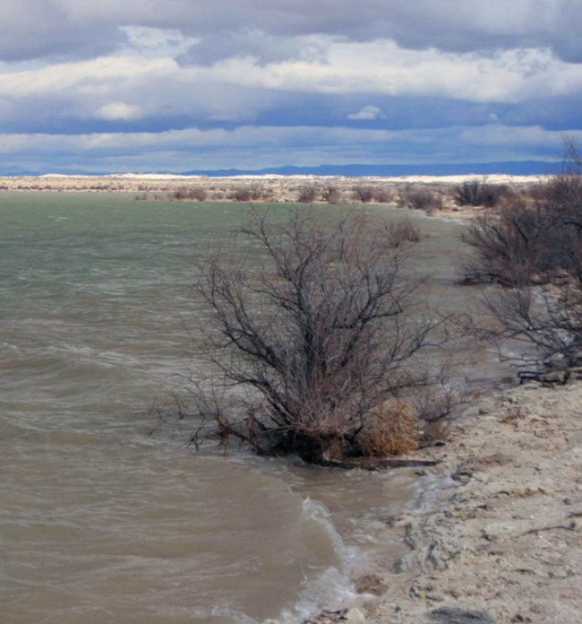
Today, these sediments are exposed in gullies and incised by at least 20 playas (Langford 2003). The largest of the playas, Lake Lucero, consists of three sub-basins in the southern part of White Sands National Park. Gypsum exposed in Lake Otero sediments provides the main source of sand for the White Sands dune field (Fryberger 2001a). Sand-sized grains from evaporite material along the shores of modern Lake Lucero are a secondary source; finer grained material is transported beyond the dune-field system (Fryberger 2001a).
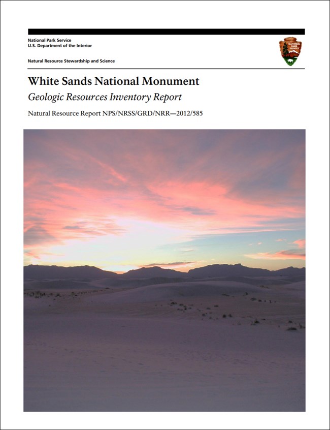
Geologic Resources Inventory Report
For more information on the geologic features and processes of White Sands, as well as an overview of the geologic history of the region, see the park's Geologic Resources Inventory Report. Topics in the report include:
Geologic Resources
-
Active Holocene Lake Basin
-
Scour Platform
-
Barchanoid Dune Field
-
Marginal Parabolic Dunes
-
Interdunes
-
Miscellaneous Geomorphic Features
-
Alluvial Deposits
-
Source of Gypsum Sand
-
White Sands as an Analogue for Mars
-
Biological Soil Crusts
-
Geothermal Features and Processes
Geologic History
-
Precambrian Time: Ancient Mountain or Rift System
-
Ordovician and Cambrian Periods: Advancing Seas
-
Silurian and Ordovician Periods: Marine Waters
-
Mississippian and Devonian Periods: Changing Marine Conditions
-
Pennsylvanian Period: Pangaea and the Ancestral Rocky Mountains
-
Permian Period: Marine and Marginal Marine Sediments
-
Rocks from the Triassic and Jurassic Periods (or the lack thereof)
-
Time and Cretaceous Period: Interior Seaway and Rise of the Rocky Mountains
-
Oligocene Epoch: Basin Filling, Volcanism, and Crustal Extension
-
Pleistocene and Pliocene Epochs: Rio Grande and the Rio Grande Rift
-
Pleistocene Epoch: Basin Fill and Pluvial Lake Otero
-
Holocene Epoch: Playa and Dune Formation
Paleontological Resources
All NPS fossil resources are protected under the Paleontological Resources Preservation Act of 2009 (Public Law 111-11, Title VI, Subtitle D; 16 U.S.C. §§ 470aaa - 470aaa-11).
Regional Geology
White Sands is a part of the Basin and Range Physiographic Province and shares its geologic history and some characteristic geologic formations with a region that extends well beyond park boundaries.
Maps and Reports
- Scoping summaries are records of scoping meetings where NPS staff and local geologists determined the park’s geologic mapping plan and what content should be included in the report.
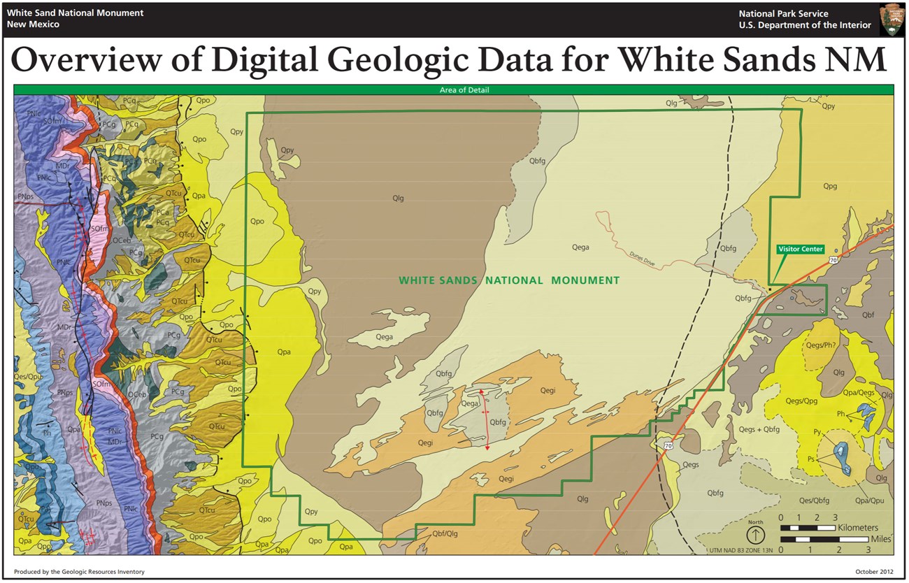
- Digital geologic maps include files for viewing in GIS software, a guide to using the data, and a document with ancillary map information. Newer products also include data viewable in Google Earth and online map services.
- Reports use the maps to discuss the park’s setting and significance, notable geologic features and processes, geologic resource management issues, and geologic history.
- Posters are a static view of the GIS data in PDF format. Newer posters include aerial imagery or shaded relief and other park information. They are also included with the reports.
- Projects list basic information about the program and all products available for a park.
Source: NPS DataStore Saved Search 3197. To search for additional information, visit the NPS DataStore.
A NPS Soil Resources Inventory project has been started for White Sands National Monument and can be found on the NPS Data Store.
Source: NPS DataStore Saved Search 3222. To search for additional information, visit the NPS DataStore.

Related Links
Related Articles
White Sands National Park
National Park Service Geodiversity Atlas
The servicewide Geodiversity Atlas provides information on geoheritage and geodiversity resources and values within the National Park System. This information supports science-based geoconservation and interpretation in the NPS, as well as STEM education in schools, museums, and field camps. The NPS Geologic Resources Division and many parks work with National and International geoconservation communities to ensure that NPS abiotic resources are managed using the highest standards and best practices available.

