Last updated: July 17, 2024
Article
NPS Geodiversity Atlas—Theodore Roosevelt National Park, North Dakota
Geodiversity refers to the full variety of natural geologic (rocks, minerals, sediments, fossils, landforms, and physical processes) and soil resources and processes that occur in the park. A product of the Geologic Resources Inventory, the NPS Geodiversity Atlas delivers information in support of education, Geoconservation, and integrated management of living (biotic) and non-living (abiotic) components of the ecosystem.

Introduction
Theodore Roosevelt National Park (THRO) consists of three separate park units—the North, South, and Elkhorn Ranch Units—situated along the Little Missouri River in Billings and McKenzie Counties, western North Dakota. Originally established as Theodore Roosevelt National Memorial Park on April 25, 1947, the park unit was redesignated as a national park on November 10, 1978 (National Park Service 2016a). THRO contains approximately 28,508 hectares (70,447 acres) and features scenic badlands and part of President Theodore Roosevelt’s Elkhorn Ranch. THRO is named in commemoration of Roosevelt for his significant contributions to the conservation of America’s natural resources, including the establishment of the U.S. Forest Service, five national parks, 18 national monuments, 150 national forests, and numerous wildlife preserves (Brinkley 2009). The North Dakota Badlands of THRO form a rugged, colorful landscape that inspired Roosevelt to adopt a conservation ethic and continues to inspire visitors today (National Park Service 2014b).
Geologic Setting
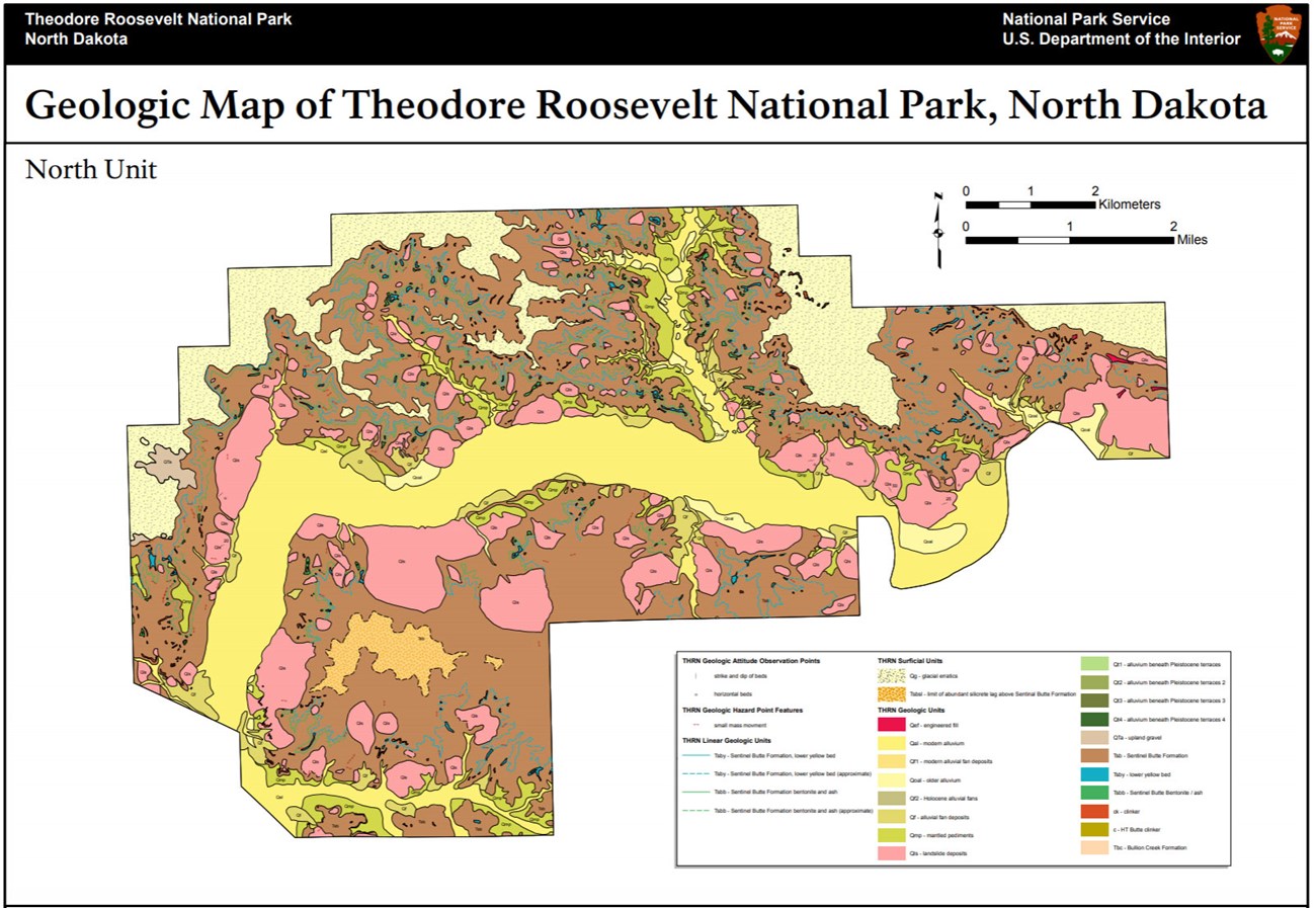
Theodore Roosevelt National Park is situated in the Great Plains physiographic province along the boundary separating the glaciated and unglaciated regions of the Missouri Plateau. The bedrock underlying THRO consists of Paleocene rocks. The Paleocene Bullion Creek Formation and Sentinel Butte Formation are well-exposed in the scenic badlands. The Bullion Creek Formation is comprised of yellowish-brown sedimentary deposits of sandstone, siltstone, and mudstone that occur in the Elkhorn and South Units. The overlying Sentinel Butte Formation is widely distributed across the North and South Units of THRO and consists of grayish-brown sedimentary deposits, tuffs, and bentonite beds (Biek and Gonzalez 2001). A variety of Quaternary surficial deposits are mapped throughout THRO, including upland gravel deposits, mantled pediment deposits, landslide debris, alluvial sediments, and alluvium.
Paleontological Resources
All NPS fossil resources are protected under the Paleontological Resources Preservation Act of 2009 (Public Law 111-11, Title VI, Subtitle D; 16 U.S.C. §§ 470aaa - 470aaa-11).
Abandoned Mineral Lands
NPS AML sites can be important cultural resources and habitat, but many pose risks to park visitors and wildlife, and degrade water quality, park landscapes, and physical and biological resources. Be safe near AML sites—Stay Out and Stay Alive!
Regional Geology
Theodore Roosevelt National Park is a part of the Great Plains Physiographic Province and shares its geologic history and some characteristic geologic formations with a region that extends well beyond park boundaries.
- Scoping summaries are records of scoping meetings where NPS staff and local geologists determined the park’s geologic mapping plan and what content should be included in the report.
- Digital geologic maps include files for viewing in GIS software, a guide to using the data, and a document with ancillary map information. Newer products also include data viewable in Google Earth and online map services.
- Reports use the maps to discuss the park’s setting and significance, notable geologic features and processes, geologic resource management issues, and geologic history.
- Posters are a static view of the GIS data in PDF format. Newer posters include aerial imagery or shaded relief and other park information. They are also included with the reports.
- Projects list basic information about the program and all products available for a park.
Source: NPS DataStore Saved Search 3179. To search for additional information, visit the NPS DataStore.
A NPS Soil Resources Inventory project has been completed for Theodore Roosevelt National Park and can be found on the NPS Data Store.
Source: NPS DataStore Saved Search 3130. To search for additional information, visit the NPS DataStore.

Related Links
Related Articles
Theodore Roosevelt National Park
National Park Service Geodiversity Atlas
The servicewide Geodiversity Atlas provides information on geoheritage and geodiversity resources and values within the National Park System. This information supports science-based geoconservation and interpretation in the NPS, as well as STEM education in schools, museums, and field camps. The NPS Geologic Resources Division and many parks work with National and International geoconservation communities to ensure that NPS abiotic resources are managed using the highest standards and best practices available.

