Last updated: July 16, 2024
Article
NPS Geodiversity Atlas—Sleeping Bear Dunes National Lakeshore, Michigan
Geodiversity refers to the full variety of natural geologic (rocks, minerals, sediments, fossils, landforms, and physical processes) and soil resources and processes that occur in the park. A product of the Geologic Resources Inventory, the NPS Geodiversity Atlas delivers information in support of education, Geoconservation, and integrated management of living (biotic) and non-living (abiotic) components of the ecosystem.

Introduction
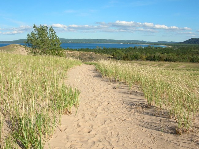
Sleeping Bear Dunes National Lakeshore (SLBE) is located along the northeastern shores of Lake Michigan in Benzie and Leelanau Counties, Michigan. Established on October 21, 1970, SLBE encompasses nearly 28,817 hectares (71,210 acres) that are distributed among four mainland units and the North and South Manitou Islands. The administrative boundaries of the park unit include about 105 km (65 mi) of Lake Michigan shoreline and numerous inland lakes and streams. The designation of SLBE is in recognition of its outstanding natural features, which include rivers, sandy beaches, beech–maple forests, clear lakes, lakeshore bluffs, and the namesake sand dunes that rise 140 m (460 ft) above Lake Michigan (Anderson 2017). The park unit contains a number of features that include an island lighthouse, lifesaving service stations, coastal villages, and agricultural landscapes.
Geologic Setting
The geology of Sleeping Bear Dunes National Lakeshore consists of young Quaternary deposits in a region that has been heavily influenced by Pleistocene glaciation events. Geologic features in SLBE such as Pyramid Point, Sleeping Bear Plateau, and Empire Bluffs are glacial moraines (ridges of unconsolidated glacial deposits left behind when glaciers retreat) that steered more recent glacial ice into Good Harbor and various lakes in the region. Thousands of years of wave action have truncated the moraines so that they now appear as headland bluffs, including the steep sand and gravel faces so prominent at Empire bluffs, Sleeping Bear bluffs, and Pyramid Point. The popular sand dunes of SLBE are perched atop the topographically elevated glacial moraines and were formed as the moraine deposits were reworked by wind and water. As the moraines eroded, lighter sand-sized material was carried higher upward on top of the moraines while heavier stones fell downward into the beach. Over long periods of time this natural sifting process would help form the famous dunes of SLBE.
Regional Geology
Sleeping Bear Dunes National Lakeshore is a part of the Central Lowland Physiographic Province and shares its geologic history and some characteristic geologic formations with a region that extends well beyond park boundaries.
- Scoping summaries are records of scoping meetings where NPS staff and local geologists determined the park’s geologic mapping plan and what content should be included in the report.
- Digital geologic maps include files for viewing in GIS software, a guide to using the data, and a document with ancillary map information. Newer products also include data viewable in Google Earth and online map services.
- Reports use the maps to discuss the park’s setting and significance, notable geologic features and processes, geologic resource management issues, and geologic history.
- Posters are a static view of the GIS data in PDF format. Newer posters include aerial imagery or shaded relief and other park information. They are also included with the reports.
- Projects list basic information about the program and all products available for a park.
Source: NPS DataStore Saved Search 3175. To search for additional information, visit the NPS DataStore.
A NPS Soil Resources Inventory project has been completed for Sleeping Bear Dunes National Lakeshore and can be found on the NPS Data Store.
Source: NPS DataStore Saved Search 3126. To search for additional information, visit the NPS DataStore.

Related Links
Related Articles
Sleeping Bear Dunes National Lakeshore
National Park Service Geodiversity Atlas
The servicewide Geodiversity Atlas provides information on geoheritage and geodiversity resources and values within the National Park System. This information supports science-based geoconservation and interpretation in the NPS, as well as STEM education in schools, museums, and field camps. The NPS Geologic Resources Division and many parks work with National and International geoconservation communities to ensure that NPS abiotic resources are managed using the highest standards and best practices available.
