Last updated: July 15, 2024
Article
NPS Geodiversity Atlas—Petrified Forest National Park, Arizona
Geodiversity refers to the full variety of natural geologic (rocks, minerals, sediments, fossils, landforms, and physical processes) and soil resources and processes that occur in the park. A product of the Geologic Resources Inventory, the NPS Geodiversity Atlas delivers information in support of education, Geoconservation, and integrated management of living (biotic) and non-living (abiotic) components of the ecosystem.

Introduction
Petrified Forest National Park is located about 160 km (100 mi) east of Flagstaff in Apache and Navajo Counties, Arizona. Originally established as a national monument on December 8, 1906, Petrified Forest was redesignated a national park on December 9, 1962 . Petrified Forest encompasses approximately 89,603 hectares (221,416 acres) and protects globally significant fossils, including petrified wood and one of the most comprehensive records of Late Triassic vertebrate evolution in North America. The national park contains one of the largest and most colorful concentrations of mineralized fossil wood in the world, including petrified logs of ancient conifer species that are more than 58 m (190 ft) long.
Geologic Setting
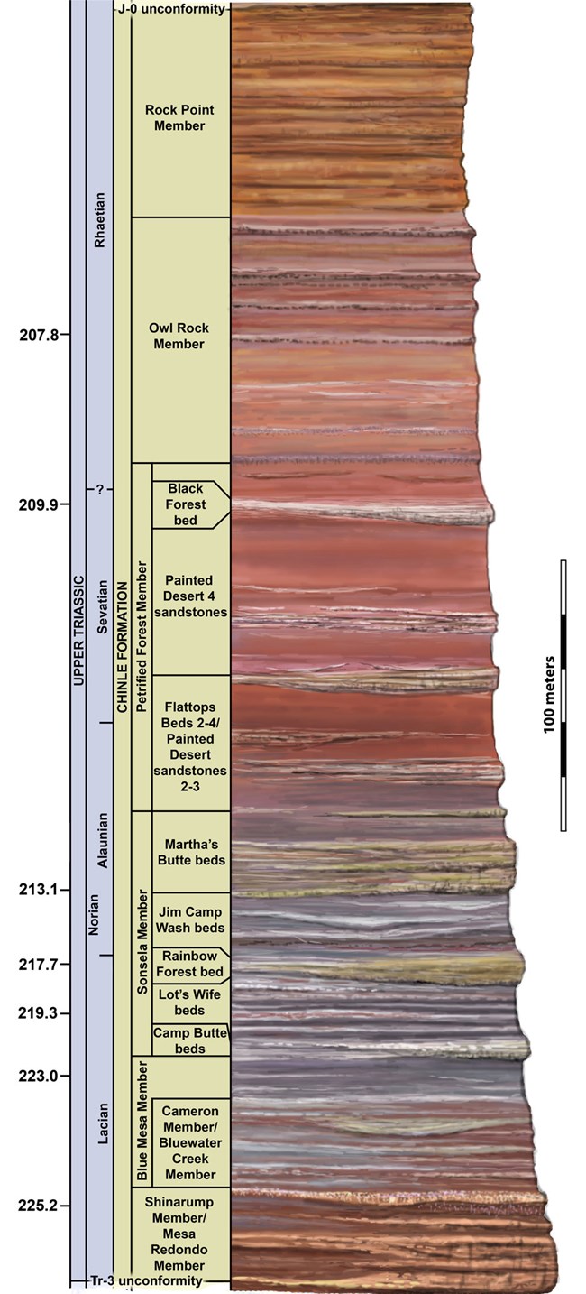
The geology of Petrified Forest National Park primarily consists of the Late Triassic Chinle Formation (and associated members) and the Miocene–Pliocene Bidahochi Formation. Paleontological resources of the Chinle Formation and Bidahochi Formation have yielded more than 700 paleontological sites in the park, making Petrified Forest a world-renowned natural laboratory for paleontology. The park’s petrified wood and other Upper Triassic fossils are considered globally significant because they document a diverse suite of terrestrial ecosystems during “the dawn of dinosaurs” between 223–208 million years ago (KellerLynn 2010; Ramezani et al. 2011). Multi-hued badland hills, flat-topped mesas, and buttes of the Painted Desert are primarily composed of sandstones, conglomerates, and mudstones of the Chinle Formation that record fluvial deposition in an ancient river basin. The stratigraphic nomenclature of the Chinle Formation in Petrified Forest has undergone a number of revisions since the early 1990s. The accepted terminology for the members of the Chinle Formation found at Petrified Forest are as follows, from oldest to youngest: the Mesa Redondo Member, Blue Mesa Member, Sonsela Member, Petrified Forest Member, and Owl Rock Member (Figure 105; Martz et al. 2012). The contact between the Chinle Formation and Bidahochi Formation is an unconformity that represents a gap in the rock record of ~190 million years.
Paleontological Resources
The excellent exposures and accessibility of the Upper Triassic Chinle Formation make Petrified Forest National Park a world-renowned natural laboratory for paleontology and other geologic disciplines such as sedimentology, stratigraphy, geomorphology, and structural geology. Petrified Forest National Park contains one of the largest and most colorful deposits of mineralized wood in the world.
The park’s forests of petrified wood and other Upper Triassic fossil flora and fauna are globally significant because they provide a distinct record of diverse terrestrial ecosystems during “the dawn of dinosaurs” about 220 million years ago. This period tracks the evolutionary transition of nonmarine animals, especially tetrapods. Scientists now recognize Petrified Forest National Park as one of the best places in the world to study these changes in the geologic record.
All NPS fossil resources are protected under the Paleontological Resources Preservation Act of 2009 (Public Law 111-11, Title VI, Subtitle D; 16 U.S.C. §§ 470aaa - 470aaa-11).
Regional Geology
Petrified Forest National Park is a part of the Colorado Plateaus Province and shares its geologic history and some characteristic geologic formations with a region that extends well beyond park boundaries.
- Scoping summaries are records of scoping meetings where NPS staff and local geologists determined the park’s geologic mapping plan and what content should be included in the report.
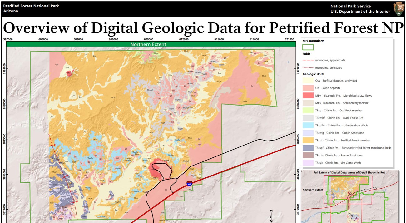
- Digital geologic maps include files for viewing in GIS software, a guide to using the data, and a document with ancillary map information. Newer products also include data viewable in Google Earth and online map services.
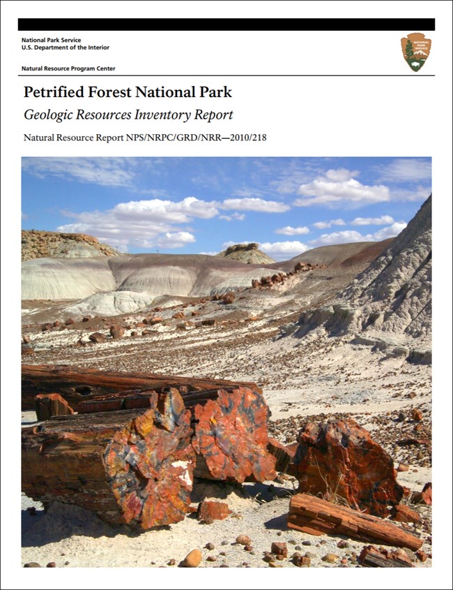
- Reports use the maps to discuss the park’s setting and significance, notable geologic features and processes, geologic resource management issues, and geologic history.
- Posters are a static view of the GIS data in PDF format. Newer posters include aerial imagery or shaded relief and other park information. They are also included with the reports.
- Projects list basic information about the program and all products available for a park.
Source: NPS DataStore Saved Search 3143. To search for additional information, visit the NPS DataStore.
A NPS Soil Resources Inventory project has been completed for Petrified Forest National Park and can be found on the NPS Data Store.
Source: NPS DataStore Saved Search 3094. To search for additional information, visit the NPS DataStore.

Related Links
Related Articles
Petrified Forest National Park
National Park Service Geodiversity Atlas
The servicewide Geodiversity Atlas provides information on geoheritage and geodiversity resources and values within the National Park System. This information supports science-based geoconservation and interpretation in the NPS, as well as STEM education in schools, museums, and field camps. The NPS Geologic Resources Division and many parks work with National and International geoconservation communities to ensure that NPS abiotic resources are managed using the highest standards and best practices available.

