Last updated: July 11, 2024
Article
NPS Geodiversity Atlas—Noatak National Preserve, Alaska
Geodiversity refers to the full variety of natural geologic (rocks, minerals, sediments, fossils, landforms, and physical processes) and soil resources and processes that occur in the park. A product of the Geologic Resources Inventory, the NPS Geodiversity Atlas delivers information in support of education, Geoconservation, and integrated management of living (biotic) and non-living (abiotic) components of the ecosystem.

Introduction
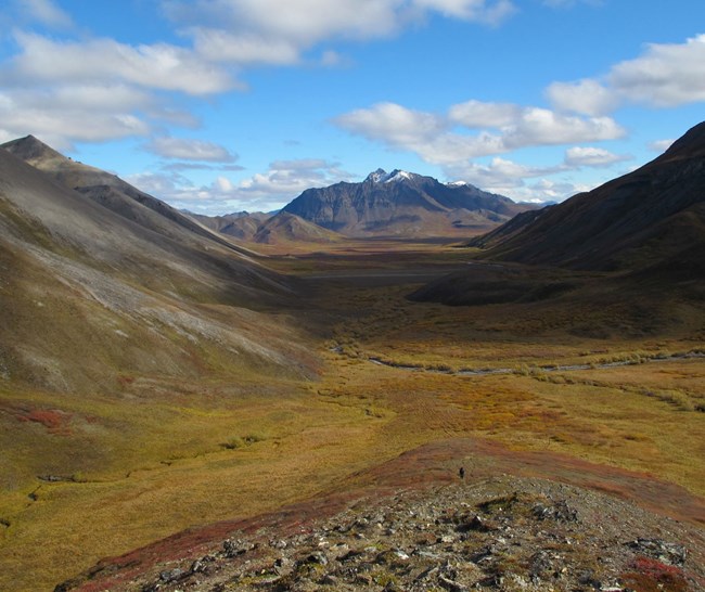
Noatak National Preserve (NOAT) is almost completely enclosed by the Baird and DeLong Mountains of the Brooks Range in the North Slope and Northwest Arctic Boroughs, Alaska. Originally established as a national monument on December 1, 1978, the park unit was redesignated a national preserve on December 2, 1980. The preserve encompasses approximately 2,665,693 hectares (6,587,071 acres) and was enacted to 1) protect the nation’s largest unaltered river basin and watershed; 2) protect habitat for a diverse array of flora and fauna; 3) preserve archeological sites; and 4) provide opportunities for subsistence and scientific study. The namesake Noatak River is classified as a national wild and scenic river, and archeologists surveying the tributaries of the river have discovered a cultural history that dates back more than 11,000 years. In 1976, NOAT was designated a Biosphere Reserve.
Geologic Setting
The bedrock geology of Noatak National Preserve is predominantly composed of formations associated with the Cambrian–Devonian Baird Group, Devonian–Mississippian Endicott Group, and Mississippian Lisburne Group. The southern portion of the preserve contains Ordovician–Devonian-age schists and quartzites, as well as the Devonian Beaucoup Formation. Exposures of the Jurassic ophiolite (a displaced fragment of oceanic crust and upper mantle) of the Brooks Range occur in western and northwestern NOAT. Some of the youngest bedrock units in the preserve include the Cretaceous Okpikruak and Fortress Mountain Formations that occur along the northwestern and north-central boundaries. A variety of surficial deposits occur in the preserve, including Pleistocene–Holocene glacial deposits, dune deposits, terrace deposits, landslide deposits, colluvium, and alluvium (Hamilton 2010).
- Scoping summaries are records of scoping meetings where NPS staff and local geologists determined the park’s geologic mapping plan and what content should be included in the report.
- Digital geologic maps include files for viewing in GIS software, a guide to using the data, and a document with ancillary map information. Newer products also include data viewable in Google Earth and online map services.
- Reports use the maps to discuss the park’s setting and significance, notable geologic features and processes, geologic resource management issues, and geologic history.
- Posters are a static view of the GIS data in PDF format. Newer posters include aerial imagery or shaded relief and other park information. They are also included with the reports.
- Projects list basic information about the program and all products available for a park.
Source: NPS DataStore Saved Search 3034. To search for additional information, visit the NPS DataStore.
A NPS Soil Resources Inventory project has been completed for Noatak National Preserve and can be found on the NPS Data Store.
Source: NPS DataStore Saved Search 3081. To search for additional information, visit the NPS DataStore.
Related Articles
Noatak National Preserve
National Park Service Geodiversity Atlas
The servicewide Geodiversity Atlas provides information on geoheritage and geodiversity resources and values within the National Park System. This information supports science-based geoconservation and interpretation in the NPS, as well as STEM education in schools, museums, and field camps. The NPS Geologic Resources Division and many parks work with National and International geoconservation communities to ensure that NPS abiotic resources are managed using the highest standards and best practices available.

