Last updated: July 10, 2024
Article
NPS Geodiversity Atlas—Lyndon B. Johnson National Historical Park, Texas
Geodiversity refers to the full variety of natural geologic (rocks, minerals, sediments, fossils, landforms, and physical processes) and soil resources and processes that occur in the park. A product of the Geologic Resources Inventory, the NPS Geodiversity Atlas delivers information in support of education, Geoconservation, and integrated management of living (biotic) and non-living (abiotic) components of the ecosystem.

Introduction
Lyndon B. Johnson National Historical Park (NHP) preserves the historic sites and landscapes associated with the life of Lyndon Baines Johnson, the 36th president of the United States. The park contains 1,570 acres, of which 674 acres are federal.
The park contains two districts, both located in the Pedernales River valley in the Hill Country of Texas. The Texas Hill Country is a relatively rugged landscape of hills with granitic or carbonate bedrock and characterized by shallow soils. Precambrian igneous and metamorphic rocks are exposed in the Llano Uplift just north of the park. Elsewhere in the Pedernales River valley, hills are capped by Cretaceous limestone underlain by sandstones and shales of the Cretaceous age and older sedimentary rocks. The scenery is characterized by a stair-stepped or benched appearance due to differential erosion, with ashe juniper and oak woodlands covering the hills.
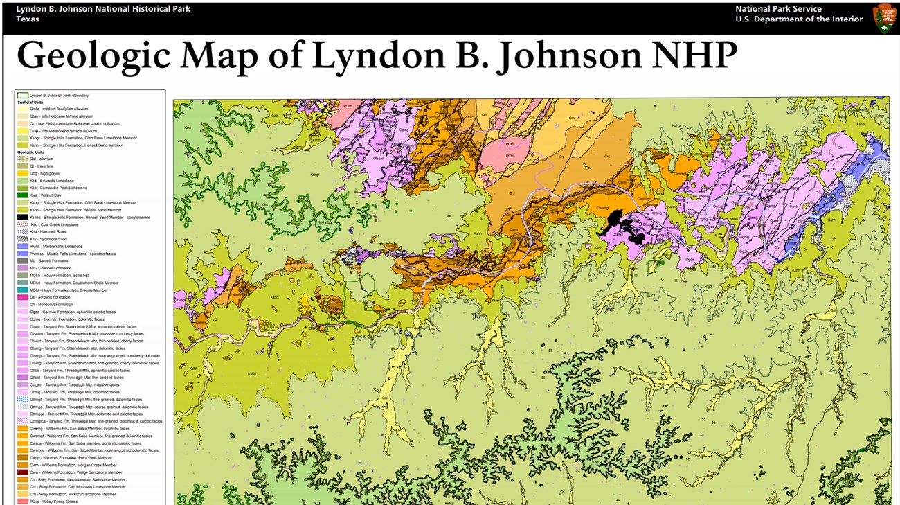
The LBJ Ranch unit contains the Texas White House, several other sites related to the Johnson family and a working ranch that recalls the atmosphere of the site when Johnson was president. The Pedernales River, a spring-fed tributary of the Colorado River, flows adjacent to the LBJ Ranch, and a significant part of the park and most of the historic buildings are located within the 100-year or 500-year floodplains. The general description of geology of the Ranch Unit is that there is a limited area of Quaternary alluvium along the river, with the Hensel Sand also exposed near the river. Farther away from the river, Glen Rose Formation occurs at the surface.
The Johnson City unit contains Johnson’s Boyhood Home and the site where his grandparents first settled in the Hill Country. Much of the Johnson City Unit in in the floodplain of Town Creek with Quaternary alluvium exposed at the surface. The Glen Rose Limestone is mapped at the surface in the rest of the unit.
Geologic Setting
Lyndon B. Johnson NHP is located near the boundary between the Edwards Plateau and Central Texas Uplift physiographic provinces. The Llano Uplift, also known as the Central Texas Uplift, consists of the the metamorphic and igneous crystalline core of a Proterozoic age Grenville Orogenic belt that formed along southern margin of the Laurentian (proto-North American) continent as it collided with one or more southern landmasses and island arcs. While the Llano Uplift is a structural dome, it is not a topographic high. It is a central basin containing rounded granite hills, rimmed by Paleozoic sedimentary rocks. Near the LBJ Ranch, the Llano Uplift consists of the Valley Spring Gneiss, Oatman Creek Granite, and Town Mountain Granite.
The Edwards Plateau surrounds the Llano Uplift. Lyndon B. Johnson NHP is in the eastern part of the Edwards Plateau, just south of the Llano Uplift. The Edwards Plateau is capped hard Cretaceous limestone with entrenched streams; caves and sinkholes are common. The Balcones Escarpment separates the Edwards Plateau from younger rocks on the Gulf Coast Plains to the southeast.
Cambrian through Cretaceous sedimentary rocks are exposed in the Pedernales River valley in the vicinity of Lyndon B. Johnson NHP. The oldest rock within the authorized boundary of the LBJ Ranch unit is the Wilberns Formation that was deposited near the end of the Cambrian Period. The sandstones and limestones of the Wilberns Formation were deposited during a marine transgression-regression cycle. Other Paleozoic units, consisting mostly of carbonates, are found in the area, but are not exposed in the immediately adjacent to either unit of the park.
A regional unconformity separates the Paleozoic units from the overlying Cretaceous limestones that are exposed at the surface in both units of Lyndon B. Johnson NHP and in much of the surrounding countryside. The Hensel Sand Formation is the lower part of a marine transgression, which continued into the overlying Glen Rose Formation. The unit contains conglomerate, sandstone, siltstone and dolomitic limestone, and is as thick as 130 ft (40 m) in the area of LBJ Ranch. It formed during the later part of the Early Cretaceous, approximately 115 million years ago, during a time when sea levels encroached from the southeast and depositional environments changed from fine-grained coastal plain environments to tidal flat and lagoonal. A gradational contact separates the Hensel Sand from the marine Glen Rose Limestone (Formation). The Glen Rose Limestone contains dolomite, limestone and clastic beds, and weathers to a characteristic stair-step topography. The Glen Rose was predominantly deposited under shallow marine conditions in a subtropical climate between about 113 and 108 million years ago. The Hensel Sand and Glen Rose Limestone are sometimes classified as members of the Shingle Hills Formation.
Younger Cretaceous limestones, including the Edwards Limestone, a key unit that containing the Edwards aquifer to the southeast of Lyndon B. Johnson NHP, are exposed in the higher elevation of the Pedernales River valley.
The Edwards Plateau experienced regional uplift during the middle Tertiary period. The Balcones Fault Zone, southeast of Lyndon B. Johnson NHP, separates the uplifted Edwards Plateau from the Gulf Coastal Plain. Subsequent river incision created the characteristic topography of the Texas Hill Country.
Hydrology and the Pedernales River
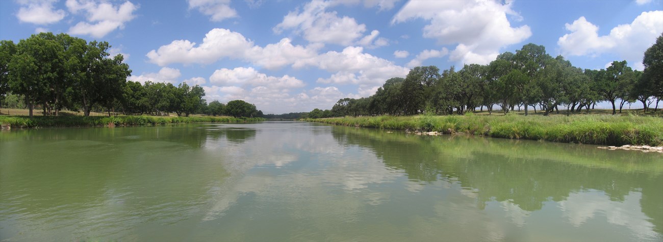
A 2.5 mi (4 km) stretch of Pedernales River is located within the Ranch Unit. Overall, the Pedernales River drains 1,302 square miles, including approximately 602 square miles upstream of the Ranch Unit. The shallow bedrock of the Hill Country, relatively steep gradient of the Pedernales River of 10.5 feet per mile, and intense precipitation events make the area very prone to flash flooding.
Generally, flood-producing storms over the Pedernales River watershed occur in the spring and fall. Estimated discharge for a 2-year flood is 16,400 cubic feet per second (cfs) flood and 320,000 for a 500-year flood. The largest flood on record occurred in 1952 with a discharge of 441,000 cfs at Johnson City.
The Junction School, the LBJ Birthplace, the Johnson Family Cemetery, the Sam E. Johnson Sr. Farmhouse (Grandparents House), and the Cedar Guest House in the Ranch unit are within the 100-year floodplain in the LBJ Ranch unit. The Texas Whitehouse is outside of the 100-year floodplain but within the mapped 500-year floodplain.
Two historic low-head dams on the Pedernales River are within the Ranch Unit, both downstream of the Texas White House. The most downstream and oldest structure is the Jordan Dam, constructed in 1940. The Johnson Dam was constructed under the direction of President Johnson in 1952. These dams are maintained by the National Park Service for their historic significance as part of the historic landscape of LBJ Ranch.
Groundwater contributes a significant portion of the baseflow of the Pedernales River. Overall, the Pedernales River Valley contains fairly shallow aquifers developed in thick deposits of Quaternary alluvium and colluvium, unconsolidated terrace deposits, and fractured Cretaceous sedimentary rocks. The coarse-grained beds and lenses of sand and gravel are often permeable and productive aquifers located at Lyndon B. Johnson NHP. Wells in the LBJ Ranch unit also are finished in the Ellenburger aquifer is in cherty limestone and dolomites of Cambrian and Ordovician age.
Most of the surface at the Johnson City Unit is covered with Quaternary Alluvium, including alluvium from Town Creek. This alluvium overlies thick Glen Rose Limestone, which overlies strata of the Ellenburger aquifer.
Related links
Cave and Karst
Carbonate rocks underlie almost all of Lyndon B. Johnson NHP, although bedrock is overlain by alluvium in some areas. Areas with carbonate layers have potential for karstic landforms, although dissolution features such as caves or sinkholes have not been documented in the park.
All NPS cave resources are protected under the Federal Cave Resources Protection Act of 1988 (FCRPA)(16 U.S.C. § 4301 et seq.).
Related Links
Paleontological Resources
Fossils have not been reported from within Lyndon B. Johnson NHP, but the rock units exposed in the park have the potential to yield fossils. Several fossil localities are found nearby. The Wilberns Formation contains brachiopods, trilobites, and stromatolites and other microbial structures in other areas. Elsewhere, the Hensel Sand contains a few root traces in the lower section, but marine fossils (including foraminifera, bivalves, gastropods, crabs, ostracodes, echinoids, ophiuroids, and burrows) are more common in the upper part of the section. The Glen Rose Limestone is very fossiliferous elsewhere in the Hill Country. Marine invertebrates and microfossils are the most common types of fossils in the Glen Rose, but vertebrate fossils, most notably dinosaur tracks such as at Dinosaur Valley State Park, are also known.
All NPS fossil resources are protected under the Paleontological Resources Preservation Act of 2009 (Public Law 111-11, Title VI, Subtitle D; 16 U.S.C. §§ 470aaa - 470aaa-11).
Regional Geology
Lyndon B Johnson National Historical Park is a part of the Great Plains Physiographic Province and shares its geologic history and some characteristic geologic formations with a region that extends well beyond park boundaries.
Maps and Reports
- Scoping summaries are records of scoping meetings where NPS staff and local geologists determined the park’s geologic mapping plan and what content should be included in the report.
- Digital geologic maps include files for viewing in GIS software, a guide to using the data, and a document with ancillary map information. Newer products also include data viewable in Google Earth and online map services.
- Reports use the maps to discuss the park’s setting and significance, notable geologic features and processes, geologic resource management issues, and geologic history.
- Posters are a static view of the GIS data in PDF format. Newer posters include aerial imagery or shaded relief and other park information. They are also included with the reports.
- Projects list basic information about the program and all products available for a park.
Source: NPS DataStore Saved Search 3008. To search for additional information, visit the NPS DataStore.
A NPS Soil Resources Inventory project has been completed for Lyndon B. Johnson National Historical Park and can be found on the NPS Data Store.
Source: NPS DataStore Saved Search 3055. To search for additional information, visit the NPS DataStore.
Related Articles
Lyndon B. Johnson National Historical ParkNational Park Service Geodiversity Atlas
The servicewide Geodiversity Atlas provides information on geoheritage and geodiversity resources and values within the National Park System. This information supports science-based geoconservation and interpretation in the NPS, as well as STEM education in schools, museums, and field camps. The NPS Geologic Resources Division and many parks work with National and International geoconservation communities to ensure that NPS abiotic resources are managed using the highest standards and best practices available.


