Last updated: July 5, 2024
Article
NPS Geodiversity Atlas—Homestead National Monument of America, Nebraska
Geodiversity refers to the full variety of natural geologic (rocks, minerals, sediments, fossils, landforms, and physical processes) and soil resources and processes that occur in the park. A product of the Geologic Resources Inventory, the NPS Geodiversity Atlas delivers information in support of education, Geoconservation, and integrated management of living (biotic) and non-living (abiotic) components of the ecosystem.

Introduction
Homestead National Historical Park of America (HOME) is located approximately 8 km (5 mi) northwest of Beatrice and 60 km (37 mi) southwest of Lincoln in Gage County, Nebraska. Authorized on March 19, 1936, HOME contains about 85 hectares (211 acres) and was established to commemorate the Homestead Act and its influence on the country. Signed by President Abraham Lincoln in 1862, the Homestead Act had a major influence on federal land and immigration policy, defined and accelerated settlement and community development, empowered women and minorities, increased opportunities for homesteaders, promoted agricultural development, and hastened westward expansion while contributing to the dispossession of Native American tribes (National Park Service 2015b). The monument contains the 65-hectare (160-acre) Daniel Freeman Claim, a homestead claim established on the first day of the Homestead Act’s implementation. Additional features preserved in HOME include the National Museum of Homesteading, the Freeman School, historic buildings, and hiking trails through burr oak forest and restored tallgrass prairie (National Park Service 2016a).
Geologic Setting
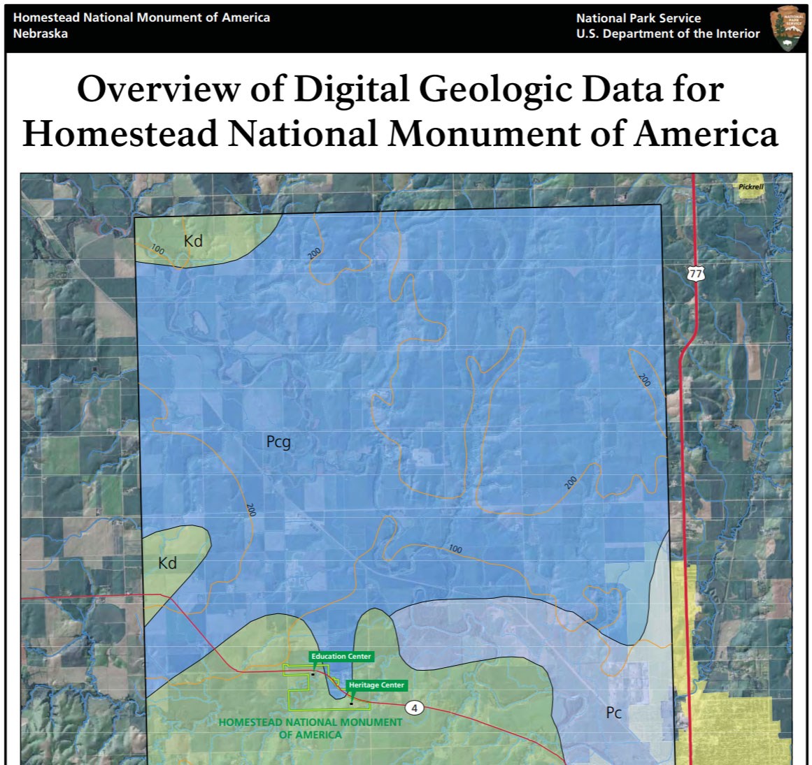
Homestead National Historical Park of America lies within the Dissected Till Plains of the Central Lowland physiographic province, a region defined by relatively flat topography with landscapes featuring geomorphic remnants of continental glaciation (Graham 2011). The bedrock geology of HOME consists of Pennsylvanian rocks associated with the Council Grove Group and the Cretaceous Dakota Sandstone. The bedrock that underlies the national monument is buried by younger Quaternary deposits that were deposited during Pleistocene glacial episodes and subsequently modified by fluvial processes. Pleistocene glacial deposits lie between the bedrock and surficial deposits and include till, loess (windblown silt), and outwash sand deposited during multiple advances of the Laurentide continental ice sheet ~2.7 million years to 640,000 years ago (Roy et al. 2004; Balco et al. 2005). The youngest units mapped within HOME consist of Holocene sediments that primarily include floodplain and river terrace deposits associated with Cub Creek.
Regional Geology
Homestead National Monument of America is a part of the Central Lowland Physiographic Province and shares its geologic history and some characteristic geologic formations with a region that extends well beyond park boundaries.
- Scoping summaries are records of scoping meetings where NPS staff and local geologists determined the park’s geologic mapping plan and what content should be included in the report.
- Digital geologic maps include files for viewing in GIS software, a guide to using the data, and a document with ancillary map information. Newer products also include data viewable in Google Earth and online map services.
- Reports use the maps to discuss the park’s setting and significance, notable geologic features and processes, geologic resource management issues, and geologic history.
- Posters are a static view of the GIS data in PDF format. Newer posters include aerial imagery or shaded relief and other park information. They are also included with the reports.
- Projects list basic information about the program and all products available for a park.
Source: NPS DataStore Saved Search 2898. To search for additional information, visit the NPS DataStore.
A NPS Soil Resources Inventory project has been completed for Homestead National Monument of America and can be found on the NPS Data Store.
Source: NPS DataStore Saved Search 2969. To search for additional information, visit the NPS DataStore.


