Last updated: July 5, 2024
Article
NPS Geodiversity Atlas—Guadalupe Mountains National Park, Texas
Geodiversity refers to the full variety of natural geologic (rocks, minerals, sediments, fossils, landforms, and physical processes) and soil resources and processes that occur in the park. A product of the Geologic Resources Inventory, the NPS Geodiversity Atlas delivers information in support of education, Geoconservation, and integrated management of living (biotic) and non-living (abiotic) components of the ecosystem.

Geologic Features and Processes
The Guadalupe Mountains host the finest example of an ancient fossil reef. The fault-block range displays portions of the world’s most extensive and significant Middle Permian limestone, containing one of the most complete Permian marine fossil sequences in the world. So exceptional are the Guadalupe Mountains that the International Commission on Stratigraphy selected this section of rocks (Guadalupian Series) to be the Global Boundary Stratotype Section and Point for Middle Permian age (270–260 million years ago). Geologists from around the globe have studied this world-renowned reef, and it has been traversed by innumerable geology students and visitors.
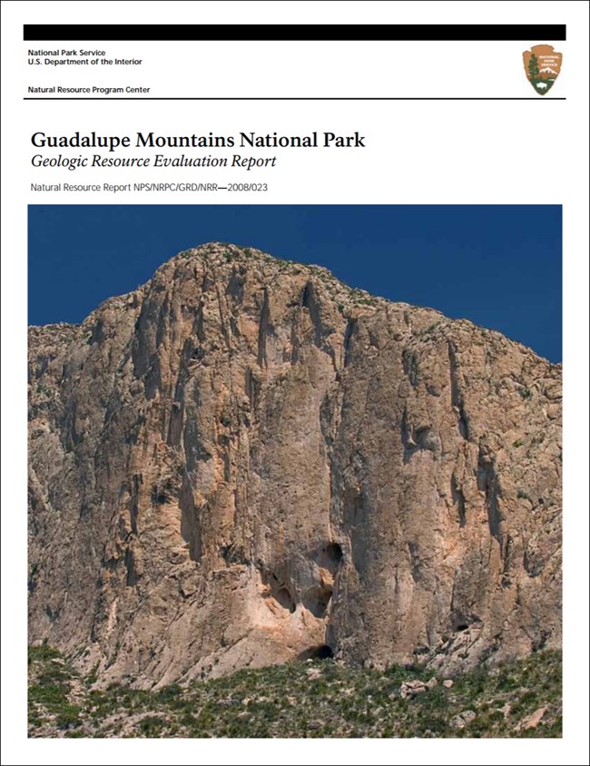
The rocks of Guadalupe Mountains National Park are the foundation for stunning scenery, possibly the most striking feature being the thousand-foot cliff of El Capitan, which is part of the Capitan forereef. The park is also notable for its cave resources, red quartz and white gypsum sand dunes, and flaggy dolomite and limestone. Abundant travertine deposits have helped the caves of the Guadalupe Mountains earn the reputation of being among the most beautiful in the world. The rocks in the park also host eye-catching sedimentary and structural features such as ripple marks, submarine slides, tepee structures, and a plethora of fossils.
Geologic Setting
The rocks that make up the Guadalupe Mountains formed in the Delaware Basin during the Permian Period. Sediments were deposited in an inland sea, which covered more than 26,000 km2 (10,000 mi2) of Texas and New Mexico at the time. Calcareous sponges, bryozoans, fusulinids, and algae, as well as calcium carbonate that precipitated from the water, built the Capitan Reef in the shallow water near the shore of this sea. In the park the reef forms a wedge pointing southward; El Capitan and Guadalupe Peak are two of its prominent points. The reef grew upward and seaward upon forereef talus broken loose by storms and persistent wave action, as well as upon the skeletal remains of algae and animals that fell or washed off the steep reef face. The south face of the Guadalupe Mountains marks the location of the seaward face of the Capitan Reef. The wide-open landscape was once covered by the deep waters of the Delaware Sea. The portion of the mountains that extends northward from the reef was once the backreef (lagoon and coastal plain).
The reef, which once paralleled the Permian shoreline, today extends across 563 km (350 mi) of western Texas and southeastern New Mexico. The majority of the reef is not exposed above ground, though reef exposures are revealed in canyons and caves throughout the Guadalupe Mountains. The famous caves of Carlsbad Caverns National Park formed within the same reef that is now exposed at the surface in Guadalupe Mountains National Park. The most extensive exposed portion is the 64- km- (40- mi- ) long eastern Guadalupe escarpment that stretches northward through Guadalupe Mountains and Carlsbad Caverns National Parks. The reef is also exposed in the Apache Mountains (about 24 km [15 mi] exposed) and Glass Mountains (about 6.4 km [4 mi] exposed) near Van Horn and Alpine, Texas, respectively.
A striking cross section of the Capitan Reef is displayed in the north wall of McKittrick Canyon. The entire 609- m (2,000- ft.) height of the reef is visible. By contrast, most canyons north of McKittrick Canyon do not incise deeply enough to expose the lower beds. Regional dip causes the reef to slope down to the northeast until it is completely buried near the city of Carlsbad, New Mexico.
Geoheritage Site
Guadalupe Mountains National Park is both nationally and internationally significant because of a combination of outstanding geologic, scientific, and scenic resources. The park preserves an important section of the Capitan Reef—one of the most extensive non- coral, fossil reefs in the world—and serves as the Global Boundary Stratotype Section and Point (GSSP) for Middle Permian time. The reef complex also hosts stunning El Capitan and interesting sedimentary and structural features.
Global Boundary Stratotype Sections and Points
Guadalupe Mountains National Park contains an international geologic reference point. The International Union of Geological Sciences (IUGS), Subcommission on Permian Stratigraphy, selected the Guadalupian Series to be the world’s reference standard for the Middle Permian—a major unit of the geologic time scale. Predicated mostly on the outcrops within Guadalupe Mountains National Park, this section of rock is one of only a few chronostratigraphic references selected within the United States. The International Union of Geological Sciences also ratified three component chronostratigraphic stages within the Guadalupian Series. The lowest is the Roadian Stage, the base of which coincides with the base of the Guadalupian Series. This point is located in Stratotype Canyon, 1 km (0.6 mi) south of Bone Canyon (Williams Ranch House) in the Middle of the El Centro Member of the Cutoff Formation. The base of the middle stage, the Wordian, is located near the park boundary at the top of the east wall of Guadalupe Canyon within the Getaway Limestone Member of the Cherry Canyon Formation. The base of the highest stage (Capitanian) is located at the crest of Nipple Hill, 1.1 km (0.7 mi) east of Frijole Ranch within the Pinery Limestone Member of the Bell Canyon Formation.
Paleontological Resources
In 1855 G. G. Shumard—geologist and member of a party exploring for a feasible railroad route to California along the newly established United States–Mexico border—recorded strata of the southern tip of the Guadalupe Mountains and collected fossils from the thousand foot-thick “upper or white limestone” unit (i.e., Capitan Limestone) in the vicinity of Guadalupe Pass and El Capitan. In 1858 he reported the circumstances of his field work in the St. Louis Academy of Science Transactions. His brother, B. F. Shumard, used this collection to identify the Guadalupe Mountains as the first known marine Permian outcrops in North America (B. F. Shumard 1858). Little further work was done in the region in the ensuing half-century (Pray 1988). However, in early 1901 G. H. Girty, a USGS geologist, extensively collected invertebrate fauna from the strata of the southern Guadalupe Mountains, mostly of the Capitan Limestone on the southern slopes of Guadalupe Peak.
Since the 1950s the majority of paleontological studies of Guadalupe Mountains National Park have focused on paleoecology, in particular, understanding of the sedimentological origin of the Permian (Guadalupian) Capitan Reef and equivalent backreef (i.e., the Yates and Tansill Formations) and basin (i.e., Bell Canyon, Cherry Canyon, and Brushy Canyon Formations) depositional systems.
Investigators have found more than 500 Permian fossil species in the Guadalupe Mountains (Rennicke 1985). Principal frame-building organisms include calcareous sponges, encrusting calcareous algae, and bryozoans. A group of common fossils is the brachiopods—shelled creatures abundant in the Permian Basin. While some 200 species of brachiopods survive today, investigators have identified 30,000 forms as fossils. Also abundant during reef building in the Delaware Basin were fusulinids, which date back 250 to 350 million years. These creatures became extinct in the latter part of the Permian Period. Fusulinids are members of a major group of fossils called foraminifera that possess lime rich shells, which helped build the Capitan Reef. During the reef-building period, foraminifers covered thousands of miles of the ocean floor with lime (Rennicke 1985). A third abundant group of fossils in the Permian reef is echinoderms, such as crinoids (sea lilies) and echinoids (sea urchins). Echinoderms are solitary, bottom- dwelling, marine organisms. An endoskeleton with bilateral symmetry, which is formed of plates or ossicles composed of crystalline calcite, characterizes these organisms. Various mollusks are also part of the reef complex, for example, gastropods (snails), cephalopods with chambered shells (modern cephalopod species include octopi and squid), and pelecypods (clams) (DuChene 2000), as well as corals, trilobites, and conodonts (Santucci et al. 2001).
Since the 1930s investigators have recognized the Guadalupe Mountains for their significant Pleistocene/Holocene cave fossils, including herptefauna; avian remains (i.e., bones and feathers); small mammals; and extinct sloth remains (i.e., dung and hide with hair). Four of the 10 known localities in the world for fossil sloth dung occur in Guadalupe Mountains National Park: Lower Sloth Cave, Upper Sloth Cave, Dust Cave, and Williams Cave (Spaulding and Martin 1979).
Based on plant macrofossils and pollen collected from caves in Guadalupe Mountains National Park, investigators have established a 13,000-year-long chronological sequence of late Pleistocene and Holocene plant communities in the Guadalupe Mountains (Van Devender et al. 1977). The plant communities in the Guadalupe Mountains have gradually changed from relatively mesic (moist) woodland and forest associations during pluvio- glacial climates in the Late Wisconsin glacial epoch to the present xeric (dry) Chihuahuan desert scrub (Van Devender et al. 1977).
All NPS fossil resources are protected under the Paleontological Resources Preservation Act of 2009 (Public Law 111-11, Title VI, Subtitle D; 16 U.S.C. §§ 470aaa - 470aaa-11).
Dunes
An expansion of the park boundary in 1987 added about 4,050 ha (10,000 ac) to the park’s western boundary and resulted in a significant portion of the red quartz and white gypsum dunes becoming incorporated into Guadalupe Mountains National Park. The National Park Service, various organizations, and individuals had long been interested in preservation of these dunes because of their scenic beauty. As the only area of gypsum dunes in the United States outside of White Sands National Monument in New Mexico, these dunes are also geologically significant. In addition, the dunes contain unusual plant associations and rare species, marking their biological significance (National Park Service 1988).
In 1948 P. B. King described the dunes as “a conspicuous feature of the basin floor”. Reaching a maximum height of 9 m (30 ft.) in the northern area, the quartz dunes spread over the edge of the basin floor and appear to be moving up the slopes of the bajada to the east. The overall form and depressions within the dunes are irregular. Many of the dune surfaces are bare and ripple marked, though mesquite and yucca commonly grow between the dunes.
Cave and Karst
The park contains at least 27 caves. Though fairly small, Guadalupe Mountains' caves are famous for archeology and paleontology. Out of ten caves known to harbor fossil sloth dung in the US, four of them are found in the park. In addition, fossils from the Pleistocene/Holocene eras that have been found in park caves include birds, small mammals, and pollen from 13,000 years of plant communities from these mountains. As well, a variety of speleothems are found within caves.
Caves of the park also preserve over 10,000 years of human history.
All NPS cave resources are protected under the the Federal Cave Resources Protection Act of 1988 (FCRPA)(16 U.S.C. § 4301 et seq.).
Geohazards
Natural geologic processes continue to shape the park on time scales ranging from seconds to years. Natural materials and processes can create geologic hazards and associated risks. Be cautious and alert to geohazards that may be present in the park, including:
Flood Hazards
Running water is a powerful mechanism for mass transport of debris. Simulations of the 100- year floodplain at Guadalupe Mountains National Park resulted in velocities up to 3.4 m/s (11.1 ft./s). Mass transport of debris in major channels and flash flooding in smaller ephemeral drainages are issues for park planning.
Mass Wasting
Mass wasting becomes hazardous when park infrastructure or human activities come in contact with the transfer of debris. The most prevalent hazard in the park is rockfall, whereby “relatively large fragments of rock become detached and by means of free-fall, rolling, and bounding move rapidly downslope under the force of gravity” (Rogers et al. 1974, p. 30). Rockfall events are common on cliffs of massive, broken, faulted, or jointed bedrock (e.g., Capitan Limestone). The most hazardous areas are on talus slopes, below cliffs of massive limestone. Factors that could trigger rockfalls are shock waves from distant or nearby earthquakes, repeated freeze- thaw cycles, airplane and vehicular noise and vibrations, high winds, and blasting during construction or mining.
Solution Collapse
No solution sinks (sinkholes) are known to exist in the park; however, the nature of the rocks makes the existence of some subsurface cavities probable. Dissolution occurs in areas underlain by highly soluble rock formations, especially gypsum and halite, and to a lesser degree limestone. Removal of consolidated or unconsolidated materials by water solution leads to surface collapse. Hydrologic factors that may cause the solution and removal of material may be natural or anthropogenic.
Abandoned Mineral Lands
The Texas and Calumet Mine operated intermittently from 1891 to 1938; its copper ore bodies were small, and operations ceased when they became uneconomic. Seventeen mine openings associated with the abandoned Texas and Calumet Mine in the park have been identified and were mitigated appropriately in the early 1990s.
NPS AML sites can be important cultural resources and habitat, but many pose risks to park visitors and wildlife, and degrade water quality, park landscapes, and physical and biological resources. Be safe near AML sites—Stay Out and Stay Alive!
Regional Geology
Guadalupe Mountains is a part of the Basin and Range Physiographic Province and shares its geologic history and some characteristic geologic formations with a region that extends well beyond park boundaries.
- Scoping summaries are records of scoping meetings where NPS staff and local geologists determined the park’s geologic mapping plan and what content should be included in the report.
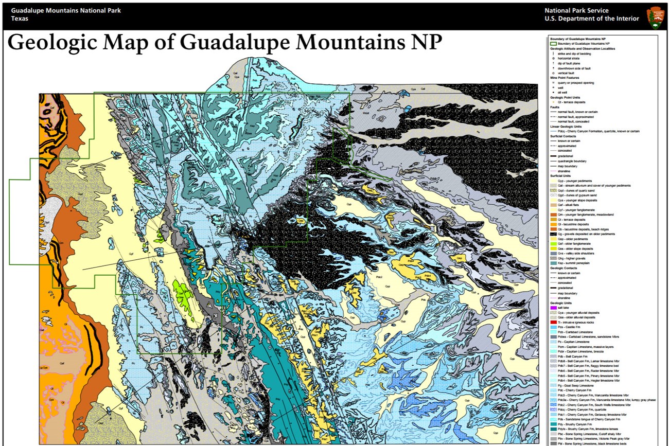
- Digital geologic maps include files for viewing in GIS software, a guide to using the data, and a document with ancillary map information. Newer products also include data viewable in Google Earth and online map services.
- Reports use the maps to discuss the park’s setting and significance, notable geologic features and processes, geologic resource management issues, and geologic history.
- Posters are a static view of the GIS data in PDF format. Newer posters include aerial imagery or shaded relief and other park information. They are also included with the reports.
- Projects list basic information about the program and all products available for a park.
Source: NPS DataStore Saved Search 2890. To search for additional information, visit the NPS DataStore.
A NPS Soil Resources Inventory project has been completed for Guadalupe Mountains National Park and can be found on the NPS Data Store.
Source: NPS DataStore Saved Search 2961. To search for additional information, visit the NPS DataStore.

Related Links
Related Articles
Guadalupe Mountains National Park
National Park Service Geodiversity Atlas
The servicewide Geodiversity Atlas provides information on geoheritage and geodiversity resources and values within the National Park System. This information supports science-based geoconservation and interpretation in the NPS, as well as STEM education in schools, museums, and field camps. The NPS Geologic Resources Division and many parks work with National and International geoconservation communities to ensure that NPS abiotic resources are managed using the highest standards and best practices available.

