Last updated: July 5, 2024
Article
NPS Geodiversity Atlas—Great Basin National Park, Nevada
Geodiversity refers to the full variety of natural geologic (rocks, minerals, sediments, fossils, landforms, and physical processes) and soil resources and processes that occur in the park. A product of the Geologic Resources Inventory, the NPS Geodiversity Atlas delivers information in support of education, Geoconservation, and integrated management of living (biotic) and non-living (abiotic) components of the ecosystem.

Geologic Features and Processes
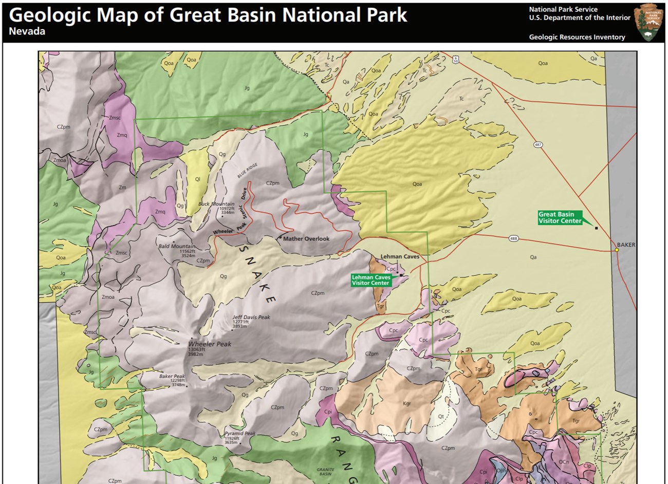
The dominant geologic structure in Great Basin National Park is the Southern Snake Range décollement (a very low-angle fault). The range is one of twenty-five distinctive metamorphic core complexes that extend from Canada to northwestern Mexico (Graham 2014). Three granitic plutons are exposed beneath the Southern Snake Range décollement and are remnants of the subduction of the Pacific Plate beneath the North American Plate in the Mesozoic: Jurassic Snake Creek/Williams Canyon Pluton, Cretaceous Pole Canyon Pluton, and the Tertiary Granite pluton.
Preserved in Great Basin is a varied landscape of igneous intrusions, geomorphic and glacial features, and desert topography associated with the décollement formation. Located in the northern portion of the Basin and Range physiographic province, the park contains the second tallest mountain in Nevada, Wheeler Peak. The peak is 3,982 m tall and was once home to the world's oldest known tree, a bristlecone pine (Pinus longaeva), before it was cut down in the 1960s (Lambert 1992). In the southern end of the park, in Lexington Canyon, is the only limestone arch in the southwest. Lexington Arch stands nearly 23 m high and is carved in the Notch Peak Limestone (Late Cambrian-Early Ordovician).
Landforms associated with arid regions that are found in Great Basin include alluvial fans, bajadas, bolsons, playas, and pediments. Many of these landforms can be viewed from the overlooks and peaks in the park.
Paleontological Resources
Park staff began extensive paleontological resource surveys in 2011 that have yielded over 1,000 fossil specimens. Two index fossils, Receptaculites oweni and Orthoceras, were discovered in the southern part of the park in stream pebbles (Bell 2011) and allow for accurate dating of the associated rocks.
Paleontological resources are found in the following formations at GRBA: Pioche Shale (Cambrian), Pole Canyon Shale (Cambrian), Lincoln Peak Formation (Cambrian), Corset Spring Shale (Cambrian), Notch Peak Limestone (Late Cambrian-Early Ordovician), Pogonip Group (Ordovician), Eureka Quartzite (Ordovician), Fish Haven and Laketown Dolomites (Late Ordovician-Silurian), Sevy Dolomite (Devonian), Simonson Dolomite (Devonian), Guilmette Formation (Devonian), Joana Limestone (Mississippian), Chainman Shale (Mississippian), and Ely Limestone (Pennsylvanian). Fossils found in the park include algae, stromatolites, foraminifera, sponges, corals, stromatoporoids, brachiopods, mollusks, trilobites, ostracods, crinoids, conodonts, and rare acanthodian fish spines.
All NPS fossil resources are protected under the Paleontological Resources Preservation Act of 2009 (Public Law 111-11, Title VI, Subtitle D; 16 U.S.C. §§ 470aaa - 470aaa-11).
Cave and Karst
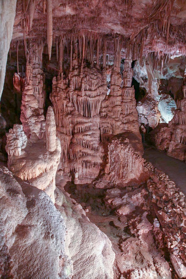
There are 46 known caves in Great Basin preserving spectacular cave formations such as stalactites, stalagmites, cave popcorn, flowstone, and more than 300 rare shield formations, 11 endemic cave species, and at least 1 significant pictograph site. Great Basin contains solution caves, fracture systems, ice caves, tectonic caves, and 23 known rock shelters. In addition, 36% of the Park is covered by carbonates that exhibit a high degree of karstification. These carbonates are the Pole Canyon Limestone (Middle Cambrian), Lincoln Peak Formation (Middle to Late Cambrian), Notch Peak Limestone (Late Cambrian to Early Ordovician), and the Guilmette Formation (Late Devonian). The formations capture, store, and deliver water to desert areas in and around the park.
All NPS cave resources are protected under the the Federal Cave Resources Protection Act of 1988 (FCRPA)(16 U.S.C. § 4301 et seq.).
Glacial Landforms
A diverse array of subalpine glacial landforms and features are preserved in Great Basin National Park. There are seven identified rock glaciers in the park, covered by rock debris of Prospect Mountain Quartzite. Subalpine glacial lakes, known as tarns, play a significant role in the ecosystem of the park and in the monitoring of climate change. Six tarns fill glacial cirques in the park and include: Stella, Teresa, Brown, Baker, Johnson, and Dead lakes. Additional glacial features at Great Basin include cirques, moraines, bergschrund, arêtes, horns, and kettles.
Soils
As documented in the completed NPS Soil Resources Inventory for Great Basin National Park, 11 different soil map units occur in the park, with 57 different soils types. See Maps and Reports, below.
Abandoned Mineral Lands
Great Basin has 15 Abandoned Mineral Land (AML) sites with 281 individual features. The 281 features include adits, tunnels, shafts, surface structures, prospects, waste rock piles, related equipment, and cabin and other building remains. NPS AML sites can be important cultural resources and habitat, but many pose risks to park visitors and wildlife, and degrade water quality, park landscapes, and physical and biological resources. Be safe near AML sites—Stay Out and Stay Alive!
Regional Geology
Great Basin is a part of the Basin and Range Province and shares its geologic history and some characteristic geologic formations with a region that extends well beyond park boundaries.
Maps and Reports
- Scoping summaries are records of scoping meetings where NPS staff and local geologists determined the park’s geologic mapping plan and what content should be included in the report.
- Digital geologic maps include files for viewing in GIS software, a guide to using the data, and a document with ancillary map information. Newer products also include data viewable in Google Earth and online map services.
- Reports use the maps to discuss the park’s setting and significance, notable geologic features and processes, geologic resource management issues, and geologic history.
- Posters are a static view of the GIS data in PDF format. Newer posters include aerial imagery or shaded relief and other park information. They are also included with the reports.
- Projects list basic information about the program and all products available for a park.
Source: NPS DataStore Saved Search 2887. To search for additional information, visit the NPS DataStore.
A NPS Soil Resources Inventory project has been completed for Great Basin National Park and can be found on the NPS Data Store.
Source: NPS DataStore Saved Search 2958. To search for additional information, visit the NPS DataStore.


