Last updated: July 3, 2024
Article
NPS Geodiversity Atlas—Golden Gate National Recreation Area, California
Geodiversity refers to the full variety of natural geologic (rocks, minerals, sediments, fossils, landforms, and physical processes) and soil resources and processes that occur in the park. A product of the Geologic Resources Inventory, the NPS Geodiversity Atlas delivers information in support of education, Geoconservation, and integrated management of living (biotic) and non-living (abiotic) components of the ecosystem.

Introduction
Golden Gate National Recreation Area (GOGA) is one of the largest urban parks on Earth, stretching across California’s San Francisco Bay area in Marin, San Francisco, and San Mateo Counties. Established on October 27, 1972, GOGA encompasses approximately 33,195 hectares (82,027 acres) and preserves iconic coastal scenery (Marin Headlands), beaches, lagoons, more than 160 km (100 mi) of trails, an infamous prison (Alcatraz Island), massive trees (Muir Woods), former U.S. military fortifications, and the site of the initial Spanish fortification in San Francisco (the Presidio). The national recreation area is part of the United Nations (UNESCO)-designated Golden Gate Biosphere Reserve, home to more than 1,250 plant and animal species, including some of the most rare, threatened, and endangered species in the NPS (National Park Service 2017). GOGA’s namesake, “Golden Gate,” refers to the narrow strait connecting San Francisco Bay to the Pacific Ocean. The bay, isolated islands, and rugged headlands created a valuable landscape that supported commerce and facilitated defense (Port 2016). GOGA consists of a collection of NPS-administered areas that includes two other park units—Fort Point National Historic Site (FOPO) and Muir Woods National Monument (MUWO).
Geologic Setting
Golden Gate National Recreation Area is situated in one of the most geologically active regions of the United States and serves as an ideal setting to study the geologic processes associated with plate tectonics. Rocks underlying GOGA date back to the Jurassic Period (~160 Ma), when the western margin of North America represented a convergent plate boundary between the ancient Farallon oceanic plate and North American continental plate. Because oceanic crust is denser than continental crust, the Farallon Plate sank beneath the North American Plate and formed what geologists refer to as the “Franciscan subduction zone”. Franciscan subduction occurred from about 160 Ma to 50 Ma (Elder 2013). Basement rocks within GOGA and the surrounding area formed (or at least assembled) in various geologic settings (e.g., oceanic trench, forearc basin, and volcanic arc) associated with the Franciscan subduction zone. Formations mapped within GOGA can be broken down into three main groups: (1) rocks of the Jurassic–Eocene Franciscan Complex; (2) Jurassic and Cretaceous-age intrusive and volcanic rocks; and (3) Cenozoic units of the Whiskey Hill Formation, Purisima Formation, Millerton Formation, Olema Creek Formation, Merced Formation, Santa Clara Formation, and Colma Formation. GOGA is bisected by the San Andreas fault system, a transform boundary between the North American Plate and Pacific Plate. Initiation of the modern transform boundary began in Southern California about 28 Ma and extended through the Bay Area approximately 10 Ma (Atwater 1989; Page and Wahrhaftig 1989; Elder 2013).
Geologic Features and Processes
Plate Tectonic Setting Related
Rocks of the Franciscan Complex
Most of the basement rocks in the park belong to the Franciscan Complex. These rocks were originally deposited in a marine environment in a sequence beginning with basalt and greenstone, followed by chert and limestone, and finally graywacke sandstone and shale. Subsequently, the rocks were metamorphosed in a subduction zone and accreted to the North American continent. Serpentinite (hydrothermally altered ancient oceanic crust) and other hydrothermal and metamorphic rocks also occur in the Franciscan Complex.
Franciscan Terranes
The Franciscan Complex is divided into terranes that represent distinct episodes of accretion onto the North American continent. The terranes consist of blocks of Franciscan rocks in which the original depositional sequence is sometimes still visible.
Franciscan Mélange
Mélange are zones of “crushed up” and “mangled” Franciscan rocks that separate the different terranes. Because mélange is so sheared, it is easily eroded into rounded hills throughout the park. Franciscan mélange is often referred to as the “Central terrane.”
Rocks of the Salinian Complex
The Salinian complex is composed primarily of the igneous rock granite. It originated from the same massive batholith that formed the core of the Peninsular Ranges and Sierra Nevada. A sliver of this complex was carried north along the San Andreas Fault, and today it forms Montara Mountain and much of the basement rocks in Point Reyes National Seashore.
Cenozoic Rocks and Deposits
Sedimentary rocks were deposited in the park, largely by surficial processes, during the last 66 million years. During this time, tectonism in the San Francisco Bay Area evolved from a subduction to a transform regime; the rocks deposited during this time reflect this complex transition. Tension, compression, and localized faulting associated with the development of the San Andreas Fault broke the pre-Cenozoic bedrock into blocks which created basins and uplifts. Cenozoic rocks are primarily conglomerate or sandstone and their depositional settings range from marine to coastal to nonmarine.
Faults and the San Andreas Fault System
Nearly 390 km (240 mi) of faults are mapped in the park. The San Andreas Fault is the most well-known but not the only fault in the San Francisco Bay Area. In actuality, the San Andreas Fault is not a single fault but a system of many faults that accommodate transform plate motion between the Pacific and North American tectonic plates. Thrust faults, which separate terranes and zones of mélange, are also a common feature in the park. Thrust faults are responsible for bringing Franciscan rocks toward the surface; erosion is exposing these rocks today.
Earthquakes
Earthquakes are ubiquitous in the San Francisco Bay Area. Most of the major earthquakes in California are caused by movements along faults of the San Andreas Fault system. Many of the faults in this system are seismically connected, meaning that an earthquake along one could generate movement on another.
Paleontological Resources
The park contains considerable paleontological resources from the remains of Cenozoic Era mammals to Mesozoic Era marine invertebrates, and the potential for continued discovery is considerable. A paleontological resource inventory for the park was completed in 2015.
All NPS fossil resources are protected under the Paleontological Resources Preservation Act of 2009 (Public Law 111-11, Title VI, Subtitle D; 16 U.S.C. §§ 470aaa - 470aaa-11).
Surficial Geology Related
Landslide Deposits and Slope Movements
Four types of slope movement are common in the San Francisco Bay Area—rockfall, slumps, debris slides, and earth/debris flows—though others can and do occur. Slope movements occur primarily in weak rocks, such as mélange, serpentinite, and unconsolidated Quaternary deposits. Slope movements also occur on steep slopes, such as those along the coast. Heavy rain, earthquakes, and undercutting of steep slopes have triggered slope movements in the park.
Alluvium and Fluvial Processes
Dynamic fluvial systems, including rivers, streams, and creeks, have deposited alluvium in the park throughout the last 2.6 million years (Quaternary Period). Recent alluvium is found primarily in active drainage channels and valleys. Older alluvial deposits give insight to the history of development of the modern San Francisco watershed.
Coastal Features and Processes
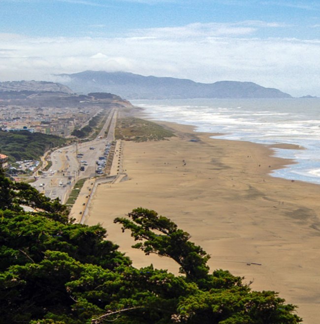
The coastline of the park features cliffs and bluffs, beaches and dunes, and calm bays and estuaries. Distinctive processes operate in each environment, and each responds differently to the impacts of climate change such as changes in sea level and rates of erosion. Slope movements are common on coastal cliffs. Beaches and dunes change size and shape seasonally in response to wave energy and storms.
Sea Caves
Sea caves are a common feature along the coast of California. Sea caves form where waves and the sediments they carry exploit and enlarge weak zones (joints, fractures, and fissures) in otherwise erosion-resistant, cliff-forming rock. Sea caves are more common in the harder and older rocks of the Franciscan Complex than in the softer and younger Cenozoic-age sedimentary rocks. The
exact number of caves in the park is unknown, but the number is likely at least 100 and potentially more than 500. Due to accessibility challenges, a formal cave inventory has not yet been completed.
All NPS cave resources are protected under the the Federal Cave Resources Protection Act of 1988 (FCRPA)(16 U.S.C. § 4301 et seq.).
Abandoned Mineral Lands
According to the NPS servicewide abandoned mineral lands database, Golden Gate National Recreation Area contains 23 abandoned mineral land features at 5 sites. The limestone quarry near Mori Point was mined by the Spanish in the 1700s to supply whitewash for Presidio buildings.
NPS AML sites can be important cultural resources and habitat, but many pose risks to park visitors and wildlife, and degrade water quality, park landscapes, and physical and biological resources. Be safe near AML sites—Stay Out and Stay Alive!
Regional Geology
Golden Gate National Recreation Area is a part of the Pacific Border Physiographic Province and shares its geologic history and some characteristic geologic formations with a region that extends well beyond park boundaries.
- Scoping summaries are records of scoping meetings where NPS staff and local geologists determined the park’s geologic mapping plan and what content should be included in the report.
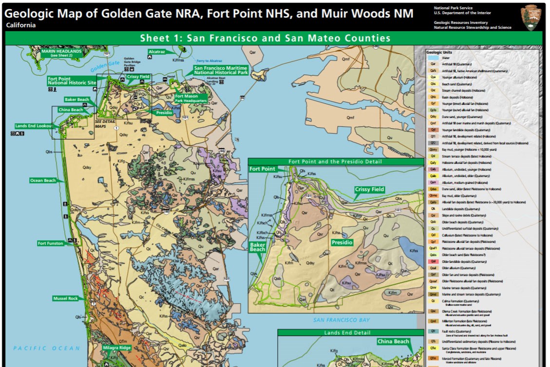
- Digital geologic maps include files for viewing in GIS software, a guide to using the data, and a document with ancillary map information. Newer products also include data viewable in Google Earth and online map services.
- Reports use the maps to discuss the park’s setting and significance, notable geologic features and processes, geologic resource management issues, and geologic history.
- Posters are a static view of the GIS data in PDF format. Newer posters include aerial imagery or shaded relief and other park information. They are also included with the reports.
- Projects list basic information about the program and all products available for a park.
Source: NPS DataStore Saved Search 2881. To search for additional information, visit the NPS DataStore.
A NPS Soil Resources Inventory project has been completed for Golden Gate National Recreation Area and can be found on the NPS Data Store.
Source: NPS DataStore Saved Search 2952. To search for additional information, visit the NPS DataStore.

Related Links
Related Articles
Golden Gate National Recreation Area
National Park Service Geodiversity Atlas
The servicewide Geodiversity Atlas provides information on geoheritage and geodiversity resources and values within the National Park System. This information supports science-based geoconservation and interpretation in the NPS, as well as STEM education in schools, museums, and field camps. The NPS Geologic Resources Division and many parks work with National and International geoconservation communities to ensure that NPS abiotic resources are managed using the highest standards and best practices available.

