Last updated: June 18, 2024
Article
NPS Geodiversity Atlas—Fort Vancouver National Historic Site, Washington and Oregon
Geodiversity refers to the full variety of natural geologic (rocks, minerals, sediments, fossils, landforms, and physical processes) and soil resources and processes that occur in the park. A product of the Geologic Resources Inventory, the NPS Geodiversity Atlas delivers information in support of education, Geoconservation, and integrated management of living (biotic) and non-living (abiotic) components of the ecosystem.

Introduction
Fort Vancouver National Historical Site consists of two park units located on the north bank of the Columbia River (Fort Vancouver Unit) and along the Willamette River (McLoughlin House Unit) in Clackamas County, Oregon and Clark County, Washington. Originally authorized as a national monument on June 19, 1948, the park unit was re-designated a national historic site on June 30, 1961. Fort Vancouver National Historical Site encompasses approximately 84 hectares (207 acres) and preserves significant resources of American history related to emigration over the Oregon Trail, the military history at Vancouver Barracks, and the aviation history at Pearson Air Museum. Fort Vancouver served as the western headquarters of the Hudson’s Bay Company’s fur trade empire and supply depot west of the Rocky Mountains. The McLoughlin house preserves the home of Dr. John McLoughlin, commonly referred to as “the Father of Oregon” because of the assistance he provided to migrating American homesteaders. The historical site protects historic structures and an extensive collection of American Indian, fur trade, and U.S. Army material which encompasses archeological artifacts, historic objects, and archival documents. These nationally significant resources directly contributed to the establishment of Fort Vancouver National Historical Site and showcase global trade networks, technological evolution, and cultural engagement over the past two centuries.
Geologic Setting
Fort Vancouver National Historic Site lies within the Portland Basin, a rhomboid-shaped depression that began forming during the Miocene ~20 Ma (mega-annum, million years ago) due to the subduction of the Juan de Fuca Plate beneath the North American Plate. The geology of Fort Vancouver and the surrounding region reflects four main geologic episodes: (1) the development of the Portland Basin, (2) the eruption of vast quantities of Columbia River Basalt lavas, (3) the evolution of the Columbia River, and (4) the influence of catastrophic ice age floods on the current landscape. The thick layers of rock and sediment that fill the Portland Basin record geologic processes that include voluminous flood basalts resulting from mantle upwelling, regionally and locally derived sediment and volcanic debris, earthquakes, subsidence, rivers and lake sediments, and catastrophic flood deposits. The bedrock geology of the McLoughlin House Unit consists solely of Miocene-age Wanapum Basalt of the Columbia River Basalt Group, while the Fort Vancouver Unit has underlying geology of younger Pleistocene-age Missoula flood deposits and Holocene alluvium of the Columbia River floodplain.
Regional Geology
Fort Vancouver National Historic Site is a part of the Puget Trough Section of the Pacific Border Physiographic Province and shares its geologic history and some characteristic geologic formations with a region that extends well beyond park boundaries.
- Scoping summaries are records of scoping meetings where NPS staff and local geologists determined the park’s geologic mapping plan and what content should be included in the report.
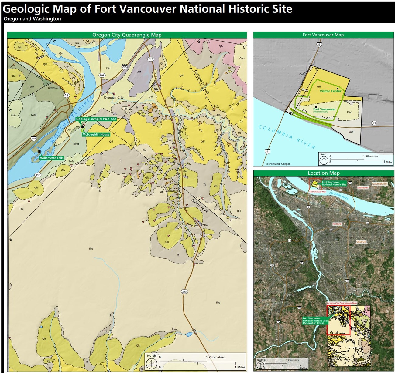
- Digital geologic maps include files for viewing in GIS software, a guide to using the data, and a document with ancillary map information. Newer products also include data viewable in Google Earth and online map services.
- Reports use the maps to discuss the park’s setting and significance, notable geologic features and processes, geologic resource management issues, and geologic history.
- Posters are a static view of the GIS data in PDF format. Newer posters include aerial imagery or shaded relief and other park information. They are also included with the reports.
- Projects list basic information about the program and all products available for a park.
Source: NPS DataStore Saved Search 2865. To search for additional information, visit the NPS DataStore.
A NPS Soil Resources Inventory project has been completed for Fort Vancouver National Historic Site and can be found on the NPS Data Store.
Source: NPS DataStore Saved Search 2934. To search for additional information, visit the NPS DataStore.
GRI Geology Image Gallery

Related Links
Related Articles
Fort Vancouver National Historic SiteNational Park Service Geodiversity Atlas
The servicewide Geodiversity Atlas provides information on geoheritage and geodiversity resources and values within the National Park System. This information supports science-based geoconservation and interpretation in the NPS, as well as STEM education in schools, museums, and field camps. The NPS Geologic Resources Division and many parks work with National and International geoconservation communities to ensure that NPS abiotic resources are managed using the highest standards and best practices available.

